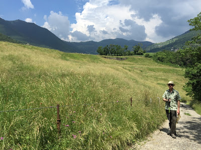

Hike Notes
Length: ~ 8km
Duration: 9:40 to 12:40, 3 hours
Elevation: high point 953 m (3,126 ft), Punta Alta, total elevation gain 783 m (2,570 ft)
Location: Lago Iseo, Predore to Tavernola Bergamasca
Overview
In Predore, we grabbed a coffee and a brioche to wake us up and then started hiking around 9:40 am. We arrived at Tavernola around 12:40. After a quick freshen-up at the local public water fountain, we headed to Trattoria Il Porticciolo for lunch. Just as the clouds started to move in threatening rain, we took the 15:05 bus back to Bergamo.
The trail options you have for this route can be found on the Club Alpino Italiano (CAI) Bergamo site. They have a geoportale site (select “Mappe”) that makes planning very easy. An example map is shown below.
The trail starts in Predore behind the municipio and just climbs and climbs and climbs. Today as we are walking it’s decorated in white and blue ribbons everywhere. Possibly decorations for recent confirmations in the church?
Soon enough we pass out of the ribbons and climb the steps up to the Santuario Madonna della Neve in San Gregorio - Parrocchia di Predore. After a bit more of road (more like a very steep lane), we come to some trail markings and take trail 734 to Punta Alta. At Punta Alta, we meant to go east to catch trail 731 and instead ended up going north to trail 730 into Tavernola. All roads lead to Tavernola eventually.
At Punta Alta, there is good view of Christo's Floating Piers, which is scheduled to open on the 18th of this month. At this time, it’s still white and don’t have its final coating of yellow.
Left: A brioche and coffee to start the hike. Right: At the top of Predore you’ll see this sign where you go right.


Left: Example of the type of maps you can get and print out from the CAI Bergamo site. Right: Looking back down the trail at Predore and Lago Iseo.


Left: View of Christo’s Floating Piers from Punta Alta looking east toward Monte Isola. Right: Another view of the Floating Piers from a roccolo (always fund to find).


Left: One more view of the Floating Piers (because it’s just so cool). Right: Just above Tavernola Bergamasca – the trail becomes a small country lane.


Left: Example of a trail marker indicating a turn right. Right: View north east toward Tavernola Bergamasca along Lago Iseo.


View of upper part of Tavernola Bergamasca.

No comments:
Post a Comment
All comments are moderated. If your comment doesn't appear right away, it was likely accepted. Check back in a day if you asked a question.