Monday, October 20, 2014

Park Butte – Easton Glacier Hike

West side of the Easton Glacier
Side of the Easton Glacier

Our Hike Route of Park Butte Fire Lookout and Easton Glacier (via Canon GPS Logger and Google Earth)

Hike Notes

Length: 12.5 miles
Duration: 8.5 hours, 9:20 am – 5:50 pm inclusive of a 45 min lunch break.
Elevation Gain: Trailhead: WTA - 3,250 ft (WTA), Garmin** - 3,347 ft, Canon* - 3,357 ft. Highest point at edge of Easton Glacier: Garmin - 6,423 ft, Canon - 6,411 ft. Total elevation gain: Garmin - 4,150 ft, Canon - 4, 877.
Location: North Cascades -- West Slope

* Canon GPS Receiver, ** Garmin HCX

Overview

For our 10th and possibly last hike of the 2014 season, we hiked up to the Park Butte historic fire lookout and then took a stroll alongside the west side of the Easton Glacier (WTA site). We have racked up 131.7 total miles this season, inclusive of this hike and beating our 115.2 total miles last year.

First stop for us was the Park Butte historic fire lookout. At the fire lookout we had about 45 minutes of just us two and nobody else inside. We sat staring at Mount Baker, eating lunch and reading the various journals and information sheets left inside. After our lookout lunch, we headed back to the junction of the Park Butte Trail and the Railroad Grade Trail, which takes you toward the Easton Glacier. We decided that we would just take a peak at the glacier, and head back to pick up the Scott Paul Trail back to the trailhead. However, once we got saw the glacier, we knew we wanted to walk up beside it. We followed the Railroad Grade to get to the Easton Glacier, which is a lateral moraine formed as the glacier retreated. We were walking on a ridge where, on one side there is green high meadow, and to the other, a sharp drop down into emptiness where the glacier once was. We got up to 6,500 feet, above High Camp and then called it a day and headed back.

Left: View from the Fire Lookout Toward Mt Baker; Right View from 6,500 feet near the Easton Glacier, Looking South
View from the Fire Lookout Toward Mt BakerRight View from 6,500 feet near the Easton Glacier, Looking South


Fly Amanita. Left: Dirty Toadstool? Right: Toadstools and Heather
Fly AmanitaFly Amanita

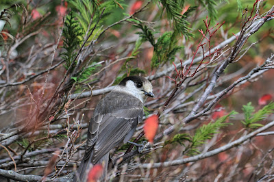
Left: A Marmot near High Camp; Right: A Gray Jay - Perisoreus canadensis
A Marmot near High CampA Gray Jay - Perisoreus canadensis

Left: Another View of Our Hike Route of Park Butte Fire Lookout and Easton Glacier (via Canon GPS Logger and Google Earth); Right: Lincoln Peak
Our Hike Route of Park Butte Fire Lookout and Easton Glacier (via Canon GPS Logger and Google Earth)Lincoln Peak

Park Butte Fire Lookout. Left: Outside; Right: Looking Inside
Park Butte Fire Lookout. Outside.Park Butte Fire Lookout. Looking inside.

Left: A Lunch Table in the Park Butte Fire Lookout; Right: View from the Fire Lookout


Hiking on the East Glacier Lateral MoraineHiking on the East Glacier Lateral MoraineHiking on the East Glacier Lateral Moraine


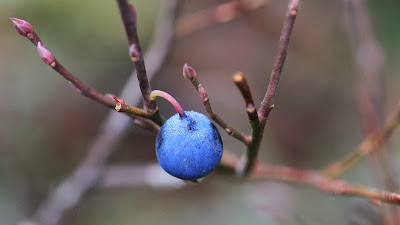
Vaccinia - Blueberries in Morovitz Meadow
Blueberries in Morovitz MeadowBlueberries in Morovitz Meadow


Left: West side of the Easton Glacier; Right: Park Butte trail wall made of log ends.
West side of the Easton GlacierPark Butte trail wall made of log ends

Friday, October 17, 2014

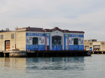
Pier 31 San Francisco - Welcome Home Mural

This water is only visible from the water. It says "Welcome Home" with anchors and the California grizzly bear.
Pier 31 San Francisco - Welcome Home MuralPier 31 San Francisco - Welcome Home Mural

Tuesday, October 7, 2014

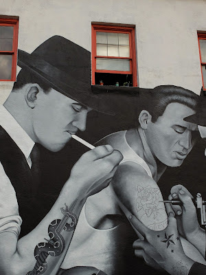
Slave to the Needle Mural – Cabron Mural

This 2014 mural is by Alex “Cabron” Forster and is located on the west wall of the Slave to the Needle in Wallingford, at NE 45th St and 4th Ave NE. Apropos to the business inside the building, this mural deals with tattooing. This mural reminds me why we go out hunting for murals, street art, and graffiti: the thrill of finding a beautiful and unexpected piece of art.

For more information on this mural, see Faces & Figures | Alex Forster, mural artist, an article in the SeattlePI.

Slave to the Needle Mural–Cabron MuralSlave to the Needle Mural–Cabron MuralSlave to the Needle Mural–Cabron Mural

Frame Central – Mark O’Connell Mural

I spotted this eye-catching mural while taking the 26 bus from Fremont to Wallingford. It is located on the side of the west side of the Frame Central location on NE 45th St and Latona Ave NE. It is a mural by Mark O’Connell (www.markoconnellvisuals.info) and features a distinguished gentleman with a large brimmed hat, thin mustache and goatee, and neck ruffle. I’m dubbing him Shakespeare’s brother.

Frame Central–Mark O’Connell MuralFrame Central–Mark O’Connell MuralFrame Central–Mark O’Connell Mural

Sunday, October 5, 2014

Lake Ingalls Hike

Left: Our Lake Ingalls Hike Route (via Canon GPS Logger and Google Earth); Right: A Marmot Watches Us Below Lake Ingalls
Our Hike Route for Lake Ingalls (via Canon GPS Logger and Google Earth)A Marmot Watches Us Below Lake Ingalls

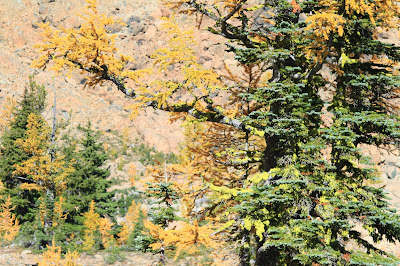
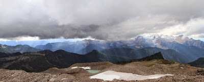
Left: Gold Larches Near Ingalls Pass; Right: Looking West Over Lake Ingalls Toward Mt. Stuart
Gold Larches Near Ingalls PassLooking West Over Lake Ingalls Toward Mt. Stuart

Hike Notes

Length: 11.8 miles
Duration: 7.5 hours (9:00 am – 4:30 pm), includes 40 minute lunch break
Elevation Gain: 5,756* / 3,591** ft - low point 4,235* ft/4,288** ft @ trailhead; high point 6,550 ft @ Lake Ingalls
Location: Snoqualmie Pass -- Salmon La Sac/Teanaway

* Canon GPS Receiver, ** Garmin HCX - Our elevation data for this hike suffers from a couple of problems. First, the Garmin was off for part of the middle of the hike, and the Canon GPS Receiver logger turned off for the last ¼ of the hike. Technology. We calculated our total hike length by using the visible trail in Google Earth.
Overview

For our ninth hike of the 2014 season, we took a loop hike around Lake Ingalls (WTA site) and down through Ingalls Creek. We have racked up 119.2 total miles this season, inclusive of this hike. (Our last hike of 2013 was to Carne Mountain, which brought us to 115.2 miles total.)

Our Lake Ingalls route was a loop that had us taking the standard route up to the lake, skirting the west edge of the lake, dropping down by and following Ingalls Creek, and the climbing up the east side of Longs Pass to rejoin the Lake Ingalls trail. The climb up Longs Pass caught us by surprise because we were tired by that point in the hike and weren’t expecting the steep climb to the pass (40-50% grade toward the top). We usually don’t use trekking poles, but we broke them out for the last 200 feet of elevation gain to get over the pass, at approximately 6,100 feet.

Lake Ingalls on this sunny, warm Fall Sunday was not too crowded. Most hikers seem to stop at the south end of the lake and then turn around and head back. We picked our way around the west side of the lake. We saw others going around the east side as well.

On the hike down to Ingalls Creek, we saw nobody. That part of the trail gets a little monotonous. The sign to Longs Pass was a welcome site. We hike up Ingalls Creek in 2012 (see Ingalls Creek Trail - Butterflies and Balsamroot) but didn’t come this far up the creek.

On our way to Lake Ingalls we saw one goat and a few marmots. In terms of larches, we thought the larches we saw on our Carne Mountain last year were more spectacular.

Left: The Obligatory Goat Photo Near Ingalls Pass; Right: Welcome to Alpine Lakes Wilderness (Okanogan-Wenatchee) – Sign
The Obligatory Goat Photo Near Ingalls PassWelcome to Alpine Lakes Wilderness (Okanogan-Wenatchee) – Sign

Left: Fern; Right: View of Mt Stuart from Ingalls Pass
FernView of Mt Stuart from Ingalls Pass

Looking Toward the North End of Lake IngallsLooking Toward the North End of Lake Ingalls

Left: Rock Near Lake Ingalls; Right: Diagonal Lines Including Mt Stuart in the Background
Rock Near Lake IngallsDiagonal Lines Including Mt Stuart in the Background

Left: Sign on Ingalls Creek Pointing the Way to Longs Pass Trail; Right: Signs Pointing to Lake Ingalls
Sign on Ingalls Creek Pointing the Way to Longs Pass TrailSigns Pointing to Lake Ingalls

Friday, October 3, 2014

Beige on Bowdoin

fall is in the air
a beige sofa is outside
fearing the winter

Thursday, October 2, 2014

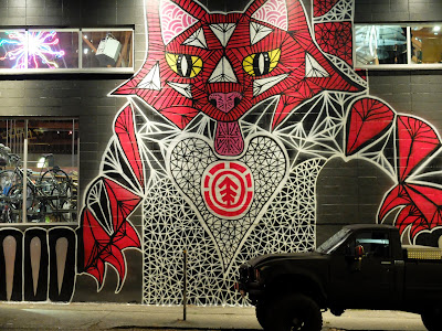
Evo Southwall Mural - Michael Kershnar

This mural by Michael Kershnar is quite striking at night.  It's part of the Evo Southwall Project. For examples of Kershnar's work in San Francisco, see SF Mural Arts.
Evo Southwall Murall - Michael KershnarEvo Southwall Murall - Michael Kershnar