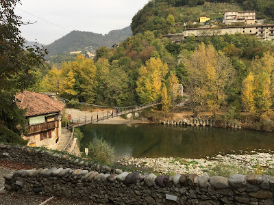
Showing posts with label roccolo. Show all posts

Thursday, November 26, 2020

Two Hikes in the Hills of Parco dei Colli di Bergamo

View east from Colle di Ranica.Rock art above Via Valle.
Left: View east from Colle di Ranica.
Right: Rock art above Via Valle.

During lockdown and not wanting to travel, we are spending more time exploring the hills north of Bergamo, which can be easily reached by foot from Bergamo (lower and upper city). The two hikes describe here are two such explorations. The hikes unfold between the cities of Bergamo, Torre Boldone, Ranica, and Ponteranica. In the latter three cities, we are in the hills above the city centers.  Most of the hike is within the boundary of the Parco dei Colli di Bergamo, a large natural park that includes the Upper Town of Bergamo and the surrounding hills. For more hikes around Bergamo, see our page Walking and Hiking Around Bergamo.

The maximum altitude reached is 660 m in hike 1 (Sunday) and 726 m in hike 2 (Tuesday), both starting from about 340 m and making for an elevation gain of 320 m / 386 m, or over a 1,000 feet elevation in each case. While not a large elevation gain, these hikes provide a good workout. The climb from Quintino Alto (Monterosso) as well as the climb from San Rocco to Colle di Ranica are brisk and unrelenting.

Both of these hikes took between 3 and 3.5 hours to complete, with few stops. And, both hikes were between 13 and 14 km ( ~ 8.4 miles).  There is an infinite number of walking variations you can devise in the Parco dei Colli di Bergamo because there are trails all over. Think of these two hikes as a starting suggestion.


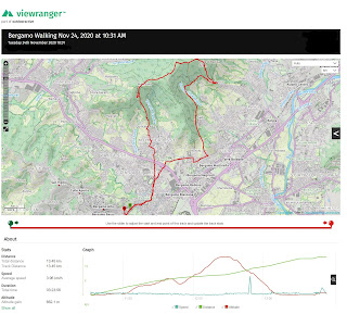
Viewranger tracks for Sunday hike.Viewranger tracks for Tuesday hike.Colle di Bergamo including Citta Alta and norther of the stadium in the hills around Maresana.

Left and center: Viewranger tracks for Sunday and Tuesday hikes.
Right: Colle di Bergamo including Citta Alta and norther of the stadium in the hills around Maresana.


Of particular interest on the first hike (Sunday) is trail 401 that extends from via delle Delizia and  climbs the ridge of the hill. The ridge has  a series of roccoli, an interesting characteristic of Bergamo and Brescia landscapes not found elsewhere in Italy. Though not in the greatest of shape, the roccoli on this hike give you an idea of how these big bird traps would have functioned.

The definition of a roccolo in Italian is appostamento fisso di uccellagione, con reti verticali collocate in un pergolato a forma di semicerchio o di ferro di cavallo, di solito impiantato in montagna o in zone collinari which translates roughly as "a fixed hunting blind for shooting or snaring birds, with vertical nets placed in a pergola in the shape of a semicircle or horseshoe and usually set up in the mountains or hilly areas".

More specifically, roccoli are situated on ridges or areas that migratory birds are likely to pass over. Inside the roccolo space there is usually a small tower (la rocca from which the word il roccolo derives) where the hunter (il roccolatore) sits and waits. Birds arrive to find food, shelter, and often attracted by the call of other birds in cages (uccelli di richiamo or "decoys"). At an opportune time, the hunter launches a device to scare the birds who during the attempt to flee are ensnared. The device launched is called a spauracchio (a scarecrow) that less like a scarecrow and more like a wicker paddle. It is designed so that when launched form the tower, it can travel through the air and appear as a bird of prey to the other (smaller) birds, which try to flee and get stuck in nets and eventually make there way to the dinner table.

Today, catching birds with roccoli is prohibited except for research purposes. The web site I roccoli e la Val Gandino had some great photos of roccoli.
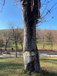
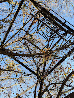
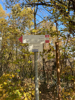
A tree in Maresana with a little mason work.A tower near Colle di Ranica.Typical signage to watch out for in the Parco dei Colli  di Bergamo.
Left: A tree in Maresana with a little mason work.
Center: A tower near Colle di Ranica.
Right: Typical signage to watch out for in the Parco dei Colli  di Bergamo.


[Asteraceae] Erigeron annuus - Eastern Daisy Fleabane (Cespica annua).[Dennstaedtiaceae] Pteridium aquilinum - Common Bracken (Felce quilina).
Left: [Asteraceae] Erigeron annuus - Eastern Daisy Fleabane (Cespica annua).
Right: [Dennstaedtiaceae] Pteridium aquilinum - Common Bracken (Felce quilina).
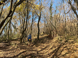
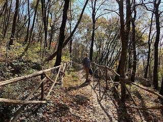
Heading up to Colle di Ranica.Above via Valle in Monterosso.
Left: Heading up to Colle di Ranica.
Right: Above via Valle in Monterosso.
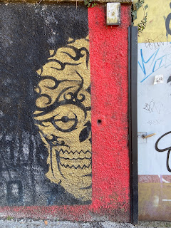
A face on the wall on via Valle.A sort-of roccolo on trail 401 in Bergamo - Torre Boldone.
Left: A face on the wall on via Valle.
Right: A sort-of roccolo on trail 401 in Bergamo - Torre Boldone.




Thursday, October 26, 2017

A Hike from Clanezzo to Monte Ubione and Back

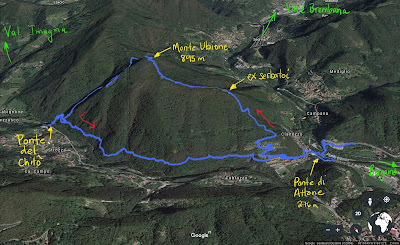
GPS tracks for round-trip hike from Clanezzo to Monte Ubione and backView from Monte Ubione, northwest into Valle Imagna on a hazy day.
Left: GPS tracks for round-trip hike from Clanezzo to Monte Ubione and back. Right: View from Monte Ubione looking northwest into Valle Imagna on a hazy day.

Overview


Length: 11 km (6.8 mi)
Duration: 3.3 hours, includes 10-minute break on Monte Ubione
Elevation: 258 m (846 ft) @ suspended bridge over the Brembo River , 895 m (2,936 ft) @ Monte Ubione. Total elevation gain of 772 m (2,533 ft).
Location: Italy, Province of Bergamo, Clanezzo

The Hike


To reach the starting and ending point of this hike, take any bus heading to Valle Brembana (B lines, usually signed as San Pellegrino Terme, Zogno, or Piazza Brembana) and get off at the last stop before the bus enters the valley. The stop is here. Warning: it's a bus stop on a busy, ugly road. Fortunately, you only have to walk about 100 m on said road.

Overall, I wouldn't call this the prettiest hike we done or the most serene. First, the woods you pass through are very "disturbed" and not all that pretty. Disturbed here means lots of ivy and weed trees. Second, the sound from the traffic in the valleys (both Brembana and Imagna at one point) is always present. These valleys are like that, limited access and busy roads during the day.

Negative aspects aside, it's a nice little hike for a number of reasons. First, you'll work up a sweat getting up to Monte Ubione. A chance for exercise is always welcome, right? As well, once on top of Ubione, it's a pretty view on a clear day. We had lots of haze (foschia) today so it was a little surreal looking.

The most interesting aspect of this hike though is that it passes by three different historic bridges. Below Clanezzo you find two of them. One is a suspended bridge across the Brembo River dating from 1878. Its called La Passarella or Ponte sospeso, is 74 m long, and dances about as you walk over it. The second bridge, nearby, is an old stone dating from the 10th century that crosses over the Imagna River. This bridge is called the Ponte di Attone and is about 25 meters.

At one time, these two bridges were the only convenient means to get to Bergamo from the Val Brembilla situated north of Clanezzo. Where there is a need, there is someone there to profit from it. At one end of the stone bridge there was a customs point for the Republic of Venice as these bridges were once the border between the Republic of Venice and their rivals the Visconti (Milan).

The Imagna River merges with the Brembo River below Clanezzo, both rivers draining their respective valleys. In fact, Monte Ubione and this hike (Sentiero 571) follows the watershed divide (spartiacque) between the two valleys. Before reaching Monte Ubione, you'll wander on a huge empty reservoir (serbatoio) half-carved in the mountain that was at one time used to store water for hydro-electricity.

After visiting the two bridges, we start climbing toward Monte Ubione, always following indications for Sentiero 571. At Monte Ubione, we rested for a bit and then continued more or less north until we hit the intersection with Sentiero 584, which took us down toward Strozza.

It's at Strozza, that you find the third interesting bridge of this hike, the Ponte del Chitò, built in 1897 and named after the engineer who designed. It's a bridge-canale that at one time brought water from the Imagna River to Clanezzo. Today, there is a modern steel passageway on top of the aqueduct that allows passage across.

From the Ponte del Chitò back to Clanezzo, there is an old canal running more or less level. On top of the canale is a walking-cycling path that we took back to the start of this hike.

Ponte del Chito - Entrance from Strozza side of Imagna River.Ponte del Chito - Cutout for taking photos from the midpoint of the bridge.Ponte del Chito - Modern walkway atop 1897 stone structure.
Views of and from Ponte del Chitò, a bridge-canal near Strozza, Italy. Left: Entrance from Strozza side of Imagna River. Center: Cutout for taking photos from the midpoint of the bridge. Right: Modern walkway atop 1897 stone structure.

View of Ponte del Chitò with flanks of Monte Ubione in the background.Sign describing walking and biking routes of Valle Imagna.
Left: View of Ponte del Chitò with flanks of Monte Ubione in the background. Right: Sign describing walking and biking routes of Valle Imagna. Today's hike is described on the sign.

Suspended bridge over the Brembo River, below Clanezzo. The bridge is just over 74 meters long.Suspended bridge over the Brembo River, below Clanezzo. The bridge is just over 74 meters long.
Suspended bridge over the Brembo River, below Clanezzo. The bridge is just over 74 meters long.

The stone bridge of Clanezzo (Ponte di Attone), at one time a point for collecting customs. The bridge allows passage over the Imagna River. In the background, the Brembo River.The stone bridge of Clanezzo (Ponte di Attone), at one time a point for collecting customs. The bridge allows passage over the Imagna River. In the background, the Brembo River.
The stone bridge of Clanezzo (Ponte di Attone), at one time a point for collecting customs. The bridge allows passage over the Imagna River. In the background, the Brembo River.

The old canal turned walkway near Clanezzo.A roccolo that Sentiero 584 passes through.
Left: The old canal turned walkway near Clanezzo. Right: A roccolo that Sentiero 584 passes through.

Start and end of the hike near state route 470.View of the Brembo River looking toward Bergamo. A sign describing another route on Monte Ubione called the Sentiero della Libertà.
Left: Start and end of the hike near state route 470.  Center: View of the Brembo River looking toward Bergamo. Right: A sign describing another route on Monte Ubione called the Sentiero della Libertà.