Showing posts with label wainwright coast to coast. Show all posts

Wednesday, August 31, 2011

Kissing Gates and Stiles – Wainwright Coast to Coast

Day 2: Kissing Gate Outside of St. Bees
Kissing Gate Outside of St. Bees
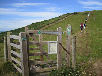
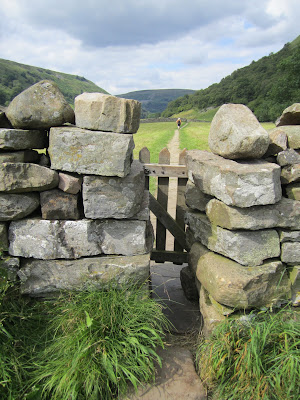
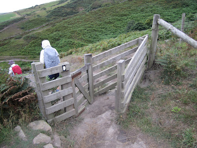
I’m still reviewing pictures from my recent Wainwright Coast to Coast walk and one thing I want to mention are the kissing gates and stiles. We passed through a lot of kissing gates, stiles, and gaps; a few are shown here. Why a kissing gate is called a kissing gate depends on who you ask. At johneckersley.wordpress.com a kissing gate is so called because “the gate merely ‘kisses’ (touches) the enclosure either side, rather than needing to be securely latched.” Okay, sounds reasonable. At the dating site kissinggates.com they invoke a legend to explain that “when the two are on either side of the gate, the person in front ‘refuses’ entry to the second person until presented with a kiss.” A little less reasonable in my mind, but it is a dating site. (No, we did not kiss when we went through the gate.)

The etymology of stile seems to be a little more straightforward. According to dictionary.com the origin is “before 900; Middle English; Old English stigel, derivative of stīgan to climb, cognate with German steigen.” (Yes, we climbed a lot using the stiles.)

In the event you cannot sleep with the meager information presented here, you can always consult the Gaps, gates and stile. Specification published by the British Standards Institute for something like £150.00. 

To match days indicated in the captions with dates and the itinerary, see Wainwright Coast to Coast Walk – Overview.

Day 2: Stile, Near Mirehouse
Stile, Near Mirehouse

Day 3: Stile, After Climbing Loft Beck Out of Black Sail Youth Hostel
Stile, After Climbing Loft Beck Out of Black Sail Youth Hostel

Day 5: Stile, Near Shap Abbey
Style, Near Shap Abbey

Day 6: Stile, East of Orton – Looking Down from the Top Step to Both Sides
Stile, East of Orton – Looking Down from the Top Step to Both Sides

Day 6: Gap, Outside of Orton Heading to Sunbiggin Tarn
Gap, Outside of Orton Heading to Sunbiggin Tarn

Day 7: Passage, Under the Train Tracks - South of Kirby Stephen Rail Station
Passage, Under the Train Tracks - South of Kirby Stephen Rail Station

Day 7: Stile, Under the Train Tracks – South of Kirby Stephen Rail Station
Stile, Under the Train Tracks – South of Kirby Stephen Rail Station

Day 7: Gap, Along the River Swale Heading to Muker
Gap, Along the River Swale Heading to Muker

Day 7: Gap, Outside of Muker
Gap, Outside of Muker

Day 9: Stile, Leaving Mount Grace Priory and Heading to Osmotherly
Stile, Leaving Mount Grace Priory and Heading to Osmotherly

Day 11: Kissing Gate, Church in Goathland
Kissing Gate, Church in Goathland

Day 12: Kissing Gate, On the Cliffs Above Robin Hood's Bay
Kissing Gate, On the Cliffs Above Robin Hood's Bay

Monday, August 29, 2011

Wainwright Coast to Coast Walk - Overview


Day 7: Heading to Gunnerside. Turning around to catch late afternoon sun

Day 11: View from the Glaisdale Moor into the Great Fryup Dale

It’s been several weeks now since I went on the Wainwright Coast to Coast Walk sponsored by National Geographic. The walk started on July 24th and ended on August 3rd and included 14 of us and 2 guides walking about 140 miles in 12 days through spectacular countryside. The route we followed was not the full Wainwright trail, but selected parts, Wainwright-light we joked. I’m not a purist in having to complete every part of the trail. The real attraction is getting to know the country, its people and geography. And to that end, this tour was a success. The National Geographic overview of the tour starts with the succinct description: “[c]ross England on foot, trekking from the Irish Sea to the North Sea through three incredible national parks.” Here’s a summary of the itinerary we followed:

Part I - Western

July 24 (day 1) :: St. Bees (Arrive in town and get settled.)
July 25 (day 2) :: St. Bees to Ennerdale Bridge
July 26 (day 3) :: Ennerdale Bridge to Rosthwaite
July 27 (day 4) :: Rosthwaite to Glenridding
July 28 (day 5) :: Lake Ullswater to Shap
July 29 (day 6) :: Shap to Ravenstonedale
July 30 (day 7) :: Ravonstonedale to Reeth

Part II – Eastern

July 31 (day 8) :: Reeth to Richmond
Aug 1 (day 9) :: Richmond to Osmotherley
Aug 2 (day 10) :: Osmotherly to Blakey Ridge
Aug 3 (day 11) :: Blakey Ridge to Grosmont
Aug 4 (day 12) :: Grosmont to Robin Hood’s Bay

So you are thinking about this tour and are not sure about it? I recommend it. This was the first group tour I’ve ever done outside of a class trip to Paris in 1983 which I think can be ignored for the purposes of the discussion here. I was worried about whether I could hang with a group for a long period and what would it be like. In the end it was fine. You form a small family with a common goal: dipping your toes in the Irish Sea and then dipping them 12 days later in the North Sea. Along the way, stories are swapped, personalities revealed, and friendships forged. It helped that a guy who would have been my roommate cancelled last minute so I had a single which gave me some private time when we weren’t walking and eating together. During the day while you walk you can always find your space if you need it– by finding a place in the line of hikers. I preferred the back of the group. Typically we had one guide in front and one in back.

The tour includes dinners and lunches (and associated arrangements), transporting your luggage from hotel to hotel, any transportation, and other logistics. You carry just a day pack during the day.

We used the FootPrint maps, more or less, with some deviation when our guides led us on a more interesting route. The FootPrint maps break the walk into two sections, west (part 1) and east (part 2), and I’ve adopted that approach in most of what I posted about the trip.

Why is this coast to coast walked named Wainwright? It is named after Alfred Wainwright (1907 – 1991), a British fell walker, who published his book A Coast to Coast Walk: From St. Bees to Robin Hood’s Bay in 1973. For more information on this book see the first link below.

Some other Travelmarx posts related to the Wainwright walk which give different views of the trip include:

- A Coast to Coast Walk: From St. Bees to Robin Hood’s Bay (book review)
- The Wainwright Coast to Coast Walk – A Botanical View (Eastern Part)
- The Wainwright Coast to Coast Walk – A Botanical View (Western Part)
- Mxyomatosis – or – The Explanation for Flattened Rabbits
- Red v. Grey Squirrel
- Rothko on the Moors
- Grosmont and Goathland
- A Name in North Yorkshire
- Benches of the Wainwright Coast to Coast
- Kissing Gates and Stiles – Wainwright Coast to Coast

Footprint Map: St. Bees to Swaledale
Footprint Map - Coast to Coast Walk Part 1 West FrontFootprint Map - Coast to Coast Walk Part 1 West Back

Footprint Map: Swaledale to Robin Hood’s Bay
Footprint Map - Coast to Coast Walk Part 2 - East FrontFootprint Map - Coast to Coast Walk Part 2 - East Back

Benches of the Wainwright Coast to Coast Walk

Day 1: St. Bees Ocean View
St. Bees Ocean View
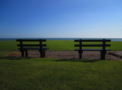
During this Wainwright Coast to Coast walk, I became interested in the idea of a bench set up for you to sit and take in a view. Ironically, we hardly did so. Instead we kept on the move, lingering only for a snack and lunch in places where there were typically no benches.

The secondary meaning of an empty bench is about missing someone. I was without the other half of Travelmarx for this vacation/trip for the first time in twenty years. So without further ado, here are a sample of benches (and bridges and a few other structures I saw along) the walk.

Day 2: High and Dry – South of Sandwith
High and Dry – South of Sandwith

Day 2: View To Whitehaven
View To Whitehaven

Day 2: Cleator Moor - Wath Bridge, River Ehen
Cleator Moor - Wath Bridge, River Ehen

Day 4: Lake Ullswater from Inn on the Lake
Lake Ullswater from Inn on the Lake

Day 5: Shap Abbey
Shap Abbey

Day 6: Lime Kiln (outside of Orton)
Lime Kiln (outside of Orton)

Day 6: Petty Hall, Orton
Petty Hall, Orton

Day 7: Ivelet Bridge

Day 7 - Kirkby Stephen Town
Kirkby Stephen Town

Day 7 - Kirkby Stephen Churchyard
Kirkby Stephen Churchyard

Day 7: Ravenstonedale – Churchyard
 Ravenstonedale – Churchyard

Day 8: Leaving Reeth in the Morning
Leaving Reeth in the Morning

Day 8: Approaching Richmond
Approaching Richmond

Day 9: Leaving Richmond
Leaving Richmond

Day 9 – Osmotherley - Center
Osmotherley - Center

Day 11: Beggar's Bridge Glaisdale
Beggar's Bridge Glaisdale

Day 12 – Goathland Morning
Goathland Morning

Day 12 – Goathland Morning
Goathland Morning

Day 12 - Overlooking Robin Hood's Bay – The End of the Walk
Overlooking Robin Hood's Bay

Thursday, August 18, 2011

A Coast to Coast Walk: From St. Bees to Robin Hood’s Bay


Alfred Wainwright’s A Coast to Coast Walk is a curious book. It was the first place I thought I should start when preparing for the Wainwright Coast to Coast walk. What happened is that I didn’t consult it much before and during the trip. It wasn’t until after the trip when I picked up the book did it start to make sense to me. Alfred Wainwright (1907 – 1991) published this book in 1973. The book I refer to here is the second edition and from the book flaps “[t]his is the first fully revised and updated edition of A. Wainwright’s unique guide to the Coast to Coast Walk which he devised in the early 1970s.”

The book is a wealth of details on how to get from point A to point B. There is a long tradition of this type of descriptive detail. In the Tower of London, days earlier, an exhibit discussed the history of the Ordinance Survey in the UK and its roots in military considerations (hence the name “ordinance”). This general cultural history, plus Wainwright’s interest in drawing and cartography I guess inevitably led to a very descriptive style where every gate, group of trees, contour line, and geological feature is called out and drawn in loving detail. To be honest, it was overwhelming at first, but makes complete sense now in retrospect having walked the land and seen what Wainwright describes, and more importantly, passed through and over numerous kissing gate and stiles - the very objects he describes. It still blows me away looking at the book as I write this that Wainwright created the 200 drawings and maps that appear in the book. Especially interesting are his precise depictions of views from key peaks where he shows direction and distance to other geographical features.
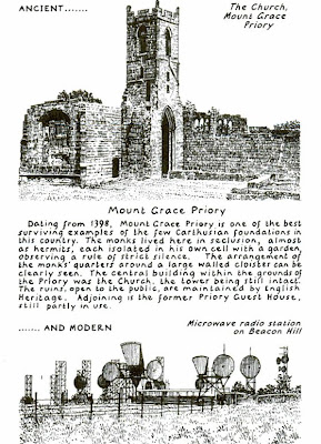
Mount Grace Priory - Page 124Views from Sunday Crag - Page 43

The book also contains lots of observational (non-navigational) passages that at times contain a good dose of humor or perhaps honesty, take your pick. Some of these selected passages are given below with some photos I captured.

Cleator
Wainwright: p. 8 Cleator is “an old village that expanded with the boom in the 19th century iron-ore mining and in so doing sacrificed its charm and character. Some architectural pretensions are evident in its places of worship and a few older houses but completely absent in the long terraces of small cottages built to a common pattern.”
Travelmarx: Sort of true. The rows of houses have an odd aspect to them. A line from the peak of the roof to the pavement abruptly separates one dwelling from the other without too much thought for continuity. The church (St. Leonard’s) has a back area with a small replica of Lourdes which I understood to have been built when the miners were out of work and today is maintained by volunteers.

Cleator – Row Houses Split Down the Middle

Patterdale to Shap
Wainwright: p. 46 “This is a farewell to Lakeland, and farewells to Lakeland are always sad. What follows is anti climax – level walking instead of up and down, trees and fields and villages instead of rough and lonely hills: lovely, yes, but not excitingly beautiful as the crossing of Lakeland has been.”
Travelmarx: Lakeland is beautiful. Who wouldn’t want to cozy up in Rosthwaite ( Borrowdale) for several months? But, the rest of the walk is just as beautiful.

Sunbiggin Tarn
Wainwright: p. 64 “Sunbiggin Tarn has many regular visitors, but none of them would describe it as visually attractive: it is little more than a large reedy pond in the middle of a morass.”
Travelmarx: I had a lovely day walking across this area. The skies were blue, the heather, well, it was purple. It was 65 degrees and Kate Bush’s Big Sky kept playing in my head.

Milk at Sunbiggin Farms

Big Skies at Sunbiggin Tarn

Richmond to Ingleby Cross (Vale of Mowbray)
Wainwright: p. 110 “If you are fond of placid rural scenery and have an interest in farming, you might enjoy this section of the walk; but if your preference is for the high ground and rough hills you will find it tedious.” p. 116 “To walkers whose liking is for high places and rough terrain, this will seem the dullest part of the whole walk; those who believe the earth is flat will be mightily encouraged on this section.”
Travelmarx: Yes, this is where we saw fields of grain (barley?) and walked through potato fields. Flat it is, yet, it was still pleasant and I don’t believe the earth is flat.

Grain Field in the Vale of Mowbray

Carlton Moor
Wainwright: p. 131 “Carlton Moor was for centuries a place of work; more recently it has been a place of leisure. Gliding is a fine sport, a thrilling and graceful exercise, and it creates no noise or litter – but not even the most ardent enthusiast will claim that the landscape has been improved by its conversion to runways and some may even agree that a large tract of natural scenery has been despoiled.”
Travelmarx: Yes, you can tell something is slightly different there, but, maybe I was too tired to care, the sun was too hot, and I was too hungry for a bacon and egg sandwich at Lord Stones Café. Could also be that the land has rebounded a bit since Wainwright wrote about it since gliding activities were suspended in 2008.

Landing Strips in Carlton Moor

Gliding Club Buildings

Robin Hood’s Bay
Wainwright: p. 163 “Now you can rest on your laurels in the Bay Hotel with a pint, but (let there be no misunderstanding about this) you do so at your own expense. It’s no use saying ‘charge it to Wainwright’ as you could in days gone by at the Border Hotel, Kirk Yetholm. No, sonny, that game won’t work here. Pay for you own. I’m skint.”
Travelmarx: I didn’t think to try to charge it to Wainwright. We did have a nice celebration dinner at the Bay Hotel. And, if you are wondering skint = broke.

The Bay Hotel at Robin Hood’s Bay
 

Personal Notes
Wainwright: p xiv “…I would feel I had succeeded better in arousing interest for the planning of private long-distance walks if the book induced some readers to follow instead their own star and find their own rainbow’s end.”
Travelmarx: We did see a rainbow while celebrating at the Bay Hotel. An appropriate end.

A Rainbow Over Ravenscar Caps the Journey

The Book Flaps of Wainwright’s Book – Second Edition