Monday, June 30, 2008

Bandera Mountain Hike

Bear Grass in Bloom

We were flipping through one of the many book in the Washington’s hikes series, 100 Hikes in Washington’s Alpine Lakes and decided to try Bandera Mountain (location). For us, on this particular day it was a so-so hike. 

On the positive side:

  • The hike was a good bit of exercise, especially the last grueling push to the ridge.
  • It was great to see bear grass in bloom (never had).
  • We saw a bear (not sure what kind) about 40 feet from us up in a tree ripping bark off.
  • The hike is fairly easy to get to (exit 45 off of I-90). 

On the negative side

  • It was fairly hot on our chosen day, about 85 F and in parts of the trail there wasn't much cover.
  • It was a bit hazy so views were not that great.
  • Parts of the trail were blocked by snow toward the top.
  • The ever-present roar of I-90 is a bit of a detractor. 
We would have dropped down into Mason Lake but it was still “snowed” in it seemed looking down on it. We hiked nearby Granite Mountain in the past and that one seems like a nicer overall experience. Perhaps, Bandera on cooler, fall day might be more interesting?

View From Bandera Ridge Looking West

Sunday, June 29, 2008

Cheese Paralysis

Cheese Selection - Too Much?
We went to a local supermarket, a Town & Country Market called Ballard Market, today to get a few things we could not find at the local farmer’s market. In particular we wanted to get a scamorza cheese for a recipe called “rosa senza spine” (rose without spines). What struck me about the cheese selection in this market was the sheer number of choices, 200+ we counted. (Of course, we were looking for a very specific cheese ourselves – helping out the demand-side of the equation.) What we almost wanted was a dozen choices and someone to walk us through them – a curated experience if you will. It seemed like more choice was paralyzing in this (cheese) case. (To do: watch Barry Schwartz video about choice on TED.) Of course if there were just a dozen cheeses, they would not have the particular cheese we were looking for unless we were in the particular region that produces it, but then again we wouldn’t be making this particular recipe? I wonder about the feedback loop of availability and what people cook.

End of the Sabbatical - Reverse Culture Shock

You're Back: Don't Worry, Be Happy

So we’ve been back for a week and we are experiencing what is called “reverse culture shock”. It wasn’t a term we were even aware of until we did some searching. Furthermore, we were “expatriates” (sounds fancy) and now we are “repatriating”.

The three stages for repatriatization are: shock, homelessness and homesickness, then peace and acceptance. I guess we are in the second phase still. For some quick info on reverse culture shock see: The Art of Coming Home (preview), a consulting service for expats and repats with some good advice, a magazine article from Transitions Abroad, and a student-focused repatriatization tips from the University of Missouri.

What manifests reverse culture shock for us? Things like this:

  • Vague dissatisfaction with our surroundings and a perceived lack of anything interesting happening.
  • Reverse homesick for Italy and Florence and the style of life we lead there.
  • Feeling marginalized after the initial “honeymoon” period of being freshly back.
  • Subtle wording choices like “so how does it feel to be home”, “you came back!” etc. We understand they are just words but they can frame our experience in a subtly negative way. Living abroad was our home for a period of time.
  • The “public environment” of home seems out-of-scale, unsustainable, not human-scaled and downright unfriendly.**see below
  • Missing the “food culture” of Italy. Italians seem more educated about food and have conscious choices they can articulate.

Things that are sort-of annoying for us? When people say:

  • “How was your vacation?” Reaching for taser….
  • “It seems like you just left last week”. Finger on the trigger….
  • “So when are you getting a job?” Pulled the trigger! We are touched that so many people care about our job prospects (not really) but why? Is it that they can only relate to us when we have a job? Suggestion for people: ask how our sabbatical was? what did we do? what was it like?

Some things we are trying to do differently?

  • The change that we saw in ourselves in Italy and that we want to continue here must emanate from inside. Few in our world “back home” can assist in the change.
  • Make conscious steps toward moving our everyday lives closer to something that resembles what we had during the sabbatical.
  • Take stock of what we learned and accomplished during the sabbatical and keep it fresh in our minds. Do things that accentuate it. For example, during our sabbatical we learned how to stop and talk to people, whether in the street or in the store. For us, practicing it here continues a small piece of the sabbatical.
  • Don’t assume people haven’t changed during our sabbatical or nothing is different for them. Probe a little, ask what they have been up to. Be an agent of change for them?
  • Treat our repatriatization as a new phase, our home turf as a new place to explore regardless of how long we might have lived here or how familiar we think we are with it. It forces us to tell a continuous story of discovery and progress rather than discontinuous story of exploration-and-now-it’s-over.
  • Be honest with ourselves if we feel like we are slipping into old, less desirable patterns.

** Some of Seattle’s public environment that seems very odd to us during our repatriatization:

  • Waiting at traffic lights. Why do we spend so much time waiting at traffic lights? Have planners every heard of a traffic circle here? Seriously, the amount of time waiting is very strange to us. Maybe it’s a typical American approach: control your driving rather than let you be responsible yourself? I still go back and read this article on traffic called Roads Gone Wild and can’t help to believe in its basic message of engineering roads differently so people take more responsibility.
  • Basic car dependence culture. The first task when we returned was ensuring the car was operational (the battery died) because we were dead-in-the-water without it. And, we live in a walkable neighborhood but there were many things we just couldn’t do without the car.
  • Buying in bulk. We started to catch ourselves buying simple things thinking about storing them for long periods of time because access to fresh produce, meat, and basic groceries isn’t a quick stop in our normal day as it was in Florence. Back in Florence, excellent veggies were only a short walk away to the nearest piazza. Buying in bulk, in my opinion, leads to the oversized and multiple refrigerator phenomena.
  • Oversized roads. Oversized, yet still packed with cars not moving anywhere. See point 1 above.
  • Lonely sidewalks. Well, they say if you build it, they’ll come. Unfortunately, there are a lot of lonely sidewalks in Seattle (excluding downtown during parts of the day). Been to Redmond lately? (Okay, technically not Seattle, but close.) It has some of the widest sidewalks this side of the Mississippi, but you would be hard-pressed to see people on them. For more eloquent thoughts on this see James Howard Kunstler’s TED talk on sprawl and bad urban design.
  • No visible laundry. There is no visible laundry because everyone has a dryer because electricity is cheap here. We got used to seeing laundry hung out and not using a dryer ourselves because there wasn’t one to use! What’s wrong with saving some energy and hanging out some laundry?
  • Trees-gone-wild. No trimming just overgrown as if the more overgrown, the more nature is introduced into the urban setting. Don’t think so. Add an ivy plant that has invaded the tree and we have a typical Seattle tree. We got used to seeing trees trimmed and maintained in urban spaces and that is just not practiced widely here. If trimming occurs here, chances are it gives the Plant Amnesty people fodder to write about. They are based in Seattle after all.

Saturday, June 28, 2008

Gelatiamo

Gelatiamo, Seattle

After our yearly physical what better way to celebrate than with some gelato! We had not been to Gelatiamo in downtown Seattle for a while. An Italian friend invited us to meet her there so we made our way over. Especially coming back from Italy, this gelateria was a pleasant reminder of what we enjoyed there. A little piece of Italy in Seattle. We sat and chatted at an outside table, laughing and eating gelato. Now, shouldn’t that be the way it always is? The owner, Maria would pop by every so often chatting and tempting us with goodies.

I finally got the double meaning of the name (all that Italian pays off): If there were a verb “gelatare” – which might be translated roughly to make or do gelato, “gelatiamo” then would translate to let’s do gelato. It can also be “gelat – ti amo” – gelato, I love you.

Friday, June 27, 2008

Loath to Clutter the Desk - Wireless Printing

HP Officejet 7310
Of the many pressing issues us repats must deal with, the inevitable cluttering of the house is certainly high on the list. Shelves and desks were clean when we returned, almost spartan. Now they are slowly filling up with stuff. Though, one small victory is that we finally figured out that our HP Office Jet 7310 All-in-One Printer can be used wirelessly. Yeah. It works like a charm and there are a few less wires in our office (think One Less Bell To Answer – the 5th Dimension – oh, the audacity of that medley!).

Tuesday, June 24, 2008

I-5 Colonnade Park

BBTC Trail Map

One thing we promised to do to lessen “reverse culture shock” is to get out more and walk around our city, Seattle. It doesn’t hurt that the weather has been nice and we don’t have jobs, yet. Anyway, today we walked around Lake Union (location). It took about 2 hours walking leisurely and stopping to explore. One thing we discovered that surprised us was the I-5 Colonnade Park. It’s an urban mountain bike skills park. We stopped and gawked at the park. We couldn’t believe they actually did something interesting with this piece of land under that concrete gash called I-5. The park is not a bad attempt at connecting the Capitol Hill and Eastlake neighborhoods so rudely divided by the freeway. The connection gives walkers, bikers, and motor scooters an edge on the car for getting between these two neighborhoods. Phase 2 is currently under construction.

Saturday, June 21, 2008

Virigina City

Virginia City Facades
A little bit of American ‘history’ for a change on Travelmarx. (BTW, did you know the same word in Italian can be used for story and history, interesting.) Virgina city, just a short car ride from Reno, is an example of a mining boom town. At its peak there were something like 30,000 residents. Today there is just a fraction of that. Its claim to fame starts with the Comstock Lode silver strike of 1859. It was largely silver which came out of the Virginia City mines. The depths that they dug looking for ore were incredible. But, alas, by the mid 1870 the pickings started to get slim and by the turn of the century the ore was largely tapped out and the town eventually shriveled. The town was made a National Historic Landmark in 1961 and has rebounded a bit. Some suggest it was helped by the television drama Bonanza (though the actors probably never stepped foot there in the flesh).

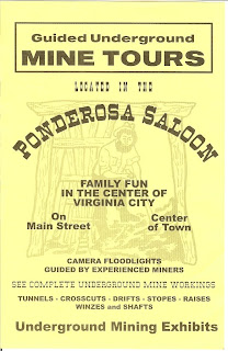
Today, the town is largely a tourist destination – as far as we could tell. We saw only a small part of it, so advice from Travelmarx is slim. We did take the tour of the “basement” of the main church (red brick, white, just off the main street) which was interestingly narrated. And, we took the Ponderosa mine tour. It’s a short tour you take from a saloon on “C” street. The mine shaft starts in the back of the saloon.
Virginia City ChurchVirginia City View
Ponderosa Saloon FlyerOn the Mining Tour

Friday, June 20, 2008

Galena Creek Park

Galena Creek Park Brochure
We had the chance to take a stroll in Galena Creek Park (location) today just outside of Reno. We are in Reno for a few days. The park is a welcome relief to get up higher, take in some cooler breezes and enjoy a little exercise. Reno, being the second city we saw after coming back from Italy is a mind scramble for me. I can’t distinguish between a Bed Bath and Beyond, a post office, a school, or a disco. Everything looks the same, a look I’ll call desert-mall. There is nothing to orient you (outside the main downtown) where to go to find a bakery or a grocery store. Malls are located far away from where people live and you have to practically drive around the mall parking lot to get between stores (I’m thinking of this mall specifically.)

Back to the park. Galena is a natural mineral form of lead sulfide. (I was thinking it was a chicken as in gallina in Italian – back to the mall for me.) It was a material that was annoying to the mining operations and there was once a town called Galena that has since been abandoned. We spent about 2 hours wandering the Jones Creek Trail. The trails were well maintained from what we could see and there were picnic areas and restrooms. We definitely would like to go back and make it up to Mt. Rose.

Saturday, June 14, 2008

The South Tyrol Museum of Archaeological – Ötzi’s Home

Otzi Museum
The South Tyrol Museum of Archaeology is located in Bolzano in the Trentino-Alto Adige region of Italy. The museum is famous because of its permanent resident, Ötzi the 5000+ year old iceman. Ötzi is certainly the star attraction but what makes the museum truly successful is how they build up to tell Ötzi’s story: how he was found, where he was found, what he was found with, and some probable and some speculative aspects of his Copper Age life.

If you want to cut to the chase and see Ötzi directly – or really, peek at him in his bedroom chamber of -6° C glacier-like temperature - then go directly to the second floor. But, to do so and not take some time to follow the curated exhibits leading up to viewing him would be to miss a big part of the museum’s charm. A word or warning: there are a couple of English signs around the viewing area of Ötzi but otherwise they are scarce, so, for English-speakers the audio guide is indispensable.

So who was Ötzi? He was a man who lived somewhere between 3,350 and 3,100 B.C. He died probably as a result for a wound to the shoulder falling into a gully on the border between Italy and Austria in what are called the Ötztal Alps (approximate location he was found). Over time he became mummified and covered with a glacier, called now the Tisenjoch glacier. He was discovered in 1991 by some hikers thanks to warmer temperatures and retreating glaciers. At first, it was thought that it was just another lost hiker as several a year are found in that area. It took a while to figure out that this was quite a different kind of find.

There are many interesting aspects of Ötzi, but the one I found the most interesting is the markings or tattoos on his skin. The markings are groups of straight lines. It is believed that these marks could well have been therapeutic in nature as they were made at specific parts of the body that were exposed to the most stress like joints and the spinal column.
otzi notes

Friday, June 13, 2008

Alta Badia and Val Gardena – Eight Hikes in the Dolomites

Summary of Eight Hikes in Alta Badia and Val Gardena (2008 version).Summary of Eight Hikes in Alta Badia and Val Gardena (2018 version).
Summary of Eight Hikes in Alta Badia. Left: Map created in 2008. Right: Update map created in 2018.

We were in the Alta Badia for 10 full days and managed to get 8 hikes in. We saw just got a taste of the region and we know we'll be back.We estimate that we hiked about 110 km (68 miles) in about 48 hours over the 8 hikes.

Alta Badia is the Val Badia of the Dolomites centered around the towns of Corvara, Badia, and La Val. (As we were updating this post in 2018, we realized that our Langkofel Hike is actually in Val Gardena not Alta Badia.)

Keep the following in mind when reading this post:
  • The time of our hikes, early June, is still low season so you won’t see a lot of folks on the trail nor will many restaurants, hotels, or more importantly, rifugi (mountain huts) open. For us, that’s okay. Everything starts to pick up here we were told around July 1st. It would have been nice to have more rifugi open so we could lessen what we were carrying food-wise.
  • We had a car so that we could drive to trail heads. We did not use public transportation. It exists though.
  • We did not intentionally do any via ferrata, except a bit at Lagazuoi which was necessary to get in and out of the Lagazuoi tunnel (if you could classify that as a ferrata).
  • We saw all sorts of weather in early June: sun, rain, lightning and thunder, hail, warm, and cold. Everyone kept saying this was a very strange spring as much of northern Italy has been experiencing. Regardless of this year, we would plan for changing weather in early June.
  • See this post for the maps we used for hiking.
  • See our 2020 post A Hiking Week in the Dolomites, Val Badia and Val Gardena for more suggestions and a week itinerary.

All hikes were interesting in their own way, but the Langkofel Hike and the Sass de Putia Hike stand out because of the experience of circumnavigating a large massif (massiccio in Italian) and getting a good sense of the geography.

Santa-Croce Hike


We took the Santa-Croce chair lifts (two of them) to the Santa-Croce rifugio at 2045m. Then we took #15 heading south to #12 heading east, then doubled back on ourselves and took #12a to #15 back to the chair lift.

Chairlifts takes you from 1365 to 2050 meters.Passing over the village of San Leonardo.New larch needles.Looking southwest toward Colfosco where we are staying and the profile of Sassongher.SassongherChiesa Santa Croce.Working our way up to the Forcela di Medesc.Looking southwest toward Corvara, Colfosco, the Sella Group and Sassongher.
Top Row. Left: Chairlifts takes you from 1365 to 2050 meters. Center Left: Passing over the village of San Leonardo. Center Right: New larch needles. Right:  Looking southwest toward Colfosco where we are staying and the profile of Sassongher.
Bottom Row. Left: Sassongher. Center Left: Chiesa Santa Croce. Center Right: Working our way up to the Forcela di Medesc. Right: Looking southwest toward Corvara, Colfosco, the Sella Group and Sassongher.

Fanes-Senes-Braies Nature Park Hike


We started at Capanna Alpina and our goal was to hike to Rifugio Fanes. The weather dogged us most of the day leading to surreal misty views. Capanna Alpina is a rifugio just southeast of San Cassiano; there is parking lot there. From the parking lot, we followed trail # 11 all the way to the Rifugio. #11 and Alta Via 1 coincide for part of the way.

Trail #11 Parco naturale Fanes-Senes-Braies.View from starting point of hike looking up into the park.View from the trail back down to where we started.Part of hike where trail #11 flattens out.
Left: Trail #11 Parco naturale Fanes-Senes-Braies. Center Left: View from starting point of hike looking up into the park. Center Right: View from the trail back down to where we started. Right: Part of hike where trail #11 flattens out.

Puez-Odle Nature Park Hike


This was a loop hike that we started and ended from our hotel in Colfosco and which passed through the Puez-Odle park. We walked from the church in Colfosco up to the Edelweiss rifugio (follow the signs). From there we headed west on trail #8. When you reach Jimmy Hutte take trail #2 (which coincides with Alta Via 2) for some time passing by Lago Crespeina. At the next major trail intersection take trail #4 back to the Edelweiss rifugio.

An example of the typical barn structure found in the pastures of Alta Badia and the Dolomites.Heading to Rifugio Jimmy near Passo Gardena.The scene in the Puez-Odle park on a rainy day.Heading south back to Colfosco; the Sella Group and Val di Mezdi in the distance.
Left: An example of the typical barn structure found in the pastures of Alta Badia and the Dolomites. Center Left: Heading to Rifugio Jimmy near Passo Gardena. Center Right: The scene in the Puez-Odle park on a rainy day. Right: Heading south back to Colfosco; the Sella Group and Val di Mezdi in the distance.

Cinque-Torre Hike


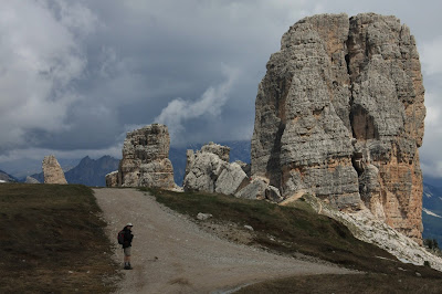
We took the Bain de Dones chairlift to Rifugio Scoiattoli (2255m) and then did the hike in two parts. First we hiked up to Rifugio Nuvolau (2575m) and then we hiked around Cinque Torre starting with the open air war museum there. The museum paths still had snow this early June. For more

View northeast - Penes de Fouzargo.Rifugio Nuvolau where we were earlier in the hike.Near Cinque Torre (5 Towers) where there is an open air war museum.
On the south side of Cinque Torre.Serrated mountains in the distance.Exploring parts of the open air war museum near Cinque Torre.Classic shot of the Croda da Lago group.
Top Row. Left: Group Croda da Lago to the east of Cinque Torre. Center Left: View northeast - Penes de Fouzargo. Center Right: Rifugio Nuvolau where we were earlier in the hike. Right: Near Cinque Torre (5 Towers) where there is an open air war museum.
Bottom Row. Left: On the south side of Cinque Torre. Center Left: Serrated mountains in the distance. Center Right: Exploring parts of the open air war museum near Cinque Torre. Right: Classic shot of the Croda da Lago group.

Circumnavigation of the Langkofel Group (Sassolungo)


We drove from Colfosco to Passo Sella (2176 m) and parked. We decided to circumnavigate the Sassolungo Group clockwise, but first we took a detour to climb up to Col Rodella (2484m) for a quick look over val di Fassa. We reversed our steps a bit, and then followed trail #4-557 west. At Rifugio Sasso Piatto we caught trail #527 heading north and then east. Eventually we met up with trail #525 which took us back to the Passo Sella parking lot.

Heading to Rifugio Sasso Piatto.A tree grows on a rock in the La città dei sassi.The Lankofel (Sassolungo) Group as seen from Passo Gardena.The nearby Sella Group in light and shadow.
West edge of the Sella Group as seen from Passo Sella.Looking north toward Gardena Pass from Sella Pass.On the north side of the Lankofel Group and stormy weather.View from Col Rodella back on the Gruppo Sassolungo. You can see the trail we hiked.
Top Row. Left: Heading to Rifugio Sasso Piatto. Center Left: A tree grows on a rock in the La città dei sassi. Center Right: The Lankofel (Sassolungo) Group as seen from Passo Gardena. Right: The nearby Sella Group in light and shadow.
Bottom Row. Left: West edge of the Sella Group as seen from Passo Sella. Center Left: Looking north toward Gardena Pass from Sella Pass. Center Right: On the north side of the Lankofel Group and stormy weather. Right: View from Col Rodella back on the Gruppo Sassolungo. You can see the trail we hiked.

Circumnavigation of Sass de Putia


Leaving the Passo delle Erbe parking lot we took trail #8a until we reach the base of the Sass de Putia group and then we headed west to begin a counter-clockwise circumnavigation still on #8a. Eventually we met up with #4 (coincides with Alta Via 2) to the Forcela de Putia (2357 m). At this point we took a detour to climb to the secondary peak of Putia (2815m). (The real peak is at 2875 m.) After coming back from this 2 hour excursion we continued around following trail #35 for some time across the south side of the mountain group. Eventually we met up with trail #8b which took us back to our starting point.


Start of hike heading toward base of Sass de Putia.The start of the path to the peak of Sass de Putia.View south toward Puez Odle park.Walking in the malga of the south side of Sass de Putia.
Walking on the south, southeast, and east of Sass de Putia with its characteristic wooden structures.Walking on the south, southeast, and east of Sass de Putia with its characteristic wooden structures.Walking on the south, southeast, and east of Sass de Putia with its characteristic wooden structures.Walking on the south, southeast, and east of Sass de Putia with its characteristic wooden structures.
Top Row. Left: Start of hike heading toward base of Sass de Putia. Center Left: The start of the path to the peak of Sass de Putia. Center Right: View south toward Puez Odle park. Right: Walking in the malga of the south side of Sass de Putia.
Bottom Row. Walking on the south, southeast, and east of Sass de Putia with its characteristic wooden structures.

Lagazuoi Tunnels


The goal of this hike was to visit the famous WWI Lagazuoi Tunnels. The tunnels and trenches and war works were part of the bitter fight between the Austrians and the Italian for control over this area.

We took the cable car up from Passo Falzarego to Rifugio Lagazuoi. From there we took some time taking in the view and then headed for the tunnel entrance. The approach to the tunnel and the exit were a little tricky. There were cables to hold on to, but if you are not one for heights, it may not be the best thing to do. Once inside the tunnel we spend several hours exploring passageways.

We rented helmets and hand lamps. Gloves wouldn't be a bad idea either. Initially, it's hard to grasp the layout of the tunnels. When you first get off the cable car from the valley to Rifugio Lagazuoi and you head east for a few steps, you see some tunnels and trenches. These were the Austrian tunnels, who held the top of the ridge. To get to the Italian tunnels you have to walk a bit more on an interesting if not a little nerve-racking trail.

Entrance pointing to the entrance to the "Italian" tunnels.View north from Rifugio Lagazuio.View from Rifugio Lagazuio toward Cinque Torre.Rifugio Lagazuoi is on the cliff and is the starting point.
Some tunnels have cables you can use to hold as you explore outside.A tunnel in Lagazuoi.Working our way to the entrance of the "Italian" tunnels.After leaving the tunnels, there is still a ways to go to get back to the valley.
Top Row. Left: Entrance pointing to the entrance to the "Italian" tunnels. Center Left: View north from Rifugio Lagazuio. Center Right: View from Rifugio Lagazuio toward Cinque Torre. Right: Rifugio Lagazuoi is on the cliff and is the starting point.
Bottom Row: Left: Some tunnels have cables you can use to hold as you explore outside. Center Left: A tunnel in Lagazuoi. Center Right: Working our way to the entrance of the "Italian" tunnels. Right: After leaving the tunnels, there is still a ways to go to get back to the valley.

Val de Mezdi, Pisciadú Waterfalls and Passo Gardena Hike


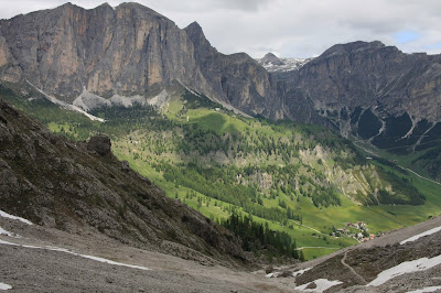
This hike starts from Colfosco. We took trail #651 to #26 to #666 to Passo Gardena to #8 to #8c which dropped us back in Colfosco. We looped around the valley between Colfosco to the east and Passo Gardena in the west. First we climbed a ways up and into Val de Mezdi, then we retraced our steps and headed west to Pisciadú Waterfalls and continued around (clockwise) to Passo Gardena and then back to Colfosco.

Walking toward Passo Gardena.Onobrychis montana – Mountain Sainfoin (Lupinella montana).Pinguicula alpina – Alpine butterwort is insectivorous.View from Val de Mezdi north toward Colfosco.
Colfosco, with Sella Group in background.Trollius europaeus in pastures of Colfosco.View from Val de Mezdi back toward Colfosco.Val de Mezdi as seen from Passo Gardena.
Top Row: Left: Walking toward Passo Gardena. Center Left: Onobrychis montana – Mountain Sainfoin (Lupinella montana). Center Right: Pinguicula alpina – Alpine butterwort is insectivorous. Right: View from Val de Mezdi north toward Colfosco.
Bottom Row: Left: Colfosco, with Sella Group in background. Center Left: Trollius europaeus in pastures of Colfosco. Center Right: View from Val de Mezdi back toward Colfosco. Right: Val de Mezdi as seen from Passo Gardena.