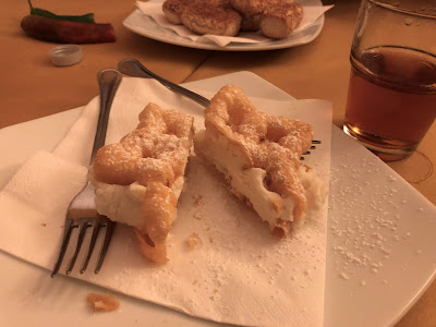
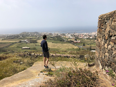
Top Left: View from Il Principe e Il Pirata restaurant on Pantelleria.
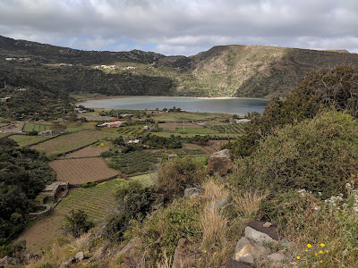
Top Right: A view of Lago Specchio di Venere.
Bottom Left: L'Arco dell'Elefante - a sea stack on Pantelleria.
Bottom Right: Punta Spadillo on Pantelleria.
[top]
Overview
This post is about the Island of Pantelleria. We recently spent six days there and have a bit to share on our experiences.
Okay, let’s start with the basics. First, the correct pronunciation is Pan-tel-le-ria with the emphasis on the rìa. (The accent isn't written.) The name derives from the Arabic name Qawsarah or Bent el Rion, meaning Daughter of the Wind, due to the ever-present winds blowing over the island.
Second, let’s talk about location. Pantelleria sits in the Mediterranean Sea, in the Strait of Sicily, a body of water between Sicily and Tunisia (Africa). The island is 100 km (62 mi) southwest of Sicily and is closer to Tunisia than to Sicily. Administratively, the island is part of the Sicilian province of Trapani.
Third, what's it like? Pantelleria is a volcanic island surrounded by beautiful blue sea, but there is not one bit of sandy beach to be found. (The exception is the beach of the salt-water lake called Lago di Specchio di Venere.) All access to the sea is not “easy” being over lava rock or stony outcrops.
Besides the surrounding sea, the island itself is beautiful. Part of the land is given over to the cultivation of grapes and capers, for which the island is famous for. Part of the island is given over to development, but not – in our opinion – it didn't feel too much or congested. There was a nice balance between populated and open spaces.
Pantelleria is often compared to its nearby neighbor to the southeast, Malta. We visited Malta in February 2017 (see the post Six Days in Malta). The two are similar in terms of climate and environment (maquis shrubland and garrigue), but that’s about it. Malta is an island country (an archipelago) and Pantelleria is a comune (a municipality of Sicily). Further, Malta is about four times as big and has at least 40 times more people. Malta is more densely packed.
Continuing with the comparison, Malta’s high point is Ta' Dmejrek (at the Dingli Cliffs) at 253 m (830 ft). On Pantelleria, the highest point on the island is Montagna Grande at 836 m (2,743 ft). It’s possible to reach the top of Montagna Grande and from there get views over pretty much the whole island. For more information, see the post Ideas for Hiking and Walking on the Island of Pantelleria, Sicily.
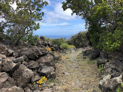
Views of inside of the Island of Pantelleria. Left: Above Khamma Pantelleria on the Serra Ghirlanda trail overlooking the beautiful Piano Ghirlanda. Center: View from Bugeber toward Lago Specchio di Venere. Right: A trail near Bugeber.
[top]
Getting Around
Pantelleria has an area of 83 km2 (32 sq mi) and is shaped like an egg leaning left, with its axis running northwest - southeast, aligned with the continental rift in this part of the strait. To navigate the island, driving the perimeter road, it would take just about one hour and you would cover about 40 km (25 miles).
There are buses that go around the island and stopping at various popular tourist spots. One bus covers the north side of the island from Pantelleria (town) to Tracino. Another bus covers the south side from Pantelleria (town) to Rekhale. Other bus routes cover the airport, which is close to Pantelleria (town).
We saw the bus often on the road as well as people waiting for the bus, so it seems popular and reliable. However, as you’d expect, the bus stays on the main roads, so some walking may be necessary to reach your final destination. For the latest bus schedule go to Pantelleria Comune and look for “orario autobus”.
To get off the main roads, you really need a car. And, with a car be prepared to drive on dirt roads. Half of the island – aside from the perimeter roads – is made up of dirt or rough roads. We were a group of four adults and rented a small Fiat at the airport. It was adequate but there were times we wished we had a jeep. Note that all gas stations seem to be in Pantelleria (town) – at the northwest end of the island – or top of the egg.
Also, a word of advice and from our experience: take pictures of the rental car as soon as you take possession of it. We didn’t because it was night, we were tired and rushed to get checked in to accommodations. Upon returning the car, the agency noted damage (a scratch) that we weren’t sure wasn’t there before we took possession.
[top]
Impressions
We stayed in the Khamma (or Kamma) area on the east side (or backside of the island). Our accommodation (a restored dammuso) was just minutes from Piazza Perugia, where we went every morning for coffee. Aside from walking to the piazza for coffee, all our days’ journeys began with a car. So, for us, a car was critical.
Dammusi, plural of dammuso, are the typical houses you see on Pantelleria. They are square buildings constructed with lava stone; they are part Arab influence and part original work of the people of Pantelleria. Dammusi fit naturally into the landscape of the island, responding to the characteristics of Pantelleria: the constant wind, the heat, the lack of rain and abundance of lava as building material. The most noticeable feature of dammusi are their sensuous, usually white-washed, bubble roofs whose purpose is to help collect rainwater water and channel it to underground cisterns as well as keep the rooms inside cooler by raising the ceiling.
Dammusi roofs: white, bulging and all about collecting precious water and cooling the rooms inside.
Left: An abandoned dammuso in a field. Center and right: The entry and window of the dammuso we stayed at.
The town of Pantelleria, we are sorry to say, is not much to look at. We had several occasions to come to town – if not for gas – and walk around a bit. The area directly on the water around the castle is pretty enough, but not beautiful. The castle was closed (off season) and not approachable. Too bad because it looked interesting. Nearby the castle, the Parrocchia del Santissimo Salvatore church will surely catch your eye: a big blue cube that looks less Catholic and more Islamic. In all fairness, the island and the town suffered 35 days of relentless Allied bombings in 1943. From the archive photos we saw in the museum at Punto Spadilla, the port was pretty much leveled. Unfortunately, the subsequent rebuilding took on the look of mid-century blandness. Two interesting notes. First, and again taken from the info in the museum, was that the military commander, Gino Pavesi, surrendered to the Allies before receiving approval from Mussolini. Second, the huge, underground hangars constructed by Pier Luigi Nervi helped shelter the population during the bombing. Unfortunately, we did not get to see these.
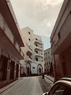
Views of Pantelleria town including the castello Barbacane and the blue-cube church, Parrocchia del Santissimo Salvatore.
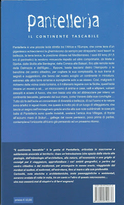
This being Sicily, one must have at least one cannolo. The best cannolo in town? Bar Pasticcieria Da Giovanni just off the piazza cater-corner to the blue-cube church. This was according to the man running Cartoleria Profumeria Maccotta, just next door. We stopped in the Cartoleria to buy the guidebook, aptly named Pantelleria, by Peppe D'Aietti, Grazia Cucci. As luck would have it, we ran into Peppe the last day of our visit, at lunch. Next time we’d visit, we would surely engage his guide services, especially for some of the ruins we saw that lacked context, such as the acropolis and the sesi complex in Mursia. And yes, the cannolo was good.
We found Pantelleria to be surprisingly clean and well-maintained. Perhaps we were biased by past experiences in Sicily, and by association assumed it would be a little bit rough around the edges. It wasn’t. Pantelleria stands apart from Sicily even if it is administratively part of it. We asked a native of the island if he identified as Sicilian and the answer was emphatically no, he was Pantesco – the name of an inhabitant of the island.
We read in several spots that the people of Pantelleria (panteschi) consider themselves more people of the land more than the sea. As one piece of anecdotal information, looking out from our dammuso, during our six days, we saw just one sailboat and a few cargo ships in the distance. Really nothing at all; a sea empty of activity. Perhaps the rough lava coasts – as you gather made an impression on us – don’t lend themselves to boat landings. Nor the wind whipping up the waves.
As we talked about in the post Ideas for Hiking and Walking on the Island of Pantelleria, Sicily, there are lots of hiking, walking, and running opportunities in Pantelleria. You might have to explore a bit to find the trails and paths, but they are there. (Try MAPS.ME with its great offline capability.)
One thing to do for sure when visiting Pantelleria is ask the locals what’s the best to do on any given day. With the winds driving so much of the character of the day, some activities are favored for windy days like visiting beaches on the “back” side of the island or visiting the Lago di Specchio di Venere. For example, the day we hiked Montagna Grande, the air quality was terrible. We couldn’t tell if it was moisture or sand from the Sahara or both. The next day was fine and we should have waited.
Left: A weathered explanation sign at Grotta Sateria explaining that the water is 40 C - when it's open. Center left: A weathered explanation sign at Sese Grande - part of the archaeological area of Mursisa. Center right and right: The business card of a tour guide Peppe D'Aietti.
Left: A sign explaining the Acropolis of Pantelleria (also called the Acropolis of San Marco and Santa Teresa). The acropolis is where three Roman marble heads were found dating from 100 AD. Center left: A sign showing the archaeological sites around Pantelleria. Center right and right: A guide book for Pantelleria.
[top]
Swimming
Swimming adventures around Pantelleria. Left: Swimming at Cala Levante. Center left: Grotta Sataria. Center right: Cala Rotonda Martingana. Right: A hot pool at Gadir.
Your first thought upon hearing of an island in the Mediterranean is probably beaches and warm water. On Pantelleria be warned: there are no sandy beaches (except for the lake). All access to the water is kind of difficult. The first clue is on Google Maps where entry points for popular swimming spots are marked as discesa a mare or descent to the sea like this one for Nikà. The name is accurate because edges of this island tend to drop off steeply and you find your self at a small boat launch, bay or cove, or lava outcrop. From there, there is usually some way to get into the water, but it isn’t always easy.
And water temperatures? During our April visit we didn’t measure the temperature but the reported average of 15.7 C (60.3 F) seems about right. Take heart: by August, the water temperature reaches its peak at 25.4 C (77.7 F). We sure could have used the extra 17 degrees F. For reference, 65 F for swimming is considered cool and only for the hardy. In fact, only one of our party of four (the other half of Travelmarx and the hardiest of the group) went in the water five times with just a bathing suit. Yours truly (writing and less hardy) went in once with a bathing suit and twice with a wet suit.
Unfortunately, we didn’t wise up to renting a wet suit until day four of our stay. We rented them at Green Divers, which seemed to be the only shop open in April. Cold water and hit-or-miss shop hours: welcome to off-season travel. Upsides: no traffic and no fighting to get into what places are open.
A summary of swimming spots we tried, in order, is below. This is by far just a small sampling of possible swimming options on Pantelleria. For Ballata dei Turchi and Cala Rotonada Martingana there is a fair amount of off-road driving on narrow and at times steep roads. Also, I’m a tenderfoot and used a pair of Keen sandals for getting in and out of the water and swimming (you never know about those sea urchins).
- (loc) Punta Karace (Gadir). Swim.
- (loc) Lago di Specchio di Venere. Swim.
- (loc) Grotta Sataria. Closed due to landslides, so no swimming.
- (loc) Mare Nikà. Just a walk to water, with no easy way into the water, so again no swimming.
- (loc) Ballata dei Turchi. Swim.
- (loc) Cala Levante. Swim.
- (loc) Cala Rotonada Martingana. Swim.
- Punta Karace (Gadir). Swim.
Pantelleria is famous for phenomena related to volcanic activity, such as hot springs and fumaroles. The most obvious place we observed this was at Gadir and its hot pools. Other than that, we did not experience it much and felt cheated in this respect. Sataria is famous as a point where the sea water is warmed (40 C) by volcanic action, but it was closed. Also, at Nikà, we had read of the warmer waters but didn’t find them.
The prettiest swimming we experienced was at Martingana. The warmest swimming we experienced was in the lake, Specchio di Venere. We swam back and forth across the lake (north/south axis) 500 m in total. The lake is set in a volcanic crater and is very scenic. The lake is famous for its therapeutic mud. The temperature of the lake where the hot springs flow is reported to vary between 35 C (95 F) and 50 C (122 F). The lake itself and not any associated hot spots nearby was definitely toward the lower end.


Left: Balneazione sicura or "safe swimming" spots on Pantelleria. Note how many are either scogli "rocks" or pianale "platform". Right: An interesting overview of the etymology of many names used on the Island of Pantelleria. For example, cuddia comes from Arabic and means small hill and tracino, also from Arabic, means point.


Left: Balneazione sicura or "safe swimming" spots on Pantelleria. Note how many are either scogli "rocks" or pianale "platform". Right: An interesting overview of the etymology of many names used on the Island of Pantelleria. For example, cuddia comes from Arabic and means small hill and tracino, also from Arabic, means point.
[top]
Food
We sampled a few restaurants during our stay on Pantelleria. See itinerary section below for all links. Our favorite hands down was Osteria Il Principe e Il Pirata. We ate there twice and it was magical. Our morning go-to coffee place was Bar Beluga; there was good coffee and food (we ate lunch once there), but we mostly went because it was reputed to have the best WIFI. In Pantelleria town, we liked Ristorante Dammuso.
We got to try most of the typical dishes and wines over the six days. Typical dishes include:
- Cous cous pantesco – Cous cous based on fish and vegetables, often served with fish broth on the side to add as desired.
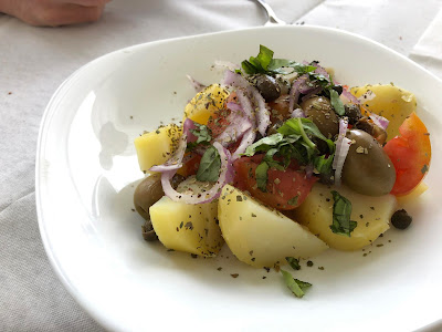
- Insalata pantesca – An easy salad of boiled potatoes, capers, onions, and fresh tomatoes as a base.
- Pesto pantesco – Not your typical green pesto made of basil but rather this version is based on fresh tomatoes.
- Bacio pantesco – The “Pantelleria kiss” is a dessert “sandwich” made of two light and crispy pastries with ricotta between them.
- Ravioli panteschi – Ravioli filled with ricotta and mint.
- Caponata pantesca – A variant of caponata.
- Riso con zucchini – A risotto-like dish with zucchini and mint.
Typical products:
- Zibibbo – Referred to as Muscat of Alexandria in the north.
- Capers – The fruit of Capparis spinosa features prominently in the cuisine of Pantelleria. The capers normally eaten are the pickled flower buds though the pickled fruits can be eaten as well.
- Busiate – A pasta common in Southern Italy and commonly seen on Pantelleria menus, busiate pasta looks like corkscrews.
- Passito di Pantelleria – a sweet wine made from zibibbo grapes and produced exclusively on Pantelleria.
Some dishes we enjoyed during our stay on the Island of Pantelleria. From left to right: Caponata pantesca, insalta pantesca, insalata pantesca, busiate, ravioli panteschi, and bacio pantesco.
[top]
Our Itinerary
Left: A map showing points visited during our six day visit on Pantelleria. Map was generated by our Digital Scrapbook software (more info). Center: A map of Pantelleria we used while on the island. Right: Sese Grande (in English it's Big Sese), part of the Archaeological area of Mursia.
This was our six-day itinerary. Use it to get an idea of what’s possible time and activity-wise. Lunches and dinners at “home” or improvised are not shown below.
Day 0: Wednesday, April 24
Arrive late evening from Trapani on DAT (Danish Air Transport).
Pick up car, drive to Khamma. Dine at Trattoria a Favarotta.
Day 1: Thursday
Activity: Hike Montagna Grande. See the post Ideas for Hiking and Walking on the Island of Pantelleria, Sicily.
Dinner: La Conchiglia
Day 2: Friday
Activity: Swimming at Punta Karace (Gadir)
Lunch: Goloso (Pantelleria town)
Activity: Acropoli di Pantelleria - The acropolis was the twin hill of San Marco and Santa Teresa just, 2 km (1.2 mi) southeast of Pantelleria town. In the acropolis you can find walls made of rectangular blocks of masonry and cisterns. It was at this site, that three marble heads were found in 2003. The heads are of Gaius Julius Caesar (c. 100-1 - 44 BC), Titus (39 - 81 AD), and Agrippina the Elder (c. 14 BC - 33 AD).
Activity: Swimming at Lago Speccho di Venere - This lake is inside an extinct volcanic crater, and is fed by rain and hot springs. The maximum depth is 12 m (39 ft) deep. It is popular for swimming, hot springs, and mud bathing. At least part of one day of any stay on the Island of Pantelleria must be to visit this lake whose name translates to Venus' mirror.
Dinner: Osteria Il Principe e Il Pirata
Day 3: Saturday
Activity: Drive to the south side of the island and stop at Grotta Sataria, Mare Nikà, and Ballata dei
Turchi. Sateria was closed. At Mare Nikà, we walked around and nothing more. At Balata dei Turchi was spent 1-2 hours on the lava rocks (in an unexpected flat spot) and swam.
The crackled sign at Sataria/Sateria reads - paraphrasing: Sateria - thermal water grotto 40° (Grotto of Health). Hollowed partly by the erosion of the wind and the sea upon a block of pumice, this site was then developed by our ancestors to take advantage of the hot water thermal spring whose water was used in ancient times to cure pains in the joints. A myth connects this grotto as the residence of the Goddess Calypso and Ulysses in the island of Ogygia.
Day 4: Sunday
Activity: Ecotrail Sicilia 10K - We happen to be on the island during this race and we became the "international" participants. My 10k time was horrible because I kept stopping to take pictures.
Activity: Museo Vulcanologico - The Ecotrail race began and ended at Punta Spadillo where the Museum of Volcanology is also located. We had time before and after the race to check out some of the exhibits.
Activity: See Arco dell’Elefante
Lunch: Sunday Dinner at Osteria Il Principe e Il Pirata
Activity: Swimming at Cala Levante
Day 5: Monday
Activity: Pick up wet suits at Green Divers
Activity: Parco Archeologico dei Sesi - The big attraction here is Sese Grande (or Big Sese in English, which has a funny ring to it). There is little to no information at the site. For a possible guide option, see the information listed elsewhere in this post. The weathered sign nearby the site reads: "Tomb with a circular, truncated cone structure, built with rocks and megalithic techniques (Bronze Age about 1800 B.C.) It's the biggest funeral monument of the large cemetery with about 70 other similar smaller tombs."
Lunch: Ristorante Al Tramonto
Activity: Swimming Cala Rotonada Martingana
Day 6: Tuesday
Activity: Walk/run around Khamma. (See the post Ideas for Hiking and Walking on the Island of Pantelleria, Sicily.)
Activity: Swimming at Punta Karace (Gadir)
Activity: Chiesa di San Francesco, Khamma Pantelleria
Lunch: Ristorante Dammuso (Pantelleria town)
Depart early evening for Trapani.
Left: Late afternoon sun at Balata dei Turchi, Pantelleria. Center: A view down on the "beach" at Nikà. Right: Boats at Nikà.
[top]
Poem: Staring at the Sea
A first for the Travelmarx blog. Original poetry. It is inspired by six days of fighting my fear to enter the cold water in less than ideal conditions (lava rock) and in my usual tortuous way of inching in instead of diving. I’ve always had a love/hate relationship with the sea. Two days into our stay on Pantelleria, the phrase “staring at the sea” popped in my mind, probably just a little bit influenced by the 1986 Cure album Standing on the Beach / Staring at the Sea. Here's my poem:
Staring at the sea
Great fear and boredom
Giant hidden world
Under a cover of blue.
People fixate on the endless blue
I turn from it interested
In the dirt, plants
On safe land, green not blue.
Breathe, waves, breathe
Cold water, sharp rocks
Slow torturous entry
Always on the lookout.
Staring at the sea
A spectator sport to forget
About all else familiar
But not me.
Panteschi: people of the land
Less of the sea, I could live here
If not for the sound of palm fronds
In the incessant wind and staring at the sea.
[top]
Not Just the Sea
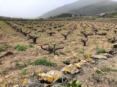
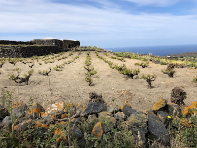
In this section, we include views around the Island of Pantelleria that are not sea-related. Particularly interesting is the cultivation of grapes with a method called in Italian vite ad alberello, which results in vines trained very close to the ground, often in a small hollow. Doing so provides a micro-climate for the vines and helps avoid loss of precious water to wind. This method of cultivation has been recognized by UNESCO as a traditional agricultural practice on the Representative List of the Intangible Cultural Heritage of Humanity. Not to quibble, but let's do it: on the UNESCO list vite ad alberello is translated as "head-trained bush vines", which is a bit inelegant. Alberello is Italian for a small tree or sapling, so perhaps a better translation is "small tree vines"?
For information on the flora of Pantelleria, see our post Selected Flora of Pantelleria (Sicily, Italy).
Vines on Pantelleria grown in the vite ad alberello method.
Left: View of Lago Specchio di Venere. Center: A view of Montagna Grande and Monte Gibele. Right: Pian Ghirlanda terracing on the side of Monte Gibele in Pantelleria.
Left: View from the Arcopolis of Pantelleria looking west back toward Pantelleria town. Center: View from the ascent to Montagna Grande - a view north on a hazy day. Right: The town of Scauri, Pantelleria.

















No comments:
Post a Comment
All comments are moderated. If your comment doesn't appear right away, it was likely accepted. Check back in a day if you asked a question.