

Left: View of Mondifrà Basso and Alto on the way to Malga Vagliana. Right: View east of the Brenta Dolomites from Malga Ritorto.


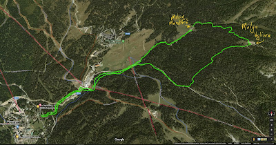
Routes for three walks. Left: Malga Ritorto and Rifugio Nambino, Center: Rifugio Montagnoli. Right: Malga Mondifrà and Malga Vagliana.
Madonna di Campiglio is a small town in the province of Trento that is situated between the Brenta Dolomites to the east and the Adamello-Presanella Alps to the west. The town is at 1522 m and is well known for the choice of summer and winter activities that are possible just walking out from the center of town.
We were there for a holiday over New Year’s which entailed lots of fireworks – and we mean a lot. The biggest display was on the night of the 1st just after the famous fiaccolata, a torchlight parade on skis where skiers with torches descend the slopes into town in a slow and serpentine fashion. Of course, it takes place at night for maximum effect.
During our stay we skied for four days and walked for three days. In terms of the slopes, we recorded about 213 km of ski movement (skiing and ski lifts) in about 20 hours on the slopes over the 4 days. In terms of walking, we hadn’t planned to do any walking and didn’t have microspikes/crampons or walking poles. For poles, we substituted ski poles. For traction, we just went slow and avoided icy spots though we fell a few times.
Each hike we started approximately at the base of the Pradalago lift, which is in the northern part of the town. Make sure to stop in the tourist office and pick up the Winter Walking Trails map (photos below), which will be a big help selecting a hike. A couple of times, we did cross a ski run or walked on the edge.
Name: Hike 1 - Malga Ritorto and Rifugio Nambino
Length: 13 km
Duration: 5 hours
Elevation: 247 m elevation gain
Location: Madonna di Campiglio (TN)
Type: loop, center of Madonna di Campiglio to Malga Ritorto to Rifugio Nambino and back to center.
Name: Hike 2 - Rifugio Montagnoli
Length: 4 km
Duration: 2 hours
Elevation: 284 m elevation gain
Location: Madonna di Campiglio (TN)
Type: loop
Name: Hike 3 - Malga Mondifrà and Malga Vagliana
Length: 10 km
Duration: 3 hours
Elevation: 309 m elevation gain
Location: Madonna di Campiglio (TN)
Type: loop, center of Madonna di Campiglio to Malga Mondifrà to Malga Vagliana and back to center

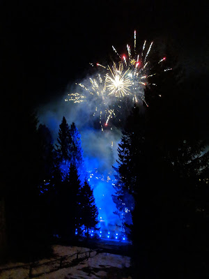

Left: The 2019 fiaccolata of Madonna di Campiglio. Center: Fireworks after the fiaccolata. Right: View from the Grotte Ski Run just above Madonna di Campiglio.

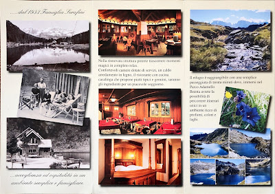
Brochure for Rifugio Lago Nambino.


Winter Hiking Trails Map (Escursioni sulla neve) for Madonna di Campiglio. Left: Front Cover. Right: Example of hike description to Lago di Nambino.


Left: Recorded tracks for Hike 2 - Rifugio Montagnoli. Center: Recorded tracks for Hike 3 - Malga Mondifrà and Malga Vagliana. Right: Detail of center part of Winter Hiking Trails Map.
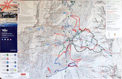

Left: Winter hiking trails map for Madonna di Campiglio. Right: Winter hiking trails descriptions for Madonna di Campiglio.


Left: Panorama in Malga Ritoro. Right: Below Malga Ritorto in a forest clearing.


Left: View east from Rifugio Malga Ritorto with a man filming. Right: Rifugio Malga Ritorto.

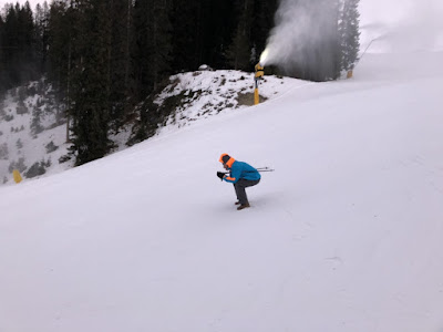
Left: The bridge a località Fortini. Right: Pretending to ski on the Fortini ski run.
No comments:
Post a Comment
All comments are moderated. If your comment doesn't appear right away, it was likely accepted. Check back in a day if you asked a question.