

Hike Notes
Length: 18.8 km (11.7 miles)
Duration: 7.5 hours roundtrip
Elevation: 982 m (3,220 feet) total elevation gain, max elevation 2.054 m (6,740 feet) @ Grotta del Gelo, starting elevation at Rifugio Ragabo 1.425 m (4,680 feet)
Location: Italy, Region of Sicilia, Province of Catania, Etna North, Piano Pernicana
Overview
This was our first hike after a few days in the Aeolian Islands and our climb to the summit of Stromboli. We were staying near Milo at B&B Dimora dell’Etna and it was an easy drive from there to the rifugio along the Strada Regionale Mareneve road. Rifugio Brunek and Ragabo are within a 100 yards of each other. We parked and started our walk from there, though later along the trail we saw another parking lot that mushroom collectors park at a gate, from which you can’t drive further (near Caserma Pitarrone).
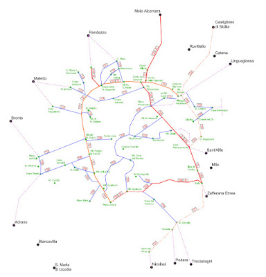
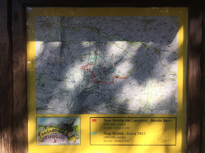
If you look at the pictures of the signs posted below, you'll see that you can make a bigger loop hike by passing through Piano Provenanza. We did not do that; instead, we came back the way we went. The tracks we followed to reach the grotta can be downloaded at the Etna Tracking site for La Grotta del Gelo. The first half to three-quarters of the trail are simple to follow as you are walking more or less on a service road. At the Grotta dei Lamponi, you depart the road and start following cairns, which is where the tracks come in handy. For an overview of trails around Etna, the Parco Etna site has some good overview images on their trails page. From Brunek/Ragabo you follow trail 701 and then at Grotta dei Lamponi you follow 724 for a bit to 714. You definitely need to study up before leaving because signage is a bit scant. Again, having the tracks on your phone to follow is easiest.
Along the way, we came across the Grotta delle Femmine, Grotta dei Lamponi, Grotta di Aci, and Grotta del Gelo. We explored only Lamponi and Gelo. We spent about 1 hour inside the Grotta dei Lamponi, with its two different galleries. It’s definitely worth a stop. It reminded us of our experience 6 years ago near Rainier in the Ape Cave Lava Tube. The Grotta del Gelo is unique in that the floor of the cave is a solid block of ice, which persists year-round, but is diminishing year over year due to warmer temperatures. We penetrated about 40 yards into the cave with normal hiking shoes. Beyond that, the ice floor of the cave sloped down in such a way that we weren’t convinced we could easily climb out, so we stopped there. The Etna Natura site has a themed page of the grotte you can see around Etna.
When exploring these caves, even just casually, bring good flashlights and head protection. Best would be a helmet of some sort, but at least have something on your head for protection. Lava is sharp.
Plants and Landscape
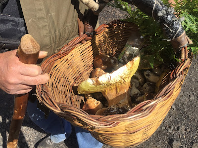
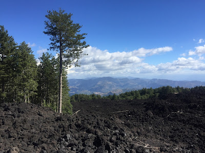
When I think of Etna, I think of fields of lava and little vegetation, let alone trees. Therefore, it was a surprise to start this hike in a lush pine forest. Yes, we eventually reached desolate (but beautiful) lava areas, but we were never far from forest. In fact, the trail passes through stands of pine and beech trees that seemed to have been spared destruction. Passing from the harsh beauty of lava to the soft beauty of forest is one of the attractions of this hike. We were equally surprised to run into groups of mushroom collectors, in particular porcini, in the woods.
Some of the plants that we noticed:
- [Fabaceae] Genista aetnensis – Mount Etna broom or la ginesta dell’Etna
- [Pinanceae] Pinus nigra subsp. calabrica
- [Orchidaceae] Neottia nidus-avis – Bird's nest orchid or il nido d’uccello
- [Cupressaceae] Juniperus communis var. hemisphaerica
A good site for reading up on these plants in Italian is on the Flora e Vegetazione della Sicilia site. Here are the entries for Genistra aetnensis, Pinus nigra, and Juniperus communis ssp. hemisphaerica. For a sampling of orchids of Mount Etna, see Le Orchidee dell’Etna (2005).
Left: Grotta dei Lamponi. Right: Grotta del Gelo (ice floor lit up with concealed flashlight; note entrance in the distance).


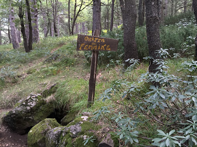
Left: Entrance to the Grotta delle Femmine. Right: Entrance to the Grotta del Gelo.

Far left: Map showing three hikes we did. Center left: A good overview map showing trail numbers and routes around Etna from the Parco dell'Etna site. Center right and far right: Signs at the start of the hike - Piano Pernicana.


Left and center: Genista aetnensis – Mount Etna broom or la ginesta dell’Etna, which bears an uncanny resemblance to the Palo Verde tree of the American southwest. Right: Juniperus communis var. hemisphaerica.


Left: We ran into a number of mushroom hunters on this hike. Porcini we think. Center: Neottia nidus-avis – Bird's nest orchid or il nido d’uccello. Right: Madonna of the Lava. There is always a shrine somewhere along the trail, you only need look.


North slope of Mount Etna - surreal landscapes looking north. Lava, lone pines, and beautiful sky.
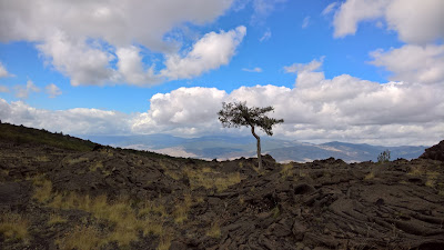
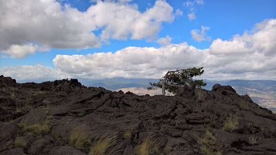
Views north from the north side of Mount Etna. In center photo, Taormina is barely visible in the distance.


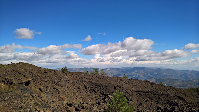
Left: Start of the hike under large pine trees. Right: Stands of forest give way to lava flows that laid waste to all that was there.

Thanks for posting pix and text!
ReplyDelete