

Left: View over the Krossa River and Básar. Right: End of the trail at Skogafoss.
Overview
Length: 15.7 miles one way
Duration: About 9.5 hours, 1:15pm - 10:45 pm with a break for dinner at Baldvinsskáli Hut
Elevation: Starting 800 feet (Básar), max at 3,400 feet (near the Magni and Móði craters), ending 89 feet (Skógafoss)
Location: Iceland, South Coast
Hike Notes
Here’s how we did this hike:
- Parked our car at the Skogar Campsite.
- Took Route 21a, departing Skogar at 8:15 am arriving at Seljalandsfoss at 8:45 am. Explored Seljalandsfoss for and hour or so, and grabbed a coffee and sandwich at the food truck.
- Took Route 9, departing Seljalandfoss at 10:45 am and arriving at Thorsmork/Basar at 1:10 pm.
- Hiked back to the car all in one go with a stop at the Baldvinsskáli Hut, approximately at the halfway point.
- The bus from Seljalandfossto Básar has a few stops. At first, we thought we took the wrong bus when it stopped at Húsadalur and almost tried to hike from there to Básar. The bus driver assured us he was going to Básar and he would be leaving in 20 minutes. (It did.)
- Arrive a few minutes before the departure time of any bus. The drivers are punctual about leaving. We almost missed the bus at Seljalandsfoss because we were dilly dallying at the food truck.
- Ask the bus driver where the bus is going and explain what you are trying to do. In one case, the buses changed on us (at Húsadalur) and if we went blindly back to the bus we came on, we’d be going in the wrong direction.
- We bought our tickets online and printed out the tickets and showed them to the driver. The buses were hardly filled and we could have purchased tickets on-board (with a credit card). Also, we might have saved some money because the online ticket sites are built for end to end trips. So, we basically bought the Reykjavik to to Básar total trip even though we started in Seljalandsfoss. Perhaps paying on the bus you’d get charged less?
- We looked at the various packages on Iceland On Your Own site and none of them seemed helpful for what we were trying to do. Though in the future, I might built a trip around the routes and packages there.
- We took this convoluted routing (parking car, bus, walking) because we did not want to camp. The downside of this route is that you start hiking later in the day (at 1:30 pm). The plus side is we saw no one going in this direction (Básar to Seljalandsfoss). We saw a few groups coming the other way.
Conditions
It was gray when we started and gray when we ended. Oh well. (We did have great weather on other days!) It sprinkled on us a few times, but nothing serious. We were walking on more snow than we expected. We started in short sleeves, got bundled up in layers at the top, and ended in a light pullover.
We finished the hike at approximately, 10:45 pm. The sight of our rental car (a very functional VW Golf) was very welcome. None of the restaurants at Seljalandsfoss were open so we headed home to our AirBnB place in Vik and ate our Icelandic TV dinners, which we wisely purchased the day before.


Left: Trailhead Map at Básar; Right: Magni and Móði Information.


Left: Example of flora - Dactylorhiza maculata – Heath Spotted Orchid, particular in the beginning of the hike. For more about Iceland flora see Selected Plant from Our Iceland Trip. Right: Reykjavik Excursions Bus, stop near the Gígjökull glacier.


Garmin final readings.
Follow the Red Backpack
We started at 1:15 pm and ended at 10:45 pm. These time-stamped shots give a sense of the middle part of the hike.


Left: 3:18 pm; Center: 3:29 pm; Right: 3:34 pm.


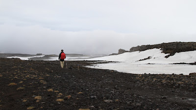
Left: 4:15 pm; Center: 5:30 pm; Right: 7:10 pm (just after dinner stop).
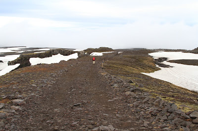
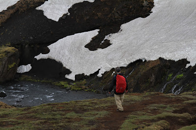
Left: 7:20 pm; Right: 8:08 pm.
Views from the Trail


Illhryggur – Godaland, Right photo: 63.659367, -19.425547.


Morinsheiði - View North from the Trail.


In the Snow Near the Pass. Right photo: 63.631097, -19.438711.

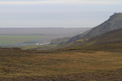
Left: Sheep Relax on the Skogar Side of the Pass 63.547903, -19.496914; Right: View from the trail south toward the ocean.

View back toward Básar from the trail.
Waterfalls on the Skógá River


Photo Right: 63.581778, -19.443036.


Left Photo: 63.575278, -19.451011.
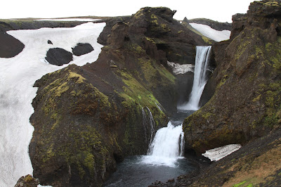
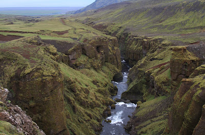


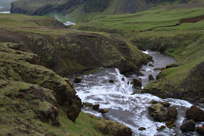

Left Photo: Location: 63°32'09.6"N 19°30'02.8"W.


Right Photo: At Skogafoss, 63.53180277777778, -19.510619444444444.
No comments:
Post a Comment
All comments are moderated. If your comment doesn't appear right away, it was likely accepted. Check back in a day if you asked a question.