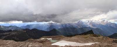
West side of the Easton Glacier
Our Hike Route of Park Butte Fire Lookout and Easton Glacier (via Canon GPS Logger and Google Earth)
Hike Notes
Length: 12.5 miles
Duration: 8.5 hours, 9:20 am – 5:50 pm inclusive of a 45 min lunch break.
Elevation Gain: Trailhead: WTA - 3,250 ft (WTA), Garmin** - 3,347 ft, Canon* - 3,357 ft. Highest point at edge of Easton Glacier: Garmin - 6,423 ft, Canon - 6,411 ft. Total elevation gain: Garmin - 4,150 ft, Canon - 4, 877.
Location: North Cascades -- West Slope
* Canon GPS Receiver, ** Garmin HCX
Overview
For our 10th and possibly last hike of the 2014 season, we hiked up to the Park Butte historic fire lookout and then took a stroll alongside the west side of the Easton Glacier (WTA site). We have racked up 131.7 total miles this season, inclusive of this hike and beating our 115.2 total miles last year.
First stop for us was the Park Butte historic fire lookout. At the fire lookout we had about 45 minutes of just us two and nobody else inside. We sat staring at Mount Baker, eating lunch and reading the various journals and information sheets left inside. After our lookout lunch, we headed back to the junction of the Park Butte Trail and the Railroad Grade Trail, which takes you toward the Easton Glacier. We decided that we would just take a peak at the glacier, and head back to pick up the Scott Paul Trail back to the trailhead. However, once we got saw the glacier, we knew we wanted to walk up beside it. We followed the Railroad Grade to get to the Easton Glacier, which is a lateral moraine formed as the glacier retreated. We were walking on a ridge where, on one side there is green high meadow, and to the other, a sharp drop down into emptiness where the glacier once was. We got up to 6,500 feet, above High Camp and then called it a day and headed back.
Left: View from the Fire Lookout Toward Mt Baker; Right View from 6,500 feet near the Easton Glacier, Looking South
Fly Amanita. Left: Dirty Toadstool? Right: Toadstools and Heather
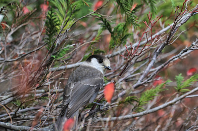
Left: A Marmot near High Camp; Right: A Gray Jay - Perisoreus canadensis
Left: Another View of Our Hike Route of Park Butte Fire Lookout and Easton Glacier (via Canon GPS Logger and Google Earth); Right: Lincoln Peak
Park Butte Fire Lookout. Left: Outside; Right: Looking Inside
Left: A Lunch Table in the Park Butte Fire Lookout; Right: View from the Fire Lookout
Hiking on the East Glacier Lateral Moraine
Vaccinia - Blueberries in Morovitz Meadow
Left: West side of the Easton Glacier; Right: Park Butte trail wall made of log ends.


No comments:
Post a Comment
All comments are moderated. If your comment doesn't appear right away, it was likely accepted. Check back in a day if you asked a question.