Left: Little Tahoma Looms Ahead; Right: Cistanthe umbellatum (Pussy Paws) in the Scree
The trail to Panhandle Gap is a section of the much larger, 93 mile Wonderland Trail which encircles Mount Rainier. From the trailhead on Sunrise Road at Fryingpan Creek, you walk just a few minutes before joining the Wonderland Trail. The Washington Trails Association page for this hike lists the round-trip miles at 12 with an elevation gain of 2,950 feet.
The scenery on this trail was probably some of the best we’ve seen this season compared to our three previous hikes (Goat Mountain, Blanca Lake, and Beckler Peak). From dappled-light old-growth, to alpine meadows, to scree slopes and rock fields, you can see quite a bit of flora. When we got back home and started looking through the pictures, we realized how many different plants and plant families we observed. The stand-out plants for us this time were in the scree areas.The Cistanthe umbellatum (Pussy Paws, Pussy Toes), in particular, was a pleasant find and it’s always pleasing to see trickling streams with mossy banks and Mimulus lewisii (Monkeyflower).
At this time of the season, we were able to catch just a few Erythronium montanum (Avanlanche Lily) still in bloom; most of them have set seed. For a overview of wildflowers you might see in the park, see Mt. Rainier Area Wildflower Guide. To make the identifications here, we also used the following sources:
- Turner Photographics – www.pnwflowers.com site. (Also, the IOS application is handy and much appreciated.)
- Plants of the Pacific Northwest Coast (Washington, Oregon, British Columbia & Alaska), compiled and edited by Pojar & Mackinnon
- Trees & Shrubs of Washington by C.P. Lyons
- Mac’s Field Guide to Pacific Northwest Wildflowers
- Washington State Trees & Wildflowers by C.P. Lyons
- And, of course just POS (plain-old-searching) on the Internet
Left: Trail From Summerland Camp Up to Panhandle Gap, Pass Two Small Lakes; Right: Mimulus lewisii (Monkeyflower)


Some of the Plants We Saw on the Wonderland Trail to Panhandle Gap
Adoxaceae
Sambucus racemosa (Red Elderberry)
Asteraceae (Sunflower Family)
Achillea millefolium (Yarrow)
Erigeron corymbosus (Fleabane)
Berberidaceae (Barberry Famil)
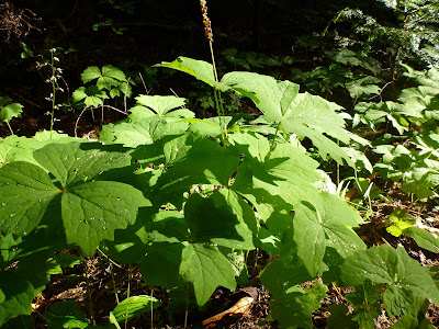
Achyls triphylla (Vanilla Leaf).
Boraginaceae (Borage Family)
Mertensia paniculata (Merten's Bluebells, Tall Lungwort)
Crassulaceae (Stonecrop Family)
Sedum divergens (Cascade Stonecrop)
Ericaceae (Heather Family)
Chimaphila umbellatum – (Pipsissewa, Prince's Pine)
Orthilia secunda (One-Sided Wintergreen)
Phyllodoce empetriformis (Pink Mountain Heather)
Rhododendron albiflorum (White-Flowered Rhododendron, Cascade Aazalea)
Fabaceae (Pea Family)
Lupinus lepidus var. lobbii (Dwarf Lupine )
Lupinus spp.
Gentianaceae (Gentian family)
Gentiana calycosa (Mountain Bog Gentian)
Liliaceae (Lily Family)
Veratrum viride (Green Corn Lily, False Hellebore)
Erythronium montanum (Avanlanche Lily)
Orchidaceae (Orchid Family)
Goodyera oblongifolia (Western Rattlesnake Plantain) - not in bloom
Plantaginaceae (Plantain Family)
Veronica cusickii (Cusick's Speedwell)
Polygonaceae (Buckwheat Family)
Eriogonum umbellatum (Sulfur Buckwheat)
Polygonum bistortoides (American Bistort)
Polygonum newberryi (Alpine Knotweed)
Portulacaceae (Purslance Family)
Cistanthe umbellatum (formerly Calyptridium umbellatum) (Pussy Paws, Pussy Toes)
Ranunculaceae (Buttercup Family)
Anemone occidentalis (Western Pasqueflower)
Rosaceae (Rose Family)
Luetkea pectinata (Patridgefoot)
Rubus spectablis (Salmonberry)
Saxifragaceae (Saxifrage Family –“Rock Breakers”)
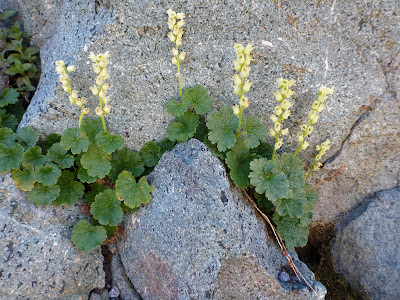
Elmera racemosa (Yellow Coralbells)
Leptarrhena pyrolifolia (Leatherleaf Saxifrage)
Parnassia fimbrata (Fringed Grass-of-Parnassus)
Scrophulariaceae (Figwort Family)
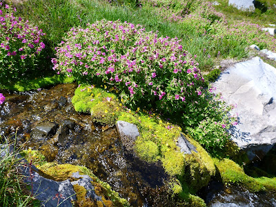
Mimulus lewisii (Lewis's Monkeyflower)
Mimulus tilingii (Mountain Monkeyflower)
Pedicularis contorta (Coiled-Beak Lousewort)
Pedicularis ornithorhyncha (Bird's Beak Lousewort)
Pedicularis racemosa (Sickletop Lousewort)
Penstemon davidsonii (Davidson's Penstemon)
Penstemon procerus (Small-flowered Penstemon)
Our Hike Notes
Length: About 11.5 miles round-trip by our GPS.
Duration: Just under 7 hours. We left the trailhead at 8:30am and arrived back at 3:15pm. We sat down at the gap at 11:30 pm for lunch and left the peak at 12:00 pm to head back.
Elevation Gain: 2,837 feet. The trailhead is at 4,018 feet and the highest point we reached was 6,829 feet.
Location: Mount Rainier National Park, Sunrise / White River.
Left: Achyls triphylla (Vanilla Leaf); Right: Rubus spectablis (Salmonberry)
Left: Sedum divergens (Spreading Stonecrop) Overlooking Fryingpan Creek; Right: Erythronium montanum (Avanlanche Lily) – One of the Last Few Blooming at this Time in August
Left: Marmota caligata (Hoary Marmot) Cools Itself on the Trail; Right: Alpine Summerland Meadow Creek with Monkeyflower
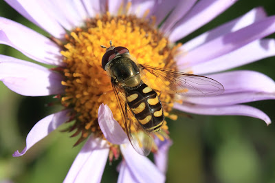
Left: Hoverfly on Erigeron. Look at those wings! Right: Mertensia paniculata (Tall Lungwort) with Bee.
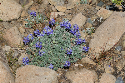
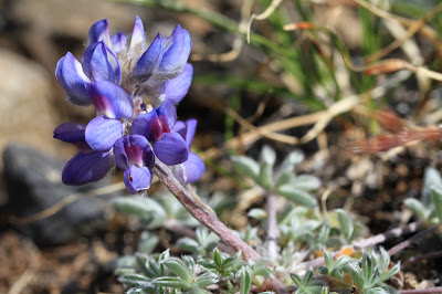
Left: Veronica cusickii (Cusick’s Speedwell) Flower; Right: View From Panhandle Gap Looking South
Left: Leptarrhena pyrolifolia (Fireleaf Leptarrhena) Red Calyxes; Right: Cistanthe umbellatum (Pussy Paws, Pussy Toes) Spread Flat in the Rocks
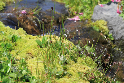
Left: Summerland Meadow Stream; Center: Parnassia fimbrata (Fringed Grass-of-Parnassus) Flower; Right: Gentiana calycosa (Mountain Bog Gentian) Flower Opening
Left: Elmera racemosa (Yellow Coralbells) Following a Rock Crevice; Center: Polygonum bistortoides (American Bistort) Alongside a Small Lake of Fryingpan Glacier Melt Water; Right: Monkeyflower and Summerland Meadow Stream
Left: Rhododendron albiflorum (White-Flowered Rhododendron, Cascade Aazalea); Right: Veratrum viride (Green Corn Lily, False Hellebore)
Left: Little Tahoma View from Summerland Meadow; Right: Ice Patterns on the Way to Panhandle Gap
References
The following images are some of the references we used to identify flowers and other flora for this hike and others in the Northwest. The Mac’s Field Guide and the Washington State Trees & Flower Guide are laminated and are easy to take on the hike.
Books, Left to Right: Plants of the Pacific Northwest Coast, Trees and Shrubs of Washington, Wildflowers of Washington, and Mac’s Field Guide to Pacific Northwest Wildflowers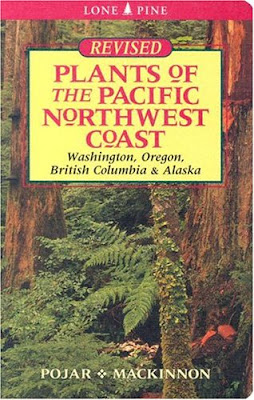


Left: Washington Wildflowers Application; Right: Washington State Trees & Wildflowers Fold-Out Quick Reference Card

Topographic Maps
The following two images show the terrain of the hike and the location of the hike relative to Seattle. Both maps are from maps.google.com.











No comments:
Post a Comment
All comments are moderated. If your comment doesn't appear right away, it was likely accepted. Check back in a day if you asked a question.