


Views from a 5-day hike in Triglav National Park in Slovenia. Left: Day 2 - View from Koča na Doliču looking northwest. Center left: End of Day 2 - View of Triglav. Center: Day 3 - Heading to Dom Planika pod Triglavom. Center right: Day 4 - On the way to Koča na Planini pri Jezeru. Right: Day 2 - Trail from from Koča na Doliču to Triglav.
Overview
Day 1
- Start: 10:00 at Koča pri Savici (653 m)
- Finish: 15:00 at Koča pri Triglavskih jezerih (1685 m)
- Duration: 5 hours
- Length: 6.0 km
- Start: 08:50 at Koča pri Triglavskih jezerih (1685 m)
- Finish: 13:40 at Koča na Doliču (2151 m)
- Duration: 5 hours
- Length: 8.0 km
- Start: 15:30 at Koča na Doliču (2151 m)
- End: 17:40 at Koča na Doliču (2151 m)
- Max elevation reached: 2400 m
- Duration: 2 hours
- Length: 3.0 km
- Start: 09:00 at Koča na Doliču (2151 m)
- Stop: 11:00 at Dom Planika pod Triglavom (2401 m)
- Start: 12:30 at Dom Planika pod Triglavom (2401 m)
- Stop: 14:30 at Vodnikov Dom na Velem polju (1817 m)
- Duration: 4 hours
- Length: 6.0 km
- Start: 08:20 at Vodnikov Dom na Velem polju (1817 m)
- End: 15:00 at Koča na Planini pri Jezeru (1453 m)
- Duration: 6.0 hours
- Length: 9.0 km
- Start: 08:15 at Koča na Planini pri Jezeru (1453 m)
- End: 11:45 at Koča pri Savici (653 m)
- Duration: 3.5 hours
- Length: 5.0 km
- Duration: 27 hours
- Length: 37 km (23 miles)
- Pace: 1.4 km/hr (0.85 mi/hr)
Hike Details
This post is about our five day hike through Triglav National Park where we stayed in mountain huts. Our route is one of many ways you could enjoy the park. We originally had planned to summit but didn't in the end. While there is no new technical information about reaching the summit in this post, there is some anecdotal information below in the section To ascend or not to ascend?
Triglav National Park is located in Slovenia in the Julian Alps, which is a part of the Eastern Alps spanning Italy and Slovenia. The highest peak in the Julian Alps and in Slovenia is Mount Triglav, which reaches 2,864 m (9,395 ft). The name Triglav means three-headed and refers to the three peaks of Mount Triglav. In Italian, the mountain is called Tricorno.
For our tour of the park, we went clockwise starting and ending at Koča pri Savici (653 m), where we parked the car for a few days. It cost several euros a day to park. In the reference we used, The Julian Alps of Slovenia: Mountain Walks and Short Treks by Justi Carey and Roy Clark (Cicerone Walking Guide), we followed a variant which took in parts of WALK 30 Triglav Lakes valley and Veliko špičje and WALK 31 Triglav – the southern approach (considered easier).
We chose to come back to Savici to arrive back at our car. A family of Danish hikers (also parked at Savici) followed a similar route as us but ended their hike in Stara Fužina and then made their way back to Savici by boat and/or bus, or at least that was their plan. I’m not sure how they made out.
Other anecdotal information about our route came our last day while we were descending the steep trail* above Savici, walking south. We met a Slovenian couple on their way up and they remarked that it’s rare for hikers to come down that trail because it is so steep. Soon after that couple, we met another group coming up the trail and they asked if something was wrong because we were coming down the trail and it wasn’t something they expected.
* The part of the trail in question is on the Komarča cliff face. The path is windy and steep but well-constructed. Along the way there are steel cables and pegs as a handrail in places. Climbing and descending Komarča was a challenging start and end to our 5 days.
Here’s the route we took in pictures:

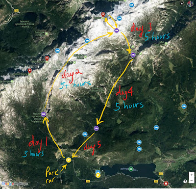
Left: The actual route we took on our Triglav National Park hike. Route was generated from GPS tracks we captured. Right: A sketch of what we had planned. The only deviation from planned was staying the night at Koča na Doliču instead of Dom Planika pod Triglavom.
In general, I thought the trails around Triglav were well-marked but not as good as we find them to be in Italy or Austria. For example, once we were on a trail around Triglav, there were many red splotches of paint to follow to make sure we didn’t get off the trail. The problem was that the signs (at least for us) sometimes referred to geographic features and not final endpoints (like a hut). Only when you are closer to a hut do you start to see signs for it. A solution is would be to make sure you have a good understanding of the geography and a good map. For example, on day 2 we left Koča pri Triglavskih jezerih (1685 m) heading for Koča na Doliču (2151 m). We kept seeing references to Hiribarice but had no idea what that meant. Later that day, we bought a map and realized it was a geographical feature that we had passed along the way. Take-away: even though we had GPS tracks loaded in offline mode on our phones, studying a map before setting out is always a smart idea. Doh!
Another observation on signs: the time estimates for reaching a destination tended to be a bit on the aggressive side. With our pace, 4 hours was more like 5.5 hours, but then again our pace was on the slower side.
This was the first time we stayed in a mountain hut (rifugio) and it was a good experience. Carrying all our stuff for the 5 days was hard at first, but we got used to it. We estimated we had about 20-25 pounds each on our backs.


Views of the mountain huts we stayed at over the 5 days (4 nights). Left: Day 1 - Koča pri Triglavskih jezerih. Center left: Day 2 - Koča na Doliču. Center: Day 3 lunch - Dom Planika pod Triglavom. Center right: Day 3 - Vodnikov Dom. Right: Day 5 - Leaving Koča na Planini pri Jezeru.
Here are some of our observations on the mountain huts we stayed at during our hike. Hopefully, this will give you an idea of what the mountain huts are like around Triglav.
- We stayed at four mountain huts, in order: Koča pri Triglavskih jezerih (1685 m), Koča na Doliču (2151 m), Vodnikov Dom na Velem polju (1817 m), and Koča na Planini pri Jezeru (1453 m).
- We had planned to stay at Dom Planika pod Triglavom (2401 m) on the second night, but due to weather and a slow walking pace, we changed our plans and called it a day at Koča na Doliču (2151 m). To be honest, as we were having a late lunch at Doliču, we liked the staff there a lot, it was less crowded, and they actually had a tomato salad on the menu. Fresh vegetables on the menu sold us.
- We called ahead weeks in advance and had made reservations for all huts. In some huts, we saw people just walk in without a reservation. The difference is that we had a private room and they didn’t. For example, we were two couples and we had 2 double rooms for 3 of the 4 nights. When we shared a room with others, it was because the hut only had common rooms (that was Koča na Planini pri Jezeru).
- It’s pretty typical that we had to be out of our rooms by 8:00 am.
- Rooms, mattresses, and blankets were clean. Bathrooms okay. At higher huts, outhouses only.
- Disposable bed linen (paper) can be rented. We brought our own sacks. Warm blankets were provided.
- We carried a few snacks with us but otherwise didn’t carry food. We ate breakfast, lunch and dinners in the huts.
- In the first 2 days of hiking we went with ½ board (sleeping accommodation, dinner, and breakfast) but found that a little bit limiting in terms of food choices. With board options, you get a choice between menus (usually 3 options) You could always pay extra and add to the menus, but in the end, we found it was about the same to not get the ½ board and pay for what we wanted to eat à la carte.
- Friendliness varied greatly in the mountain huts. It seemed to us that the higher we went, the nicer the staff was. Favorite huts: Doliču and Vodnikov Dom. Least favorite huts: Koča na Planini pri Jezeru and Koča pri Triglavskih jezerih. At Koča pri Triglavskih jezerih a woman working at the hut told one of us that the shower was broken and to go jump in the lake to get clean. She probably didn’t understand the impact of that in English…or maybe she did. We didn’t jump in the lake, too cold and too green. Though, a German hiker did.
- A good amount of cash is helpful when buying things in the huts. Only one hut we visited took credit card (Doliču).
- Showers: we had one in four days. We had read and expected that in huts at higher altitudes showers weren’t possible. At two of the lower altitude huts where showers were advertised, they weren’t available for one reason or another. That was fine, but just be prepared.
- The food was simple but filling and sometimes good. You won’t find much fresh vegetables or fruits, but what do you expect in the mountains? That said, we were surprised to find a tomato salad at Dolicu and that warmed our hearts so much that we decided to spend the night there. Typical fair includes jota – a traditional soup of cabbage and beans - an Istrian stew, golaž – goulash, and ričet – beans, barley and vegetable soup/stew.
- Alpine Association of Slovenia is where you can go and find out about huts, prices, and opening times. Hut web pages have distances to other nearby huts.


Views from the trail. Left: Climbing the Komarča cliff face from Koča pri Savici. Center left: A sign pointing to Koča pri Triglavskih jezerih. Center and center right: Trail markers during Triglav hike. Red circle with white center. Right: Planina Laz where they make cheese and sour milk.
To ascend or not to ascend?
We did not reach the summit of Triglav to see Aljazev Stolp (Aljaž Tower). As a group, we decided against it as we didn’t have the proper equipment: helmet and safety ropes. It’s a personal decision for each hiker.
The following is just what we heard, it’s not advice! From the folks we talked to at Doliču, reaching the top from that side is easier and less crowded. One woman and a couple just down from the summit said that from the Doliču side, you could do it without any equipment, no helmet or ropes. They added that coming from the Doliču side, ropes wouldn’t be that useful since it was mostly pegs and not cables. And, since there are fewer people going up from Doliču, there is less risk of rocks falling on you that were dislodged by someone above you. Huts may seem to loan helmets and ropes; we saw many people carrying their own. When we stopped at Dom Planika hut for lunch, we saw many people going up with the proper gear. From Planika, the climbers going to and from the summit looked like a bunch of tiny ants marching to the top.Safety equipment aside, you must have a head for heights if you plan on going to the summit. I don’t and was happy not to go up. (If our group of four had decided to go up, I would have likely stayed behind.) For me, the beauty of Triglav was the journey, the views, and park around the peak, not reaching the summit.
If we had helmets with us, there were two other possible events on our hike where we might have used them. First, we caught 15 minutes of moderate hail on day two and had to take cover because it was starting to sting. A helmet could have been useful if the size of the hail got any bigger and we wanted to protect our heads. Second, on our final day as we descended to Savici on the Komarča cliff face, hikers above us started a small cascade of rocks. A good 4-5 inch rock missed us by a couple of feet.


Food photos, from left to right: Bread and kislo mleko (sour milk) at Planina Laz. Cheese produced at Planina Laz that you can buy. Food at Dom Planika, soup, crepes and the popular Laško beer. Meal at Koča na Doliču with fresh tomatoes. Menu at Koča na Planini pri Jezeru. Menu at Vodnikov Dom.
Language
Almost all of these translations come from PONS Online Dictionary and The Julian Alps of Slovenia: Mountain Walks and Short Treks by Justi Carey and Roy Clark (Cicerone Walking Guide). (Buy that book!) Why do I include the translations here? Well, I felt like a dummy when I asked myself questions like: who or what is Narodni in the name of Triglav park? Who is the mountain hut Dom Planika pod Triglavom named after? Why do all the mountain huts seem to have jezero in the title?
Answers: Not all nnational parks and mountain huts are named after people. Triglava Narodni Park just means Triglav National Park and planika in Dom Planika pod Triglavom means edelweiss (the flower). Jezero (and variants with different suffixes) have something to do with a lake. Koča na Planini pri Jezeru is the cabin on the plain by the lake.
Therefore, studying a few basic language terms before you go can demystify the name of places. Additionally, being able to make out geographical features on a map (in Slovenian) is useful when hiking there. This includes terms like dolina (valley), greben (ridge), planina (plain), and vrh (peak). We didn’t know any of these terms before starting our hike and it slowed us down a bit.
botanični – botanical garden
- Above Vodnikov Dom there is an area called Botanični vrtec velo polje, which is a botanical area rich in plants.
dom – home
- Used along with koča to refer to mountain huts, as in Dom Planika pod Triglavom, a mountain hut we stopped at for lunch, and one of the most popular starting places for climbing Triglav.
- We saw this term on maps we used. I think it refers to a peak or head of a mountain.
golaž – goulash
- A common menu option in the mountain huts we visited.
jama – grotto, cave
- The famous Postojna Cave is Postojnska jama.
- Lake Bled is Blejsko jezero and Bohinjsko jezero is Lake Bohinj, which is is a popular starting and ending point for hikes in Triglav National Park.
- We ate a lot of this in our 5 days in the mountains. Jota z mesom is jota with meat.
- We ate this at the cheese diary on the Laz pasture on our way to Koča na Planini pri Jezeru. It's also available in some restaurants around Lake Bohinj.
koča – rifugio, cabin, cottage
- We parked the car and started our hike at Koča pri Savici. Planinska koča is a mountain hut.
mleko - milk
most – bridge
muzej - museum
na – on
- On our last night, we stayed one night at Koča na Planini pri Jezeru, cabin on the plain, by the lake.
- The Triglav National Park (TNP) in Slovenian is Triglavski narodni park.
- One of the most common beers you’ll see in Slovenia, especially in the mountain huts is Laško, with its distinctive green can.
- Italy being so close to Italy, expect some good pizza.
planina – mountain pasture or meadow
polje – field
- Common terms on maps.
- A hiking trail is pohodna pot.
preval - pass
pri – by
- On our last night, we stayed one night at Koča na Planini pri Jezeru, cabin on the plain, by the lake.
- A common dish at the mountain huts. Ričet z mesom is ričet with meat, usually smoked ham.
- We had one stuffed with cheese and tarragon. Interesting.
Triglav hike views. Left: Day 3 - Dom Planika in the distance. Center left: Day 3 - Sunset from Vodnikov Dom. Center right: Day 4 - Planina Laz = cheese. Right: Day 4 - Making our way to Koča na Planini pri Jezeru.
- On our second to last day of hiking, we stopped at Sirarna na planini Laz or the cheese diary on the Laz pasture.
soba – room, as in rooms to rent
Soča – a river in Slovenia that we went rafting on before our hike.
slap – waterfall
- We started our hike at Koča pri Savici the most common starting spot for walks to see the Savica Waterfall or Slap Savica, which is the source of the Sava Bohinjka River which flows into the Sava River. Savica means 'little Sava'.
stolp – tower
- The Aljazev Stolp (Aljaž Tower) sits on top of Triglav summit.
trg – piazza or square
Triglav – the highest mountain in Slovenia at 2,863 m (9,395.2 ft).
- The name means three-headed (in Italian Tricorno) referring to the three peaks that make up the mountain. Triglav is part of the Triglav National Park, the only national park in Slovenia.
vrh – peak or summit
vrtec – nursery school, kindergarten
- Above Vodnikov Dom there is an area called Botanični vrtec velo polje, which is a botanical area rich in plants.
Views from the hike. Left: Day 2 - View south from near Morbegno. Center left: Day 3 - Heading out and south from Koča na Doliču. Center: Day 3 - Heading to Dom Planika pod Triglavom. Center right: Day 3 - On the way to Vodnikov Dom. Right: Day 2 - Heading to Koča na Doliču.
Flora
When planning a hike, the Cicerone guides (books) are a great place to start.
Books
- Alpine Flowers: How to Recognize 230 Alpine Flowers by Gillian Price (Cicerone)
- The Julian Alps of Slovenia: Mountain Walks and Short Treks by Justi Carey and Roy Clark (Cicerone Walking Guide) – has a short and concise section about alpine plants.
- Wild-flowers App is for flower identification in France and Western Europe. I used the app’s wizard to help zero in on family or genus for a flower that I’m having trouble identifying.
- Triglav Narodni Park site page on flora.
- Discusses just a handful of plants but does so with interesting stories and interesting facts. For example, for the endemic Zois’ Bellflower it says: “The mouth on a Zois' bellflower is too narrow for insects to enter. They have to make a hole in the corolla in order to pollinate the plant.”
- Republic of Slovenia site page on the floral wealth of Slovenia
- A list of twenty plants with a separate fact page for each.
- Checklist Flora per Region site, set for the Friuli-Venezia Giulia region of Italy. Mount Triglav is in the Julian Alps, which extend from Slovenia into northeaster Italy, Friuli-Venezia Giulia.
The list below includes plants we saw that we could identify and get a good picture off. All of these plants (with photos attached in this post) are were easily seen without wandering off trail.
Key: [Family] Genus species – Common name in English (Common name in Italian)
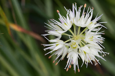
[Amaryllidaceae] Allium ochroleucum – (Aglio giallognolo)


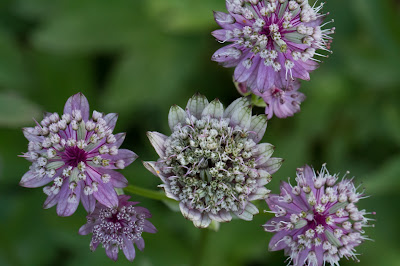
[Apiaceae] Astrantia major – Greater Masterwort (Astranzia maggiore)
[Apiaceae] Heracleum austriacum - Austrian Hogweed (Panace austriaco)

[Asteraceae] Achillea moschata – Musk Yarrow, Milfoil (Millefoglio aromatic)

[Asteraceae] Carlina acaulis – Silver Thistle, Stemless Carline Thistle (Carlina acaule)

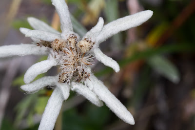
[Asteraceae] Leontopodium alpinum – Edelweiss (Stella alpina)
We saw fewer than we expected. The mountain hut Rifugio Dom Planika pod Triglavom takes its name from the flower, which is “planika” in Slovenian.

[Campanulaceae] Campanula cochleariifolia – Earleaf bellflower (Campanula con foglie di coclearia)
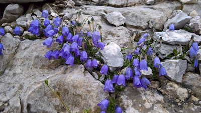
[Campanulaceae] Campanula zoysii – Zois’ Bellflower or Crimped Bellflower (Campanula di Zois)
Notice the punctures in the sides of this endemic flower. It’s the only way the insects can get into the flower. The specific epithet honors its discoverer, botanist Karl von Zois (1756–1799), a Slovenian amateur botanist and plant collector.
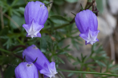
[Campanulaceae] Phyteuma orbiculare – Round-headed Rampion (Raponzolo obicolare)
Possibly P. hemisphaericum. Need better picture of leaves to be sure. Also, possibly P. scheuchzeri

[Caprifoliaceae] Scabiosa ochroleuca – Cream Pincushions (Vedovina giallognola)
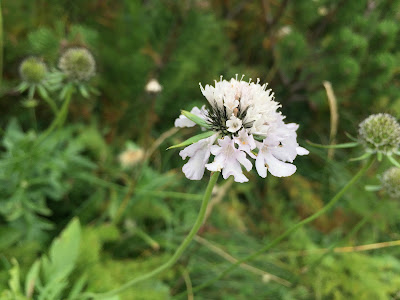

[Caprifoliaceae] Knautia sp. – Sabiosa (Ambretta)
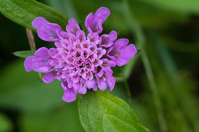
[Caryophyllaceae] Silene alpestris – Alpine Catchfly (Silene alpestre)

[Caryophyllaceae] Silene dioica – Red Campion (Silene dioica)

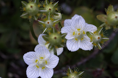
[Celastracease] Parnassia palustris – Marsh Grass of Parnassus (Parnassia delle paludi)

[Crassulaceae] Rhodiola rosea – Rose Root (Rodiola rosea)


[Ericaceae] Rhododendron hirsutum – Hairy Alpenrose (Rododendro peloso)

[Gentianaceae] Gentiana asclepiadea – Willow Gentian (Genziana di Esculapio)
I was surprised to find this was a gentian. Initially we saw a lot of this, but not in bloom and we were stumped on what it could be.

[Gentianaceae] Gentiana pannonica – Pannonic Gentian (Genziana rossigna)
According to Flora Alpina Bergamasca, often confused with Gentiana purpurea. Pannonica was indicated on a poster of “local plants” that we saw in Koča na Planini pri Jezeru.


[Gentianaceae] Gentiana pumila – (Genziana a foglie acute)

[Gentianaceae] Gentianella germanica – Chiltern Gentian (Genzianella tedesca)
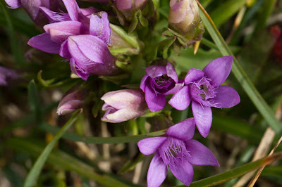
[Gentianaceae] Gentianopsis ciliata – Fringed Gentian (Genziana sfrangiata)
Flowering time: August and September. I found a lot of confusion around this one regarding the genus, some sources giving it as Gentianella or Gentiana.

[Hypericaceae] Hypericum maculatum –Spotted St Johnswort (Iperico macchiato, Erba di S. Giovanni macchiata)

[Lamiaceae] Thymus praecox – Wild Thyme (Timo precoce)

[Papaveraceae] Papaver aurantiacum – Rhaetian Poppy (Papavero delle Alpi Retiche) (Papavero dorato)
[Papaveraceae] Papaver julicum syn. of Papaver ernesti-mayeri – (Papavero delle Alpi Giulie)
Flowers July – August. There are a number of other plants that on first glance look similar such as Ranunculus alpestris (flowers May – September), Ranunculus glacialis (flowers July – August), and Pulsatilla alpine (flowers April – August). P. ernesti-mayeri seem to be treated as a subspecies of P. alpinum.

[Plantaginaceae] Linaria alpina – Alpine Toadflax (Linajola alpina)


[Polygonaceae] Rumex acetosella – Common Sheep Sorrel (Romice acetosa)

[Polygonaceae] Rumex alpinus – Munk’s Rhubarb, Alpine Dock (Romice acetosella)

[Orobanchaceae] Euphrasia officinalis – Eyebright (Eufrasia officinale)


[Orobanchaceae] Melampyrum pretense - Common Cow-Wheat (Melampiro dei prati)
[Orobanchaceae] Pedicularis verticillate – Whorled Lousewort (Pedicolare a foglie verticillate)
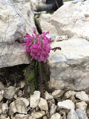
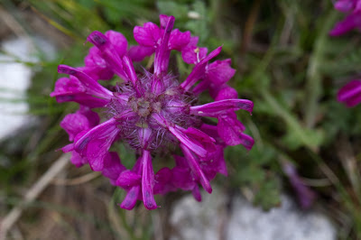
[Ranunculaceae] Aconitum tauricum – Venus’ Chariot (Aconito taurico)
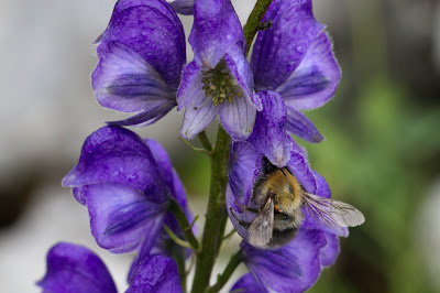
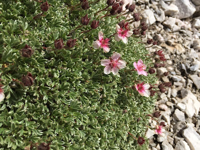
[Rosacease] Dryas octopetala – White Dryas, Mountain Avens (Camedrio alpino)

[Rosaceae] Potentilla nitida – Pink Cinquefoil, Triglav Rose (Cinquefoglia delle Dolomiti, Potentilla rosea)
This potentilla is a symbol of the Triglav National Park.


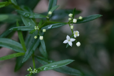
[Rubiaceae] Galium sp. – Bedstraw (Caglio)
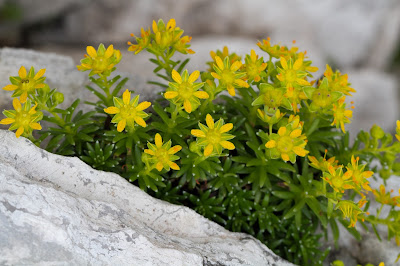
[Saxifragaceae] Saxifraga aizoides – Yellow Saxifrage (Sassifraga gialla)
[Saxifragaceae] Saxifraga crostata – Encrusted Saxifrage (Sassifraga incrostata)
You often see salt encrustations on the leaf edges.

[Saxifragacease] Saxifraga squarrosa – (Sassifraga delle Dolomiti)


[Saxifragaceae] Saxifraga sedoides – Eastern Saxifrage (Sassifraga setolosa)

[Scrophulariaceae] Rhinanthus alectorolophus – Greater Yellow Rattle (La cresta di gallo comune)

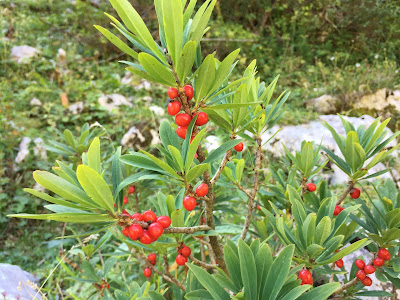
[Thymelaeaceae] Daphne mezereum – February Daphne (Dafne mezereo o fior di stecco)
We only saw the red berries as the plant blooms from March to May.

Fauna
Rupicapra rupicapra – Chamois (Camoscio alpino)
Salamandra atra – Alpine Salamander (Salamandra nera)
Daddy-Long-Legs or Harvestman with mites.


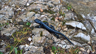
Left: Daddy -Long-Legs with a mite, Triglav, Slovenia. Center left and right: Rupicapra rupicapra – Chamois (Camoscio alpino). Right: Salamandra atra – Alpine Salamander (Salamandra nera).
Maps


Left: Tourist overview map of the Bohinj Area and Triglav National Park. Center Left: The Julian Alps Mountain Huts and Bivouacs. Center: Map showing ridges and peaks around Triglav. Center right: Sign for botanical area - Botanični vrtec velo polje above Vodnikov Dom. Right: Sign for botanical area - Botanični vrtec velo polje - List of plants in Solvenian.


Triglav 1 to 25000 map we used during the hike. Map can be bought at most mountain huts.


Thanks for this. We've been to Vogel skiing for the last few years (really recommend it) and I'm planning to take the family for the "green season" this summer. Good to get a sense of what is possible.
ReplyDeleteThanks. Good to know. We stopped at the bottom of Vogel to buy hiking gear, and we could see the resort across the way at some parts of this hike.
DeleteThanks so much for this post, its incredibly insightful with tons of great info! My wife and I are heading to Slovenia in late August, we're strong hikers in our early 30s, and after researching Triglav 2-night hut-to-hut routes, the route you ended up taking is almost exactly what I was thinking (first overnight at Dolic hut). I have a couple of questions in case you have a moment to share your experience:
ReplyDeleteOne of my biggest questions is how to end the loop. Going down the Komarca wall back to our car at Savici doesn't sound too enticing from your description, and so I'm wondering whether it makes sense to hike a bit further and stay at Dom na Komni and either hike down or take the cable car back to Savici (not even sure if this is possible?).
The other option is ending the trip on the other side of the lake and either keeping a car near the Voje Valley Waterfall and busing over to Savici via Stara Fuzina to begin the loop, or keeping the car at Savici and taking a bus at the end back to the car. I'm having trouble finding info on whether its easy to get public transport between Voje Valley and Savici...it seems like there are buses between Stara Fuzina and Savici, but I'm unsure about whether you can get up to Voje or if we'd have to walk all the way down to town. Any help you can offer on the bus situation would be awesome.
Thanks again for your thoroughness and super helpful post!
Happy trails,
Jeff
You're welcome Jeff.
ReplyDeleteDom na Komni as the last stop and walking down to Savici would be a great option. We met some folks on the trail who were doing that because (if I remember correctly) it was easier to do. If we hadn't been restricted on the number of days for our trip, we would have probably taken this route.
Ending on the other side of the lake (Stara Fužina) seems like a nice option to avoid repeating the same trail and seeing more of the park. As well, starting there would work. I had the sense that most people intending to summit start from Stara Fužina side because it's the most direct route and/or easy to get to.
Here's what I found for public transit between Savici and Stara Fužina: http://www2.bohinj.si/en/about_bohinj/location/timetables/bus_transport It seems like going between Savici and Stara Fužina would work at least on summer schedule.
The walk down the Komarča wasn't that bad, but it was definitely one of the points during the whole hike that required the most focus on the trail.
What a wonderful post with tons of information!! For someone with a low/moderate fear of heights, would coming down the Komarča cliff face to Slap Savica be too daunting? I had planned on starting in the vicinity of the Vršič pass, visiting the 7 Triglav lakes, and then making my way down to Slap Savica?
ReplyDeleteCheers beers Daniel
Thanks. Starting at Vršič pass and passing by the 7 lakes sounds like an interesting itinerary.
ReplyDeleteFor someone with low to moderate fear of heights, I'd say he/she would be fine with coming down Komarča cliff face. I count myself in that category and I thought it was okay. I never felt "exposed" coming down and the trail was well-constructed. At least it was in 2017 and barring a washout or something similar I would expect it to be the same. Have a great time!
Hello, This post is exactly what I have been looking for. I am planning on starting on the opposite side (Stara side), with the following as my overnights. 1. Vodnikov Dom 2. Dom Planika (and possibly do Trivlag that day? 3. Zasvaska koca na Prehodavcih 4. Koca pri Triglavski Jezerih. and then likely back to the lake or possibly to Koca Savici? My question is...is this too ambitious? Or not ambitious enough. Its hard to guess on the elevation, but I'd like to be hiking usually 4-6 hours a day. HOpefully you can guide me! Kathy
ReplyDeleteLooks like you are going counter-clockwise. Putting the huts on a map and looking at it, to us it certainly seems feasible. Between huts no distance or time stood out as extreme. But, please verify this for yourself if you haven't already. Of course, so much depends on weather, trail conditions, and your general fitness. Also to consider: what kind of day you want to have. Do you want to walk until dinner? Or do you like arrive for lunch at your destination, eat, and then relax?
DeleteAs we wrote, we did not go up to summit Triglav so adding that as a stop between the hike from Vodnikov Dom to Dom Planika seems reasonable, but suggest you rely on authoritative web sites to figure out the details of that. Also, from Koca pri Triglavski Jereezih you could end up at Savici or walk along the lake to get back to Stara. Just keep in mind you have descend the Komarča cliff (very doable but usually done in the other direction reading my comments above). We are excited for you hike!