
Hike Notes
Length: 12.2 km (7.6 miles) round-trip
Duration: 2.5 hours up and 2 hours down (4.5 hours total walking time excluding time for lunch)
Elevation: 1.139 m (3,737 ft) gain, Hafelekarhaus @ 2.256 m (7,400 ft), Pfeishütte @ 1.922 m (6,306 ft)
Location: Austria, Tirol State, Innsbruck.
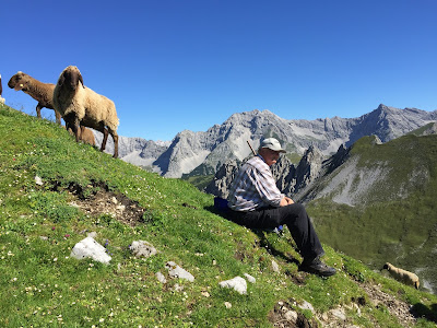
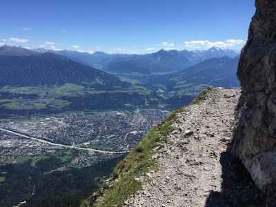
Today we hiked the spectacular mountains that are the backdrop of Innsbruck, the Karwendel range of the Northern Limestone Alps. It wasn’t a long hike, but it was quite spectacular and a bit of a challenge for folks like me that don’t like heights. There were cable guides for some of the trickier parts of the trail. The cables are described as only useful in the winter; I made good use of them today as did a number of other hikers we encountered.
To get to the start of the hike:
- We took the chic Nordkette from Innsbruck center @ 574 m (1,883 ft) up to Hungerburg @ 860m (2,820 ft).
- From Hungerburg, we took the cable car to Seegrube @ 1.905 m (6,250 ft).
- Finally, we took the cable car to Hafelekar @ 2.256 (7,400 ft).
Here is a good overview of the hiking you can do from the Hafelekarspitze peak. Specifically, we followed the Goetheweg Trail 219 from Hafelekar station (Hafelekarhaus) to Pfeishütte mountain hut. At Pfeishütte, we ate a great lunch listening to the cacophony of cowbells. Another good overview of the trail is on tyrol.com.
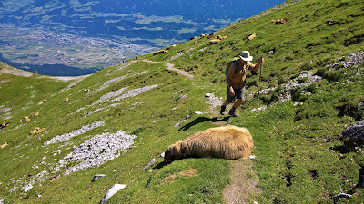
Left: A shepherd along the trail. Right: Later in the day, a sheep cools itself on the trail. Innsbruck valley in the upper left of photo.


Examples of the Goetheweg Trail. Left: Cables to grab on to.


The fabulous futuristic funicular stations designed by Zaha Hadid. Left: Congress statioin. Right: Hungerburg station (topmost station).


Left: Pfeishütte mountain hut lunch. Center: Nordkette Geo Trail. Right: Signage along the Goetheweg Trail. Innsbruck in the valley.


Different views of the Goetheweg Trail.


Left: View north of Innsbruck Town Square (Maria Theresien-Straße) with Seegrube and Hafelekar in the background. Center: View south back down to Innsbruck from the mountain. Right: View from cable car at Hafelekar.


Plants
Left: Saxifraga. Center: Saxifraga and Alchemilla. Right: Hieracium.


Left: Unknown. Center: Silene vulgaris. Right: Dryas octopetala seed head.


Left and center: Scabiosa. Right: Phyteuma.


Left and center: Campanula. Right: Carlina.


Left and center: Rhododendron. Right: Pedicularis.


No comments:
Post a Comment
All comments are moderated. If your comment doesn't appear right away, it was likely accepted. Check back in a day if you asked a question.