Left: Our Lake Ingalls Hike Route (via Canon GPS Logger and Google Earth); Right: A Marmot Watches Us Below Lake Ingalls

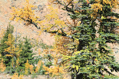
Left: Gold Larches Near Ingalls Pass; Right: Looking West Over Lake Ingalls Toward Mt. Stuart
Hike Notes
Length: 11.8 miles
Duration: 7.5 hours (9:00 am – 4:30 pm), includes 40 minute lunch break
Elevation Gain: 5,756* / 3,591** ft - low point 4,235* ft/4,288** ft @ trailhead; high point 6,550 ft @ Lake Ingalls
Location: Snoqualmie Pass -- Salmon La Sac/Teanaway
* Canon GPS Receiver, ** Garmin HCX - Our elevation data for this hike suffers from a couple of problems. First, the Garmin was off for part of the middle of the hike, and the Canon GPS Receiver logger turned off for the last ¼ of the hike. Technology. We calculated our total hike length by using the visible trail in Google Earth.
Overview
For our ninth hike of the 2014 season, we took a loop hike around Lake Ingalls (WTA site) and down through Ingalls Creek. We have racked up 119.2 total miles this season, inclusive of this hike. (Our last hike of 2013 was to Carne Mountain, which brought us to 115.2 miles total.)
Our Lake Ingalls route was a loop that had us taking the standard route up to the lake, skirting the west edge of the lake, dropping down by and following Ingalls Creek, and the climbing up the east side of Longs Pass to rejoin the Lake Ingalls trail. The climb up Longs Pass caught us by surprise because we were tired by that point in the hike and weren’t expecting the steep climb to the pass (40-50% grade toward the top). We usually don’t use trekking poles, but we broke them out for the last 200 feet of elevation gain to get over the pass, at approximately 6,100 feet.
Lake Ingalls on this sunny, warm Fall Sunday was not too crowded. Most hikers seem to stop at the south end of the lake and then turn around and head back. We picked our way around the west side of the lake. We saw others going around the east side as well.
On the hike down to Ingalls Creek, we saw nobody. That part of the trail gets a little monotonous. The sign to Longs Pass was a welcome site. We hike up Ingalls Creek in 2012 (see Ingalls Creek Trail - Butterflies and Balsamroot) but didn’t come this far up the creek.
On our way to Lake Ingalls we saw one goat and a few marmots. In terms of larches, we thought the larches we saw on our Carne Mountain last year were more spectacular.
Left: The Obligatory Goat Photo Near Ingalls Pass; Right: Welcome to Alpine Lakes Wilderness (Okanogan-Wenatchee) – Sign
Left: Fern; Right: View of Mt Stuart from Ingalls Pass
Looking Toward the North End of Lake Ingalls
Left: Rock Near Lake Ingalls; Right: Diagonal Lines Including Mt Stuart in the Background
Left: Sign on Ingalls Creek Pointing the Way to Longs Pass Trail; Right: Signs Pointing to Lake Ingalls


No comments:
Post a Comment
All comments are moderated. If your comment doesn't appear right away, it was likely accepted. Check back in a day if you asked a question.