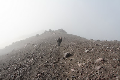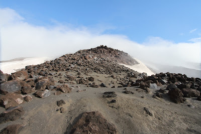
We’ll come clean right away. We climbed to the rim of Mount St. Helens and saw nothing. It was the weather: foggy with sleet and rain showers. But, we did make it to the top. It was a bit of a slog and our quadriceps were talking to us for days after. We climbed on September 7th, 2010.
The details:
- Route: Summer route (aka Monitor Ridge) from Climbers’ Bivouac.
- Length: 10.5 miles round trip.
- Elevation Gain: 4,615 feet, starting at 3,750 feet and ending at 8,365 feet.
- Suggested Season for the Hike: Late spring through fall.
- Difficulty: Very Difficult.
- Permit: NW Forest Pass Required for parking and a permit to go above 4,800 feet.
- Our Duration: Started at 6:55am from Climbers’ Bivouac. Reached the summit at 10:15am. Back down and at our car at 1:15pm (includes a 20-30 minute stop for lunch).
The path is marked in the boulder field with large wooden posts. Use them as guideposts but don’t go directly from post to post – unless you want to. The post-to-post approach will wear you out. When you reach one post look to see where the next one is and also look for the footprints of where people have gone as a guide and you’ll see that there is usually a path to get you there. The wooden posts disappear at the last part of the hike and you are on your own as the trail seems faint. Hint: go up!
Planning:
- The Mount St. Helens National Volcanic Monument site – it has all the information you need. Really read this page and weigh the risks and warnings.
- You have to get a permit to climb above 4,800 feet on the volcano which can be picked up at the Lone Fir Resort, 16806 Lewis River Road, Cougar, WA. (The permit includes a pass to park at Climbers’ Bivouac.)
- You should sign in before and after the hike at the Lone Fir Resort. You can sign in up to a day ahead of time – see the link above for details.
- You should bring versatile gear and expect all kinds of weather. There is a 10 essentials list here.
- What we brought: everything on the essentials list except a flashlight (we forgot), emergency shelter, and a hard hat. We were happy to have really good rain gear and rain paints. And to have brought warm gloves.
- We brought a GPS that was handy for telling us elevation, because most of the time we couldn’t see that far ahead and didn’t know how much farther there was to go.
- We also brought too much food thinking we could ‘picnic’ up at the top. That was clearly not the case for our hike. There really weren’t many ‘picnic’ spots. So perhaps just bring lots of snacks and save the food for the end. We ended up eating on the side of the trail on the way down at the edge of the forest.
- Nearby lodging: The Lone Fir Resort. We stayed here.

Midway up and looking off over Swift Glacier


No comments:
Post a Comment
All comments are moderated. If your comment doesn't appear right away, it was likely accepted. Check back in a day if you asked a question.