
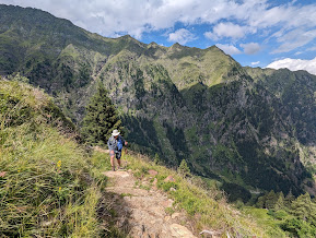
Upper left: Hike 1 - Pfossental (Val di Fosse)
Upper right: Hike 2 - Spronsor Seen Lakes (Merano)
Lower left: Hike 5 - Monte Cervina (Hirzer) - Riffelspitz Loop Hike
Lower right: Tappeinerweg walking west (Merano)
After hearing about Merano for years now, we got a chance to visit recently. Merano is in the Autonomous Province of Bolzano, in the Autonomous Region of Trentino Alto-Adige/South Tyrol. (That’s a mouthful!) Autonomous means the province or region has a degree of autonomy – self-government compared to other provinces or regions. There are five autonomous regions in Italy.
We spent a week in Merano: five days hiking and one day visiting the Trauttmansdorf Castle Gardens. All the hikes involved getting to the starting point of the hike (for us in car but public transportation was available except for Hike 1) and taking a cable car to start the hike (again, except Hike 1). All of the hikes took place starting at an altitude of greater than 1700 m (5580 ft). (There was a heatwave the week we were in Merano. Getting up high for some relief was a good strategy.)
Tappeiner Way is a popular big draw for walkers in Merano. It’s a level walking trail that sits about 60 m (200 ft) above the center of Merano. We walked about half of it one evening.
The path/way/trail is named for Franze Tappeiner (1816 – 1902), an Austrian physician and anthropologist, who championed the trail's initial creation.
There is a bust of Tappeiner not far from the start of the trail. There is also a bust of Henri Chenot (1943 -2020), VIP diet and wellness guru, and namesake of the anti-ageing Chenot method. Ahem, I smell bullshit and woo-woo culture here. And that unfortunately is a side of Merano that exists if you look for it: woo-woo wellness for the jet set.
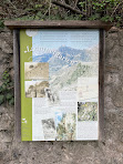
About midway on the Tappeinerweg, there is a sign that describes an interesting point about vegetation around the trail. Starting in 1907, the botanist-pharmacist Arthur Ladurner (1872 – 1960) created a maquis shrubland (macchia mediterranea) on the south-facing hill the trail runs through. If you stop for a moment on the Tappeinerweg trail on a warm day, it is hard to believe you are as far north as you are!
A combination walk with some substantial distance would be to combine the Tappeinerweg and Algunder Waalweg (irrigation canal walk) which would be about 9 km one way. For more information, see The Waalweg trails (merano-suedtirol.it). The last link contains information on the Masier Waaleeg in Maia Alta as well. That walk is interesting because you pass through farms and apple cultivation.
There are a ton of choices for eating in Merano, which we did for every evening we stayed. We tried two Osteria Guide (Slow Food) pickks.
Our five hikes treated us to idyllic scenes of alpine pastures interspersed between stands of spruce and larch, alpine lakes and streams, herds of horses, cows, and goats. The human influence on the land is clearly presence but in a pleasing way.
Down in the valleys, a whole different type of human influence on the land meets the eye: apple cultivation.
As we drove into the Merano area, we were surprised to see the endless rows of apple trees and overhead irrigation systems. Orderly rows of apple trees 8 – 10 ft tall grow under nets to protect their fruit from hail and birds. The cultivation method is called the “slender spindle system” and was introduced in the 1970s. All the trees are grafted on to dwarf rootstock. All to say these aren’t your grandma’s wild apple trees growing in the back yard.
Apples are big business in South Tyrol. In fact, the Merano area is part of one of the largest contiguous apple-producing areas in the EU. Bäcksteinerhof, where we stayed for the week, is an example of a typical small farm that grows apples.
What kind of apples are grown in South Tyrol? All kinds, including Fuji, Braeburn, Morgenduft, Winesap, and golden delicious (the most cultivated), to name a few.


Upper right: Hike 2 - Spronsor Seen Lakes (Merano)
Lower left: Hike 5 - Monte Cervina (Hirzer) - Riffelspitz Loop Hike
Lower right: Tappeinerweg walking west (Merano)
Overview
After hearing about Merano for years now, we got a chance to visit recently. Merano is in the Autonomous Province of Bolzano, in the Autonomous Region of Trentino Alto-Adige/South Tyrol. (That’s a mouthful!) Autonomous means the province or region has a degree of autonomy – self-government compared to other provinces or regions. There are five autonomous regions in Italy.
Hikes
We spent a week in Merano: five days hiking and one day visiting the Trauttmansdorf Castle Gardens. All the hikes involved getting to the starting point of the hike (for us in car but public transportation was available except for Hike 1) and taking a cable car to start the hike (again, except Hike 1). All of the hikes took place starting at an altitude of greater than 1700 m (5580 ft). (There was a heatwave the week we were in Merano. Getting up high for some relief was a good strategy.)
Hike 1 - Pfossental (Val di Fosse)
Duration: 4:40 h:m (includes lunch stop)
Elevation gain: 380 m
Length: 10.6 km
Lunch: Eishof – one of the best rifugio lunches ever
References: Eishof hiking page
Notes: Park at Gasthof Jägerrast.
Hike 2 - Spronsor Seen Lakes
Duration: 7:00 h:m (includes lunch)
Elevation gain: 1207 m
Length: 17.9 km
Lunch: Oberkaseralm
References: www.merano-suedtirol.it: a more aggressive version of the hike that we did. www.seilbahn-hochmuth.it: is another variation.
Notes: There are many ways to reach these lakes. We chose a route to avoid two passes: Taufenscharte (Karjoch) and Hochgangscharte gap. Leave your car or take public transportation to the Seilbahn Hochmuth (cable car) parking lot and take the cable car up to start the hike.
Hike 3 - Meran 2000 - Kratzbergersee Lake
Duration: 6:00 h:m (includes lunch)
Elevation gain: 377 m
Length: 12.2 km
Lunch: Waidmannalm
References: www.merano-suedtirol.it
Notes: Leave your car or take public transportation to the Meran 2000 (cable car) parking lot and take cable car up to start the hike.
Hike 4 - Monte Cervina (Hirzer)
Duration: 5:00 h:m (includes lunch)
Elevation gain: 367 m
Length: 8.5 km
Lunch: Gompm Alm - quite fancy for a rifugio!
References: www.meranerland.org
Notes: Leave your car or take public transportation to the Hirzer Seilbahn Talstaion (cable car) and take the cable car up to start the hike.
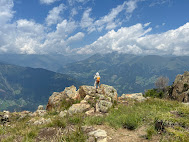
Hike 5 - Monte Cervina (Hirzer) - Riffelspitz Loop Hike
Duration: 6:00 h:m (includes lunch)
Elevation gain: 598 m
Length: 12.1 km
Lunch: Hintereggalm - also signed as “SteakAlm”.
Notes: A variation of hike 4 put pushing to walk some of the E5 European long distance path to a point called Rifflspitz.
Duration: 6:00 h:m (includes lunch)
Elevation gain: 598 m
Length: 12.1 km
Lunch: Hintereggalm - also signed as “SteakAlm”.
Notes: A variation of hike 4 put pushing to walk some of the E5 European long distance path to a point called Rifflspitz.


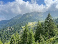
Left: Hike 4 - Monte Cervina (Hirzer)
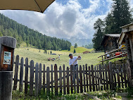
Center: Hike 4 - Monte Cervina (Hirzer) - raking hay at Gompm Alm
Right: Hike 5 - Monte Cervina (Hirzer) - Riffelspitz Loop Hike
Besides hiking, our other must-do thing while in Merano was to visit Trauttmansdorf Castle Gardens. We spent 6 hours there (including lunch) and felt like we could have explored more. The gardens are impressive and the museum about tourism and the history of the area is interesting too.
The garden was spectacular and informative with lots of information about plants besides just their names. The castle gardens are really much more than just a garden. There is something for everyone and it’s all neat as a pin and beautiful to wander through. We’ll mention just a few parts of the garden that we liked:
Between Trauttmansdorf and the center of Merano, you can follow Sissi’s walk (Sissiweg), the path that connects the two. It’s about 4 km long and has a difference in altitude of about 90 m (~ 300 ft).
Elisabeth (born Duchess Elisabeth Amalie Eugenie in Bavaria; 1837 – 1898), nicknamed Sisi or Sissi, was Empress of Austria and Queen of Hungary from her marriage to Emperor Franz Joseph I in 1854. After Sissi’s first visit to Merano in 1870, a travel boom to Merano started. Sissi stayed at Trauttmansdorf Castle, using the Studiolo as a dressing room.
Whether Sissi walked the trail between the castle and the town, we don’t know and suspect it is more marketing than fact. But hey, go with the fantasy if it suits you and “sissy that walk” - at least that’s what we told ourselves.
Trauttmansdorf
Besides hiking, our other must-do thing while in Merano was to visit Trauttmansdorf Castle Gardens. We spent 6 hours there (including lunch) and felt like we could have explored more. The gardens are impressive and the museum about tourism and the history of the area is interesting too.
The garden was spectacular and informative with lots of information about plants besides just their names. The castle gardens are really much more than just a garden. There is something for everyone and it’s all neat as a pin and beautiful to wander through. We’ll mention just a few parts of the garden that we liked:
- The Glass House with Terrarium. The number of plants was small but all beautifully presented and healthy. The leafcutter ants are the highlight of the Terrarium. Their custom-built formicarium provides visitors with a voyeur's view into their everyday life— their fungus chamber, feeding chamber and waste chamber and all of the paths which connect them.
- The gardens feature lots of paths and staircases for you to find your own way around. The sloping nature of the land helps with the intrigue factor because you don't know where paths and stairs lead. The plantings never feel too over the top, but just right.
- An interesting show about the world underground – life below the soil called Botanical Underworld.
- In the Water and Terraced Gardens, there is a small hedge maze made from yew trees with a pomegranate tree as your award to find in the middle.
- The Sun Gardens featuring including the most northernmost olive grove and a 700-year olive tree. And, a limonaia where we felt like we were in Sorrento.
- The museum on tourism was thought-provoking. The permanent exhibition is spread out in many rooms so you can wander and find something that interests you. Make sure you make it all the way through to top floors to see the oldest room like the Studiolo, Princess Room, and Emperor’s Chamber.
Between Trauttmansdorf and the center of Merano, you can follow Sissi’s walk (Sissiweg), the path that connects the two. It’s about 4 km long and has a difference in altitude of about 90 m (~ 300 ft).
Elisabeth (born Duchess Elisabeth Amalie Eugenie in Bavaria; 1837 – 1898), nicknamed Sisi or Sissi, was Empress of Austria and Queen of Hungary from her marriage to Emperor Franz Joseph I in 1854. After Sissi’s first visit to Merano in 1870, a travel boom to Merano started. Sissi stayed at Trauttmansdorf Castle, using the Studiolo as a dressing room.
Whether Sissi walked the trail between the castle and the town, we don’t know and suspect it is more marketing than fact. But hey, go with the fantasy if it suits you and “sissy that walk” - at least that’s what we told ourselves.
It’s easier to walk from the castle to the city because you go downhill. Whichever direction you walk the path, you pass through Maia Alta (a neighborhood of Merano), which has a cute center and one of the best gelato places we found: Konditorei Eisdiele Theiner. Their mint stracciatella was to die for.
Tappeinerweg
Tappeiner Way is a popular big draw for walkers in Merano. It’s a level walking trail that sits about 60 m (200 ft) above the center of Merano. We walked about half of it one evening.
The path/way/trail is named for Franze Tappeiner (1816 – 1902), an Austrian physician and anthropologist, who championed the trail's initial creation.
There is a bust of Tappeiner not far from the start of the trail. There is also a bust of Henri Chenot (1943 -2020), VIP diet and wellness guru, and namesake of the anti-ageing Chenot method. Ahem, I smell bullshit and woo-woo culture here. And that unfortunately is a side of Merano that exists if you look for it: woo-woo wellness for the jet set.
About midway on the Tappeinerweg, there is a sign that describes an interesting point about vegetation around the trail. Starting in 1907, the botanist-pharmacist Arthur Ladurner (1872 – 1960) created a maquis shrubland (macchia mediterranea) on the south-facing hill the trail runs through. If you stop for a moment on the Tappeinerweg trail on a warm day, it is hard to believe you are as far north as you are!
A combination walk with some substantial distance would be to combine the Tappeinerweg and Algunder Waalweg (irrigation canal walk) which would be about 9 km one way. For more information, see The Waalweg trails (merano-suedtirol.it). The last link contains information on the Masier Waaleeg in Maia Alta as well. That walk is interesting because you pass through farms and apple cultivation.
Center left: Maiser Waalweg - view from trail to Dorf Tyrol above Merano
Center right: Maiser Waalweg (Merano, Italy) - view west
Right: Il giardino degli animali - Merano, Italy
Eating
There are a ton of choices for eating in Merano, which we did for every evening we stayed. We tried two Osteria Guide (Slow Food) pickks.
- Brunnenplatz (Maia Alta) – old school, watery and bland dishes.
- Schlossgarten – not bad for being inside the heavily trafficked Trauttmansdorrf Castle Gardens
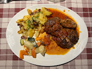
- Knödelglück - near the beginning of the Tappeinerweg. Great position, okay dishes.
- Roberts Stube (Osteria Guide pick) - for an Guide pick we were slightly disappointed.
- Forsterbräu Meran – Downtown Merano, brewery and restaurant of hometown beer, Forster. Just outside of town the interesting looking Forst Braugarten was closed for holiday, which typically happens in July in this area.
- Schanlshuberhof (Osteria Guide pick) – worthy of the Osteria guide. Simple food, informal service. Worth it.
- Mösl (Maia Alta) - A popular pizzeria/eatery that we tuned our noses up at but had a decent pizza there.
- Eishof – See hike 1 above.
- Oberkaseralm – See hike 2 above.
- Malga Bocker (Schutzhaus Bockerhütte) – On the return part of hike 2, we stopped by this malga for some fresh yogurt.
- Waidmannalm – See hike 3 above.
- Gompm Alm – See hike 4 above.
- Hintereggalm – See hike 5 above.
Dishes at Eishof in Val di Fosse including kaiserschmarren.
Apples
Our five hikes treated us to idyllic scenes of alpine pastures interspersed between stands of spruce and larch, alpine lakes and streams, herds of horses, cows, and goats. The human influence on the land is clearly presence but in a pleasing way.
Down in the valleys, a whole different type of human influence on the land meets the eye: apple cultivation.
As we drove into the Merano area, we were surprised to see the endless rows of apple trees and overhead irrigation systems. Orderly rows of apple trees 8 – 10 ft tall grow under nets to protect their fruit from hail and birds. The cultivation method is called the “slender spindle system” and was introduced in the 1970s. All the trees are grafted on to dwarf rootstock. All to say these aren’t your grandma’s wild apple trees growing in the back yard.
Apples are big business in South Tyrol. In fact, the Merano area is part of one of the largest contiguous apple-producing areas in the EU. Bäcksteinerhof, where we stayed for the week, is an example of a typical small farm that grows apples.
What kind of apples are grown in South Tyrol? All kinds, including Fuji, Braeburn, Morgenduft, Winesap, and golden delicious (the most cultivated), to name a few.
We were a bit confused on how the business of apples worked and pieced together the following. 90% of growers (on average 2 – 2.5 hectares) belong to a cooperative (for mutual assistance like Coop. Cafa Merano). A cooperative is part of consortium (for marketing, like Vog or Vip). Consortiums sell the coops’ apples under three brands: Marlene, Vinschgau/Val Venosta, and South Tyrolean PGI. Some growers grow “club apples”, which is a term for apples grown under a trademark restriction, such as Pink Lady. Only a limited number of specially selected growers are permitted grow club apples. This ensures quality control but also limits the supply to prevent the prices from being driven down by many competitors.
But why this area? The Merano (and Bolzano) region is perfect for growing apples because it is protected in the North by the Alps and open in the South. Large temperature swings between day and night produce vibrant colors. High altitude cultivation leads to slower growing apples that are crisper and denser. According to www.bolzanosurroundings.info: “Every second apple in Italy and every tenth apple in Europe is grown here. With a market share of 40% South Tyrol is Europe’s largest supplier of organic apples.”
Today, the growing area South Tyrol (which includes Merano) is about 15,000 football fields and involves 7000 family farms. The growing of apples took off with the construction of a railway line in 1867, which helped transport the apples to the north. Folks like Sissi in Vienna, Berlin, and St. Petersburg couldn’t get enough of those South Tyrol apples.
German and Italian are both official languages of South Tyrol. Many signs and information feature German, Italian, and English. People we met could seamlessly switch between at least German and Italian, if not all three languages, so we had no problem communicating.
Be careful when looking at a map because you could see just the German name, the Italian name, or both. Many web sites we used like www.meranerland.org and www.merano-suedtirol.it are in three languages: German, Italian, and English.
It’s useful to know some basic German words before going. And you know us, we can’t resist putting together a word list. These are words that we came across the most during our week. Put these words into your favorite translator and listen to how they sound. For example: auf wiedersehen.
Alm – malga, like a rifugio in Italian
Auf wiedersehen – see you later, goodbye
Ausfahrt – exit
Bitte schön – please
Danke – thanks
Danke schön – thank you very much
Dorf – village, hamlet
Eingang – entrance
Eisdiele – gelateria
Frühstück – breakfast
Gasthaus – inn, guest house
Guten morgen – good morning
Guten tag – good day
Hallo – hello
Hof – farm
Konditorei – pastry shop
Kunst – art (as in Kunst Meran, the art museum in Merano)
Meran – Merano
Obermais – Maia Alta (a neighborhood of Merano on the west side of the Passirio River)
See(n) - lake(s)
Seilbahn – cable car
Südtirol – South Tyrol (Alto Adige in Italian, but also Sudtirolo)
Tschüss – ciao, cheers, bye (often used when hiking and passing other hikers)
Waal – irrigation canal (used in Waalweg)
Weg – path, way (as in Tappeinerweg or Sisisweg)
But why German and Italian languages? Because South Tyrol was created from a portion of the southern part of the historic County of Tyrol, a former state of the Holy Roman Empire and crown land of the Austrian Empire of the Habsburgs. After WWI, as part of a pre-war deal, the German-speaking territory was annexed to the (then) Kingdom of Italy in 1919.
We talked to one older, local gentleman one evening after dinner who basically said: “we were given as a gift to the Italians....is that right?” It goes without saying that the region is fiercely proud of maintaining their language and customs – as they should be.
But why this area? The Merano (and Bolzano) region is perfect for growing apples because it is protected in the North by the Alps and open in the South. Large temperature swings between day and night produce vibrant colors. High altitude cultivation leads to slower growing apples that are crisper and denser. According to www.bolzanosurroundings.info: “Every second apple in Italy and every tenth apple in Europe is grown here. With a market share of 40% South Tyrol is Europe’s largest supplier of organic apples.”
Today, the growing area South Tyrol (which includes Merano) is about 15,000 football fields and involves 7000 family farms. The growing of apples took off with the construction of a railway line in 1867, which helped transport the apples to the north. Folks like Sissi in Vienna, Berlin, and St. Petersburg couldn’t get enough of those South Tyrol apples.
German
German and Italian are both official languages of South Tyrol. Many signs and information feature German, Italian, and English. People we met could seamlessly switch between at least German and Italian, if not all three languages, so we had no problem communicating.
Be careful when looking at a map because you could see just the German name, the Italian name, or both. Many web sites we used like www.meranerland.org and www.merano-suedtirol.it are in three languages: German, Italian, and English.
It’s useful to know some basic German words before going. And you know us, we can’t resist putting together a word list. These are words that we came across the most during our week. Put these words into your favorite translator and listen to how they sound. For example: auf wiedersehen.
Alm – malga, like a rifugio in Italian
Auf wiedersehen – see you later, goodbye
Ausfahrt – exit
Bitte schön – please
Danke – thanks
Danke schön – thank you very much
Dorf – village, hamlet
Eingang – entrance
Eisdiele – gelateria
Frühstück – breakfast
Gasthaus – inn, guest house
Guten morgen – good morning
Guten tag – good day
Hallo – hello
Hof – farm
Konditorei – pastry shop
Kunst – art (as in Kunst Meran, the art museum in Merano)
Meran – Merano
Obermais – Maia Alta (a neighborhood of Merano on the west side of the Passirio River)
See(n) - lake(s)
Seilbahn – cable car
Südtirol – South Tyrol (Alto Adige in Italian, but also Sudtirolo)
Tschüss – ciao, cheers, bye (often used when hiking and passing other hikers)
Waal – irrigation canal (used in Waalweg)
Weg – path, way (as in Tappeinerweg or Sisisweg)
But why German and Italian languages? Because South Tyrol was created from a portion of the southern part of the historic County of Tyrol, a former state of the Holy Roman Empire and crown land of the Austrian Empire of the Habsburgs. After WWI, as part of a pre-war deal, the German-speaking territory was annexed to the (then) Kingdom of Italy in 1919.
We talked to one older, local gentleman one evening after dinner who basically said: “we were given as a gift to the Italians....is that right?” It goes without saying that the region is fiercely proud of maintaining their language and customs – as they should be.
Photos


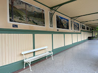
Left: Wandelhalle - Passeggiata inverno - Merano, Italy
Center: Trauttmansdorf - Matteo Thun Viewing Platform - Binoculars
Center: Trauttmansdorf - Matteo Thun Viewing Platform - Binoculars
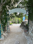
Center left: The entrance to the Tappeiner Way in Merano, Italy
Center: Tappeiner Way - A sign describing the vegetation along the path, maquis shrubland
Center: Tappeiner Way - A sign describing the vegetation along the path, maquis shrubland
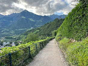
Center right: Tappeiner Way - a section of the path in Merano, Italy
Hike 2 - Spronsor Seen Lakes


Left: Hike 1 - Pfossental (Val di Fosse)
Center and right: Hike 3 - Meran 2000 - Kratzbergersee Lake
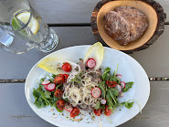
Left: Gompm Alm - carne salada
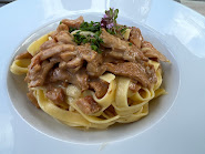
Center: Gompm Alm - fresh pasta with mushrooms
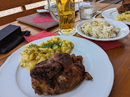
Right: Hintereggalm - half chicken and potato salad


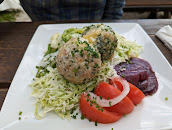
Left: Waidmannalm - cabbage salad with speck
Center left: Malga Bocker - fresh yogurt with fruit


Left: Waidmannalm - cabbage salad with speck
Center left: Malga Bocker - fresh yogurt with fruit
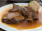
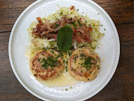
Center right: Oberkaseralm - canerdeli
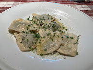
Center: Schnalshuberhof - ravioli
Right: Waidennalm- canerderli



.jpg)




No comments:
Post a Comment
All comments are moderated. If your comment doesn't appear right away, it was likely accepted. Check back in a day if you asked a question.