Overview | Our Itinerary | Notes
Upper left: View from Val de Mezdi toward Colfosco, Alta Badia (Hike 1).
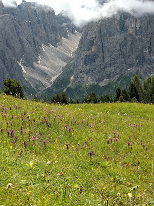
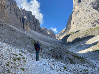
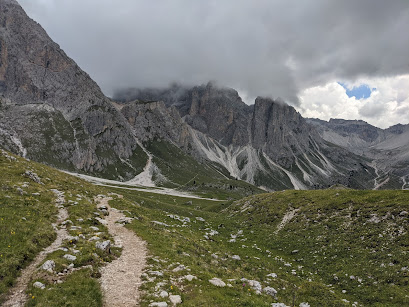
Upper right: View east on trail 527, north side of Langkofel Group in Val Gardena (Hike 3).
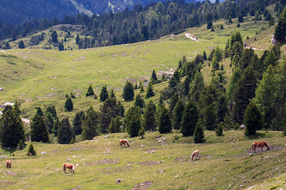
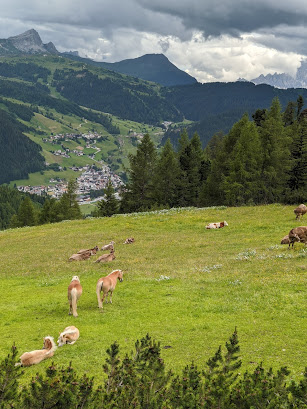
Lower left: On the trail in Alpe di Cisles, Val Gardena (Hike 4).
Lower right: View on trail 8 above Colfosco, Alta Badia (Hike 6).
Overview
Our 2018 post Six Days in Val Badia - Dolomites: Hiking, Walking, and Dining gives an overview of previous trips to this magical area of Italy, our favorite if you can’t tell by how much we’ve written about it. Our first big taste of South Tyrol was back in 2008 and we were hooked. After an 8-year gap, we began returning regularly in winter and summer from 2016 onward.
If you are wondering about hiking in Alta Badia/Val Gardena, we have these reference trips, each with their pros and cons.
In 2008, we spent a week hiking in early June.
- Pros: We had the trails to ourselves as it was still early in the season for most hikers.
- Cons: The weather was variable and chairlifts/gondolas and rifugi were closed, which meant we had to plan our walks without assistance and carry food.
- Pros: Great weather generally, chairlifts/gondolas and rifugi still open.
- Cons: Not as impressive of a flower display, if that’s important to you.
- Pros: Chairlifts/gondolas and rifugi open, display of flowers still spectacular.
- Cons: A bit more crowded on the trails.
We had originally planned to walk the Dolomites Alta Via 1 and stay in a different mountain hut (rifugio) every night for 14 days in total. With Covid-19, we decided to cancel that trip and instead base ourselves in one hotel and do day hikes. This strategy worked out well for us. (All the better, if at least one or more hikes can be started from your hotel.)
Creatures of habit that we are, we stayed once again in Delta Nature Hotel making for our 7th visit. We’ve been at this hotel in both winter and summer and have been happy with the choice each time. The hotel is uphill from Colfosco center with a beautiful view east over Colfosco to the soft pastures and beyond to the austere Cunturines Group.
There is a companion post to this one called Flower Spotting in the Dolomites – Botanical Discoveries from One Week of Hiking that includes photos of the flowers and plants were were able to identify on this trip.
Our Itinerary
Use our itinerary below as a guide of what’s possible. For reference, we are average hikers good for 10 – 20 km or 6 – 12 miles a day, of course depending on the type of terrain. And, we love eating at rifugi so all of hikes have at least one place to stop for lunch.
We had seven total (full) days for hiking and walking. One of the seven days was rainy, so we visited two museums that day. Walk 1 and Hike 6 we did on the same day. Here we mean “walk” as an activity that is not strenuous and with little elevation gain.
Day 1: Hike 1 to Rifugio Pisciadù (Val Badia)
- Date: 2020-07-10
- Total distance: 10 km (6.2 mi)
- A technical climb with spots on the trail fitted with cables, steps, and handholds.
- We walked out from our hotel and straight up in the Val de Mezdi, turning onto trail 676 to arrive at Rifugio Pisciadù.
- From the rifugio, we returned on trail 666 (Val de Setus), which we found out later was “closed” but you wouldn’t have guessed that out by the number of people using it. I think 666 was the worse trail we encountered on the whole trip.
Left: GPS hike tracks for Rifugio Pisciadù.
Center left: Starting off in the meadows of Colfosco.
Center right: Looking up Val de Mezdi. To reach Pisciadù, turn right.
Right: Lunch at Rifugio Pisciadù - our first canerderli of the trip but not our last!
Left: A short section of cable-assist on trail 676 with Via de Mezdi in the background.
Center left: On trail 676 with Rifugio Pisciadù in sight.
Center right: Starting down trail 666 (part of Alta Via 2) in what is called the Val de Setus.
Right: A view over Colfosco from trail 29.
Day 2: Museum Day
- Date: 2020-07-11
- Museum Ladin Ursus ladinicus (San Cassiano)
- Lunch at Ostaria Garsun
- Museum Ladin Ciastel De Tor (San Martino in Badia).
- One ticket gets you into both museums. They are separated by a 25-minute drive.
- Both are fascinating museums. The Ciastel de Tor gives you a good introduction to the Ladin culture. In particular, you learn about the different style of house/barn combinations (called a maso) and the typical grouping of houses (masi) into a hamlet (vila) that leaves such a strong impression on any visitor to this region.
Center: A room in the Museum Ladin Ciastel De Tor.
Right: View from Delta Nature Hotel toward Colfosco and Sassongher peak.
Day 3: Hike 2 to Rifugio Scotoni and Lago Lagazuoi (Parco naturale Fanes - Sennes – Braies)
- Date: 2020-07-12
- Total distance: 13 km (8 mi)
- Park at Capanna Alpina.
- We intended to take the popular trail 11 (to Rifugio Fanes) and then switch to trail 20b to reach Rifugio Scotoni from something other than the conventional route, but our plan was foiled when we found that trail 20b (“furcela di lech”) was closed due to damage from recent storms. So, we doubled back to Capanna Alpina and took the conventional route (trail 20) to Scotoni and then continued up to visit the Lago Lagazuoi above Scotoni before returning to Scotoni for lunch. Scotoni is famous for its grilled meat and shouldn't be missed!


Left: GPS hike tracks for Rifugio Scotoni.
Center: View from trail back down over the meadow in front of Rifugio Scotoni.
Right: Lago Lagazuoi.

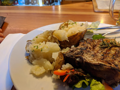

Center: Rifugio Scotoni ribs.
Right: Rifugio Scotoni strudel.
Day 4: Hike 3 Around Sassopiatto and up to Rifugio Vicenza and Rifugio Demetz (Passo Sella, Val Gardena)
- Date: 2020-07-13
- Total distance: 14 km (8.7 mi)
- Park at Passo Sella.
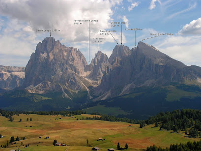
- Sassolungo and Sassopiatto are the two principal parts of the massive called the Langkofel Group. We walked around Sassopiatto (clockwise) starting at Passo Sella (proceeding clockwise) and then up the middle of the group to have lunch at Rifugio Vicenza. (Vicenza has the best kaiserschmarrn that we’ve had!)
- From Rifugio Vicenza, we hoofed it up to Rifugio Demetz, where we took the cable car down to where we left the car at Passo Sella.
Left: Starting out the hike above Passo Sella.
Center: Hiking on the southeast side of the Langkofel Group.
Right: Heading up toward Rifugio Vicenza.
Left: Walking up the Forcella Sasso Lungo.
Left center: A profile of the Langkofel group from the north that shows the peaks and the Forcella Sasso Lungo where we hiked. (Image from Wikipedia)
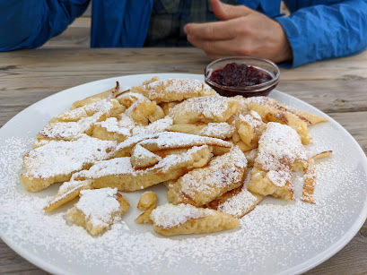
Right center: Kaiserschmarrn at Rifugio Vicenza - the best we've had and worth the sweat to get there.
Right: Lunch (a soup entry) at Rifugio Vicenza.
- Date: 2020-07-14
- Total distance: 11 km (6.8 mi)
- Park at Col Raiser lower station.
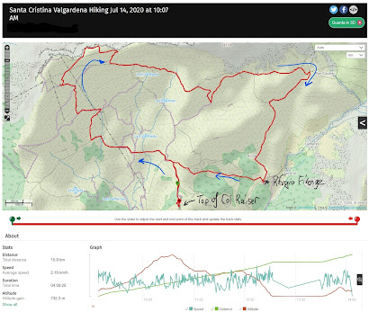
- We took the Col Raiser cable car up and walked around these spectacular alpine pastures.
- There is no shortage of walking possibilities. We did a clockwise loop taking us to Rifugio Seceda and then on trail 8b to lunch at Rifugio Firenze. From Firenze, we closed the loop to the top of the cable car and took it back down.
Left: GPS hike tracks for the Alpe di Cisles.
Center left: A view from the Col Raiser gondola.
Center right: The peaceful meadows of Alpe di Cisles.
Right: The unreal Panascharte upper part of the Alpe di Cisles meadows.
Left: Example of the flower-filled meadows of Alpe di Cisles.
Center: On trail 8 under the Odle Group.
Right: A map of the Alpe di Cisles available at the Col Raiser station.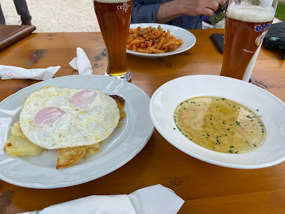

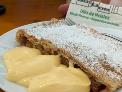
Left: Lunch at Rifugio Firenze (also called Regensburgerhütte).
Center: Pasta at Rifugio Firenze.
Right: Strudel at Rifugio Firenze - we sampled over a half dozen strudels on this trip.
Day 6: Hike 5 - Circumnavigate Monte Nuvolau and Cinque Torre (Cortina d’Ampezzo)
- Date: 2020-07-15
- Total distance: 12 km (7.5 mi)
- Park at the Cinque Torre lower station.
- We took the Cinque Torre chairlift up and started hiking.
- We didn’t have much of a plan and improvised when we arrived at Rifugio Scoiattoli at the top of the chairlift.
- We ended up circumnavigating Monte Nuvolau counterclockwise, passing by Rifugio Averau, Passo Giau, and ending up back at Scoiattoli where we had lunch.
- We tried to take trail 438 (called Ra gusela), a via ferrata, to reach Rifugio Nuvolau, but we realized that we were not properly equipped and turned around.
- Note: some trails like on Day 1's hike have cables and handholds in spots and we were able to manage them without equipment (harness, rope, helmet). But trail 438 was just a bit beyond our comfort zone.
- After lunch at Scoiattoli (name translates as “squirrels” of which we didn’t see any), we did a tour of the Cinque Tour and the open air war museum with trenches, buildings, and good signage. This was the front line in World War I between Italy and Austria.


Left: GPS hike tracks for excursion around Monte Nuvolau.
Center left and right: The trail on the east side of Monte Nuvolau - view toward Lastoni di Formin.
Right: The impressive Lastoni di Formin from Passo Giau. (It's on our list to hike next time we are there.)


Left: Map of the La Grande Guerra "The Great War" sign for understanding the outdoor museum.
Center: A view of the outdoor war museum under Cinque Torre. "War, what is it good for? Absolutely nothing."
Right: View toward Monte Nuvolau from Passo Giau.


Lunch dishes and dessert at Rifugio Scoiattoli.
Day 7:
- Date: 2020-07-16
- Walk 1: Tru dles viles - Sentiero dei masi (La Villa, Val Badia)
- Total distance: 5.4 km (3.3 mi)
- Park at the big La Villa parking lot.
- A simple walk featured on the Alta Badia app/site. We did half of the walk in the interest of time. The Alta Badia app is a great place to see what's available for attractions, including walking and hiking.
- “Viles” are hamlets of on average five or more buildings that have a long history in the Ladin culture. you can’t be walking or driving around without noticing these pleasing groups of building and wondering about them. The Italian Wikipedia page for Vila shows some representative photos. You can also learn about the architecture and history of the area in the Ladin Museum (see Day 2).
- Hike 6: Hike to Ütia Forcelles and Col Pradat (Colfosco, Val Badia)
- Total distance: 9 km (5.6 mi)
- After our morning walk, we returned to Delta Nature Hotel, and followed trail 8b and then 8 that explore the base of the area under Sass da Ciampac. In particular, we interested in eating at Ütia Forcelles. We've been to this Ütia in winter while skiing and we’ve always enjoyed the food there, so we were eager to try it in summer. We weren't disappointed.


Left: GPS tracks for hike above Colfosco.
Center left: View on the walk "Tru dles viles" - toward the Dolomiti Orientali di Badia.
Center right: A typical view on the walk "Tru dles viles" on the meadows above La Villa.
Right: A view from trail 8 above Colfosco toward Val de Mezdi.
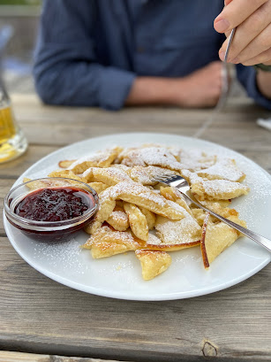
Left and center left: Kaiserschmarrn at Rifugio Forcelles. So good, had to include it twice.
Center right: A tris di canederli at Rifugio Forcelles and spätzle.
Notes
Useful for a trip to this corner of Italy is a sense of what place names mean. This guide shows translations from Italian to Ladin. Using that guide, with our English translations, here are some common translations to help when looking at a map:
- English – Italian – Ladin
- Chalet – Baita – Ütia
- Example: Ütia Forcelles
- Cross – Croce – Crusc
- Example: Crusc da Rit
- Forest – Bosco – Bosch
- Hill – Collina – Col
- Example: Col di Lana
- Lake – Lago – Lech / lè
- Example: Lech de Lagaciò
- Meadow – Prato – Prè
- Mountain – Montagna – Munt
- Peak – Cima – Crëp, Piza
- Example: Ütia Crëp de Munt
- Stream – Torrente – Rü
- Trail – Sentiero – Trù
- Example: Le tru di artisc
- Water – Acqua – Ega
- Waterfall – Cascata – Pisciadù
- Example: Rifugio Pisciadù
For more information about the ladin language (in English), see the Ladinia.it site. The ladin language dates back to the first century.
When planning hikes, check the lift schedules for opening and closing times: Alta Badia summer schedule and Val Gardena lift. Consider taking a lift to save time or your legs, either up or down.
In terms of dining, we took all our breakfasts and dinners at our hotel, Delta Nature Hotel, as a half-board option, which is typical. The exception is the one night we made our usual pilgrimage to Maso Runch. For more information about Maso Runch, see our post Dining Reccomendataion for Alta Badia in the Dolomites, South Tyrol.
On our Day 3 hike (starting at Rifugio Alpina), we flirted with trying to find the cave where the Ursus ladinicus bear remains were found but realized it was folly. There are organized hikes to it we heard from a park ranger (see for example, here), which on second thought is a better bet to be going with a group and a guide. The cave is locked; you can’t enter. Also, the sculpture piece that we “thought” was there was not there anymore.
While visiting the Museum Ladin Ursus ladinicus in San Cassiano, we learned a lot about this extinct bear, especially about bear teeth and how much you can tell about a bear's life. In the museum, there was a video about a sculptural piece by the ladin artist Lois Anvidalfarei that was placed at the entrance of the cave’s gate (La Grotta delle Conturines). We didn’t realize the sculpture was temporary, being removed in 2017. Boy, would we have been disappointed to hike up and not find it!











No comments:
Post a Comment
All comments are moderated. If your comment doesn't appear right away, it was likely accepted. Check back in a day if you asked a question.