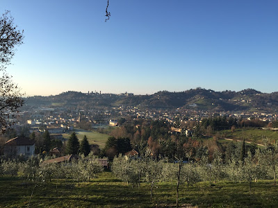
Left: Hike route. Followed counterclockwise. Right: View from Sentiero 533 to Città Alta of Bergamo.
Hike Notes
Length: 14.3 miles (23 km) from starting point at Quintino Alto @ Monterosso.
Duration: 6 hours total: 4 hours before lunch at Antichi Sapori in Sorisole and then 2 hours after lunch.
Elevation: Total elevation gain 4,689 feet. Max elevation 3,622 feet. Min elevation 843 feet.
Location: Parco di Colli di Bergamo, Bergamo, Province of Bergamo
Update
We did this hike again in 2020. For more information, see A Classic Bergamo Hike: Canto Alto.
Overview
The last hike of 2015 took us from the historic Bergamo city center to the top of a nearby peak, Canto Alto (3,760 ft or 1,146 m), part of the Bergamasque Prealps. The Parco di Colli di Bergamo provides a good opportunity to do this kind of hike because it includes 18 square miles of mixed town and country around Bergamo and the the surrounding communities of Almé, Bergamo, Mozzo, Paladina, Ponteranica, Ranica, Sorisole, Torre Boldone, Valbrembo, and Villa d'Almé.
To start this hike, we took a the number 6 (ATB) bus to Quntino Alto to cut off 3 km of city walking and start fresh on the trail sentiero 533. But, we did walk all the way back to the center of Bergamo. Once on the trail, follow the red and white signs and chart your own way. There is always more way than one to get somewhere. We plotted our hike around lunch in Sorisole at the wonderful Trattoria Antichi Sapori. 10 euro lunch with several courses, a good deal.
The hiking tally for 2015 is 11 hikes and 127 miles.
Left: Start of sentiero 533. It starts steep. Middle: Winter trail near Forcella del sorriso. Right: Unexpected splah of color on the trail.
Left: Sentiero 533 leads to Croce dei morti; Center: At Forcella del sorriso (“saddle of the smile”); Right: A man takes a motorcyle up sentiero 220. Woah.
Left: Walking down from Canto Alto. Right: Crocus and brown leaves.
Other views of the hike route. Route was done counterclockwise in images shown, starting in Quntino Alto and ending in Bergamo centro.
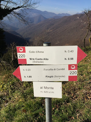
Left: Signage on sentiero 220. Right: Canto Alto cross.
Left: View north from Canto Alto; Right: View north from Via alla Porta San Lorenzo looking toward Canto Alto.
Pages
▼
Tuesday, December 29, 2015
Saturday, December 26, 2015
Valle Ellero, Rastello to Cima Pigna Hike
Left: View toward Monte Viso from Cima Pigna. Right: Trail route from Rastello to Cima Pigna, we went in a clockwise direction. The other red line is previous day hike in Valle Pesio.
Hike Notes
Length: 12 miles (19.3 km)Duration: About 6 hours, with a little rest time near Rifugio S. Comino.
Elevation: Total elevation gain 5,265 feet (1,605 m), started at 2,485 feet (757 m) @ Rastello, max elevation 6,154 feet (1,876 m) @ Cima Pigna.
Location: Valle Ellero, Province of Cuneo, Piemonte
Overview
We were uncertain at the start of this hike where we were going and where we'd end up because we weren't certain of what the roads and trails would be like. Heck, we hadn’t even planned on doing any hiking while in Piemonte visiting family, but here we are with a free day and nice weather.
It's supposed to be winter in Piemonte, but there has been very little snow with warmer than average temperatures. We parked in Rastello because we didn’think our rental car could make it past some ice we encountered on the road up to Rifugio Havis de Giorgio Mondovì. So we walked from Rastello up the road to Ponte Murate where we found a steep bit of trail to take us to G7. Once on G7 we headed north to Cima Pigna and then the rest was a finding our way back to Prea via country lanes and roads. From Prea, we walked across the small valley back to Rastello. Most hikers would park in Prea and head southwest to reach the summit of Pigna, as shown here. Not us...everything in reverse.
Walking on the ridge heading toward the plain, you walk between the Valle Pesio on the left and the Valle Ellero on the rise. Both valleys give rise to rivers of the same name, Fiume Pesio and Fiume Ellero. Both rivers eventually empty into the Tanaro, which in turn empties into the mighty Po River. The area around Cuneo is all about the rivers and the valleys that originate in them. For example, see Alpi Cuneesi for a list of valleys.
Other information if you are thinking about a hike in this area:
- The hike described here is just outside the Parco Marguareis eastern border.
- You can see trails for this area from this Provincia di Cuneo mapping application. Drill in to the area of interest.
- This hike is at the edge of what is also called the Pian Marchisio. For more serious hikes for better weather, see Cuneo 360 Itinerari.
- You can download detailed maps from the site for Piemonte Regional geographic data.
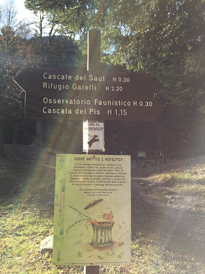
Left: Road leaving Rastello and heading to Rifugio Mondovì. Center: Picking up the trail at Ponte Murate. Right: Signage for G7 trail pointing to Rifugio S. Comino and Cima Pigna.
Left: G7 trail signage showing time to destination. Right: A shrub common edge of high meadow with 5 seed capsules, probably Ericaceae.
Left: Heading up the spine of the hill toward Cima Pigna. Right View toward Artesina ski resort.
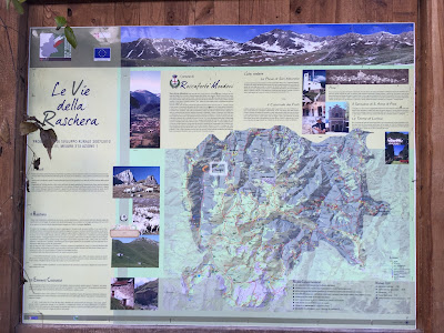
Left: Le Vie della Raschera map, Comune di Roccaforte Mondovìi. Right: Hike route (in blue) shown on a map generated from the Provincia di Cuneo Sentieri Alpini mapping application.
Tuesday, December 22, 2015
Valle Pesio, Pian delle Gorre to Cascata del Pis del Pesio
Left: Road near Vigna, driving into the Valle Pesio. Right: The Pis del Pesio is not pissing today. It is a seasonal waterfall, what did we expect?
Hike Notes
Length: 5 miles (8 km)Duration: About 2.5 hours.
Location: Italy, Piemonte, Province of Cuneo, Valle Pesio
Overview
On our previous trip to Piemonte in 2013, one of our hosts suggested a trip to Pis del Pesio. We didn't make it there, but the name stuck in my head and I was determined to see it this time even if it was the middle of winter. Well, sort of winter. It's been unusually warm here and very little snow, therefore when a free day came up during our Christmas visit to relative, we decided to take a look.We drove up to Rifugio Pian delle Gorre part of the Parco Marguareis (www.parcomarguareis.it).
For resources about hiking in this area, see the post Valle Ellero, Rastello to Cima Pigna Hike.
Left: Giro del Marguareis map. Right: Parco Naturale del Marguareis map.
Left and Center: Signage for Cascata del Pis and the H10 trail. Right: Description Pis del Pesio.
Gias Fontana. "gias" comes from giaciglio, a place for animals in Occitan language the Dizionario escursionistico - alpinistico - valdostano.