
Hike Notes
Length: 14.3 miles (23 km) from starting point at Quintino Alto @ Monterosso.
Duration: 6 hours total: 4 hours before lunch at Antichi Sapori in Sorisole and then 2 hours after lunch.
Elevation: Total elevation gain 4,689 feet. Max elevation 3,622 feet. Min elevation 843 feet.
Location: Parco di Colli di Bergamo, Bergamo, Province of Bergamo
Update
We did this hike again in 2020. For more information, see A Classic Bergamo Hike: Canto Alto.
Overview
The last hike of 2015 took us from the historic Bergamo city center to the top of a nearby peak, Canto Alto (3,760 ft or 1,146 m), part of the Bergamasque Prealps. The Parco di Colli di Bergamo provides a good opportunity to do this kind of hike because it includes 18 square miles of mixed town and country around Bergamo and the the surrounding communities of Almé, Bergamo, Mozzo, Paladina, Ponteranica, Ranica, Sorisole, Torre Boldone, Valbrembo, and Villa d'Almé.
To start this hike, we took a the number 6 (ATB) bus to Quntino Alto to cut off 3 km of city walking and start fresh on the trail sentiero 533. But, we did walk all the way back to the center of Bergamo. Once on the trail, follow the red and white signs and chart your own way. There is always more way than one to get somewhere. We plotted our hike around lunch in Sorisole at the wonderful Trattoria Antichi Sapori. 10 euro lunch with several courses, a good deal.
The hiking tally for 2015 is 11 hikes and 127 miles.
Left: Start of sentiero 533. It starts steep. Middle: Winter trail near Forcella del sorriso. Right: Unexpected splah of color on the trail.


Left: Sentiero 533 leads to Croce dei morti; Center: At Forcella del sorriso (“saddle of the smile”); Right: A man takes a motorcyle up sentiero 220. Woah.


Left: Walking down from Canto Alto. Right: Crocus and brown leaves.


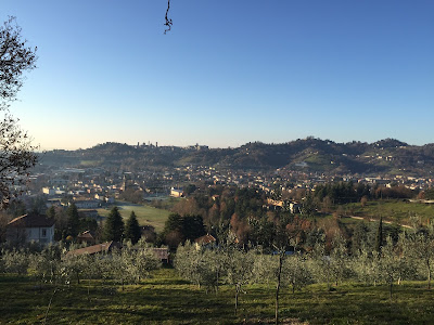
Other views of the hike route. Route was done counterclockwise in images shown, starting in Quntino Alto and ending in Bergamo centro.


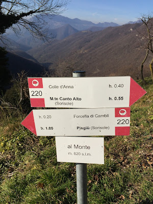
Left: Signage on sentiero 220. Right: Canto Alto cross.


Left: View north from Canto Alto; Right: View north from Via alla Porta San Lorenzo looking toward Canto Alto.


No comments:
Post a Comment
All comments are moderated. If your comment doesn't appear right away, it was likely accepted. Check back in a day if you asked a question.