Overview ~ Hike 1 ~ Hike 2 ~ The Area


Left: Walking down the Valbiolo ski run in twilight approaching Passo del Tonale.
Center left: Tracks for hike 1.
Center right: Walking into the sunset at Passo del Tonale.
Right: Tracks for hike 2.
Overview
Last year, we did two late winter hikes, one west of Ponte di Legno and one east at Passo del Tonale: Two Late Winter Hikes Near Ponte di Legno, Italy. This year, we stayed at a rented house in Passo del Tonale over the New Year. To add diversity to our days instead of just skiing (see How I Learned to Like Skiing – 7 Simple Rules), we looked for hikes to do. Here, we show two simple hikes of under two hours that we did on Jan 2 and Jan 3, 2024. There are hikes more waiting to be discovered in this area.
Both hikes were done in the late afternoon, so we hiked into dusk for both. Start earlier if you can.Hike 1: Tour delle Marmotte
Duration: 1.25 hours
Elevation: 60 m gain (estimate)
Length: 6 km
Our path on this day we cut short because of waning light and a freezing wind! Otherwise, we would have taken the road up to the cozy Ospizio San Bartolomeo (now called Hotel/Restaurant Mirandola). We, in fact, visited this hotel/restaurant twice in the days before this hike. We include some of those photos here. We had a nice lunch at Ospizio one day and an afternoon hot drink on another.
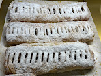
On the way back into town for hike 1 we stopped at the Panificio Pezzani to get some strudel to take home for dessert! Don’t miss it.
Passo del Tonale is split between the regions of Lombary (Lombardia in Italian) and Trentino-South Tyrol (Trentino-Alto Adige in Italian). The dividing line is at the landmark Military Memorial Passo del Tonale (Sacrario militare del Tonale). (See Street Sign Language Lesson XL.)
We started the walk here, near the area for campers.
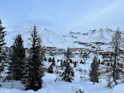
Left: Passo del Tonale view north from Tour delle Marmotte trail.
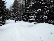
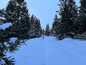
Center and right: Tour delle Marmotte trail with fresh snow between trees.


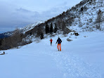
Center left: View from Hotel Mirandola toward sunset and Valbiolo chairlift.
Center right: Walking near Ospizio San Bartolomeo/Hotel Mirandola.
Right: Starting off on the Tour delle Marmotte trail.
Hike 2: Walk to Galleria Alveo
Elevation: 235 m
Length: 8.5 km
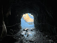
Last summer, we took the gondola up to see the Presena Glacier (see Presena Glacier – A summer visit to the covered glacier). On this hike, we follow the path partly up to the glacier from the pass. Our turnaround point is the Alveo tunnel (Galleria Alveo), a short tunnel through the mountain. The tunnel was made during WWI. If you continue on this trail, you would reach the ex-military village of Monticelli (dating to WW1) and Rifugio Capanna Presena. This is numbered trail 281. (Other references and photos: here and here.)
Alveo in Italian is “riverbed”, referring to the riverbed plateau the trail takes you to. The river is caused by glacier runoff.
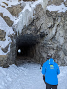
Hold on to the ropes in the tunnel. It was very slippery even though it didn’t look to be so.
We started the walk here, near the area for campers. This trail is called 723 – Tour delle Marmotte, which we walked part of in Hike1. Instead of following Marmotte all the way, at this point we caught the trail to Presena (here or here if there is a lot of snow).
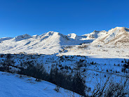
Right: View from Trail 218 looking east, near the Galleria Alveo.

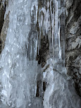


Ice formations in and near the Galleria Alveo.


The area
Eastern Alps
--|--|Adamello-Presanella Alps (II/C-28.III SOIUSA, highest peak Presanella at 3,558 m)
The Adamello-Presanella Alps Alpine group is a mountain range in the Southern Limestone Alps mountain group of the Eastern Alps. It is located in northern Italy, in the provinces of Trentino and Brescia. The name stems from its highest peaks: Adamello and Presanella. The Tonale Pass separates the Adamello-Presanella Alps from the Ortler Apls to the the north.





No comments:
Post a Comment
All comments are moderated. If your comment doesn't appear right away, it was likely accepted. Check back in a day if you asked a question.