Left: At the start of the trail, a commemorative sculpture for the "witches of Tonale". Witches were said to have practiced their witchcraft in these hills. There were two public burnings of witches (mostly female and some male) in the 1500s in Val Camonica. Over 100 people were killed. Right: Val Cané and view south toward the Adamello Group.
We recently spent a weekend in Ponte di Legno skiing and walking. In this post, we’ll talk about two easy hikes we did, good for late winter season. We’ve visited Ponte di Legno four times over the last few years, each time for a few days, usually for skiing. Each time, we find more to do and more restaurants to try. It’s a place worth visiting.
Overview
Where are these hikes? Both hikes are near Ponte di Legno, a small comune of less than 2,000 people. It’s located in Lombardy Italy, about a 2.5 hour drive due northeast from Bergamo. While Ponte di Legno is a summer and winter destination spot (note number of shuttered homes at any given time), it still retains some of its charm as a town with people who live and work there. The old town is centered around the confluence of the Frigidolfo and Narcanello rivers, which give birth to the Oglio River. The Oglio passes through Lago Iseo and like all water in the north of Italy empties into the mighty Po River.
Getting there? You can reach Ponte di Legno on public transport. We’ve done it twice on public transport. Once, we did it all by bus from Bergamo (with two changes). That took about 3-4 hours – not much longer than by car, 2 hours without trafffic. And once, we arrived by train from Bergamo to Brescia to Edolo. We took a break at Edolo for a lunch at La Corte di Bacco. From Edolo to Ponte di Legno, it’s a bus. There is also a direct bus from Milan (Sesto San Giovanni), passing through Bergamo Airport. From Ponte di Legno, you can take a small bus up to Passo Tonale or the cable car.
Surroundings? Ponte di Legno is located between two major parks: to the north Parco di Stelvio and to the south Parco Adamello. Even in the center of Ponte di Legno, it feels like you are close to nature. Walking in the compact city center’s winding streets and crossing numerous bridges, you are never far from the sound of rushing water. Look up, and there is almost 360 degrees of mountains and trees. You can walk right out of town on numerous pleasurable walks or serious hikes.
Duration: 2 hours, going and returning (doesn’t include time for lunch)
Elevation: 440 m (1,440 ft), start at 1,900 m (6,230 ft), finish at 2,340 m (7,680 ft)
Length: 7 km roundtrip
Our first hike was up to Malga Valbiolo, above Passo Tonale. We love eating at this rifugio on a popular ski run. Usually, we are skiing, and we stop there for lunch. Today, we walk up.
To get there, either take the cable car (Cabinovia Ponte di Legno – Tonale) from Ponte di Legno up to Tonale, and then walk to the base of the Valbiolo ski lift (Seggovia Valbiolo - location). From there, follow the small road up to Opsizio San Bartolomeo and grab a coffee. (Be sure to see the commemorative sculpture about the witch trials of the 1500s in Val Camonica. Very interesting.) From San Bartolomeo, just follow the signs up. (Alternatively, drive up and park at the base of the Valbiolo ski lift.)
From Opsizio San Bartolomeo, follow the signage for “Malga Valbiolo”. The trail was covered in snow the higher up we went. Sometimes we missed the trail and followed the snowshoe trail for a bit. The trail markers list the trail as “111”.
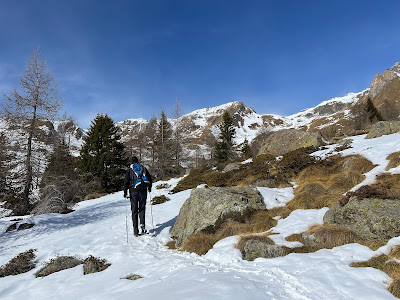

Walking up to Malga Valbiolo and toward Passo Contrabbandieri.
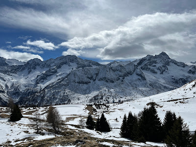

View from trail south toward Presanella Group.


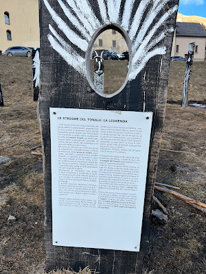
A commemorative sculpture near Ospizio San Bartolomeo telling of the story of two witch trials in Val Camonica in the 1500s. Witches (mostly woman and some men) were reported to come to this area on Passo Tonale to practice their witchcraft.
Duration: 2.25 hours, going and return, a few stops for a sip of water
Elevation: 460 m (1,510 ft), start at 1,540 m (5,050 ft), turn around at 2,000 m (6,560 ft)
Length: 9 km roundtrip
Our second hike was up Val Canè (Val di Canè), an alpine valley in the Province of Brescia, in upper Val Camonica. The valley is just a few minutes south of Ponte di Legno and is within the Stelvio National Park. This small valley begins north of the village of the same name and ends at 3,228 m with the Punta di Pietra Rossa. After passing through the village there is a parking lot (location) at the trail head at 1,540 m. (We only reached 2,000 m before turning around following trail “165”.)
Getting there? You can reach Ponte di Legno on public transport. We’ve done it twice on public transport. Once, we did it all by bus from Bergamo (with two changes). That took about 3-4 hours – not much longer than by car, 2 hours without trafffic. And once, we arrived by train from Bergamo to Brescia to Edolo. We took a break at Edolo for a lunch at La Corte di Bacco. From Edolo to Ponte di Legno, it’s a bus. There is also a direct bus from Milan (Sesto San Giovanni), passing through Bergamo Airport. From Ponte di Legno, you can take a small bus up to Passo Tonale or the cable car.
Surroundings? Ponte di Legno is located between two major parks: to the north Parco di Stelvio and to the south Parco Adamello. Even in the center of Ponte di Legno, it feels like you are close to nature. Walking in the compact city center’s winding streets and crossing numerous bridges, you are never far from the sound of rushing water. Look up, and there is almost 360 degrees of mountains and trees. You can walk right out of town on numerous pleasurable walks or serious hikes.
Hike 1: Malga Valbiolo
Elevation: 440 m (1,440 ft), start at 1,900 m (6,230 ft), finish at 2,340 m (7,680 ft)
Length: 7 km roundtrip
Our first hike was up to Malga Valbiolo, above Passo Tonale. We love eating at this rifugio on a popular ski run. Usually, we are skiing, and we stop there for lunch. Today, we walk up.
To get there, either take the cable car (Cabinovia Ponte di Legno – Tonale) from Ponte di Legno up to Tonale, and then walk to the base of the Valbiolo ski lift (Seggovia Valbiolo - location). From there, follow the small road up to Opsizio San Bartolomeo and grab a coffee. (Be sure to see the commemorative sculpture about the witch trials of the 1500s in Val Camonica. Very interesting.) From San Bartolomeo, just follow the signs up. (Alternatively, drive up and park at the base of the Valbiolo ski lift.)
From Opsizio San Bartolomeo, follow the signage for “Malga Valbiolo”. The trail was covered in snow the higher up we went. Sometimes we missed the trail and followed the snowshoe trail for a bit. The trail markers list the trail as “111”.


Walking up to Malga Valbiolo and toward Passo Contrabbandieri.


View from trail south toward Presanella Group.
Left: Food at Malga Valbiolo. Center: Sign for trail 111 for Malga Valbiolo in Passo Tonale. Right: To get to the rifugio you pass under the ski lift.


A commemorative sculpture near Ospizio San Bartolomeo telling of the story of two witch trials in Val Camonica in the 1500s. Witches (mostly woman and some men) were reported to come to this area on Passo Tonale to practice their witchcraft.
Hike 2: Val Canè
Elevation: 460 m (1,510 ft), start at 1,540 m (5,050 ft), turn around at 2,000 m (6,560 ft)
Length: 9 km roundtrip
Our second hike was up Val Canè (Val di Canè), an alpine valley in the Province of Brescia, in upper Val Camonica. The valley is just a few minutes south of Ponte di Legno and is within the Stelvio National Park. This small valley begins north of the village of the same name and ends at 3,228 m with the Punta di Pietra Rossa. After passing through the village there is a parking lot (location) at the trail head at 1,540 m. (We only reached 2,000 m before turning around following trail “165”.)

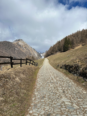
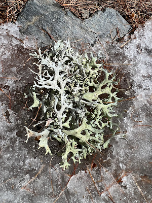
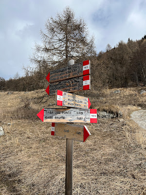
Left and center left: Start of trail 165 to Val Cané. Center right: Lichen. Right: Example of trail signage on way to Val Cané.

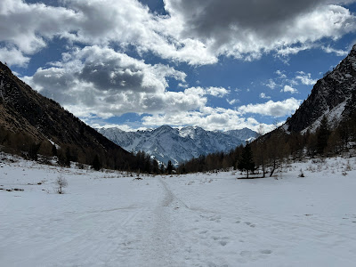
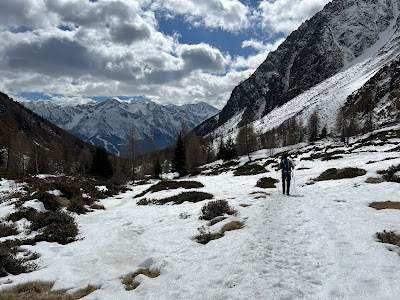
Left: View north toward the pass in Val Cané. Right: View south from the tail toward the Adamello group.
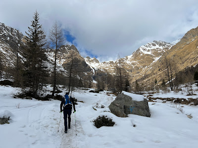

Trail shots. Little snow in the beginning, and more snow the higher you go in Val Canè.
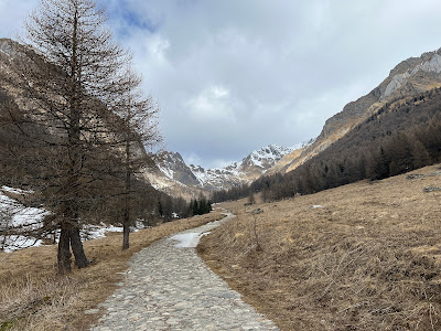

Aesthetically pleasing roads leading to mountains in Val Cané.


No comments:
Post a Comment
All comments are moderated. If your comment doesn't appear right away, it was likely accepted. Check back in a day if you asked a question.