


![[Saxifragaceae] Saxifraga byroides](https://blogger.googleusercontent.com/img/b/R29vZ2xl/AVvXsEicNEMQX7M2vR-_pcPVF__8t2SlDQG9FHQ94E8svrYOcB0BYGLtO19FSBaI_kcPkHnnWQVReOurqmOFDF0ISWb0hZxIvJxc22BnhkbQMWSCB6UdVQzryTR23wdTeBrfgX0QnyMfVubPjUEQBr4_kAaFaUDsWGtucM5xzEg3gwonj9b4q2gF3tHTXGD4KQ/s4080/%5BSaxifragaceae%5D%20Saxifraga%20byroides%2003.jpg "[Saxifragaceae] Saxifraga byroides")
Top left: Fellaria East Glacier Lake showing cliff with tongue or terminus with proglacial lake.
Top right: Heading toward Rifugio Bignami with Alpe Gera lake on the right.
Bottom left: Fellaria East Glacier Lake edge.
Bottom right: [Saxifragaceae] Saxifraga byroides
Overview
Duration: 8.5 hours (including time at the glacier lake, and lunch at Rifugio Bignami)
Elevation gain: 684 m
Location: Italy, Lombardy, Valtellina
Notes
Rifugio Bignami is more or less the midpoint to on the trail hiking from the Alpe Gera dam to the Fellaria East glacier lake.
The Fellaria Glacier (Ghiacciaio Fellaria) is in the Alta Valmalenco, province of Sondrio (Lombardy, Italian Alps), right below the Swiss border. Its upper plateau reaches about 3500 m a.s.l. and today its terminus sits near 2 600 m, where meltwater has pooled into a small proglacial lake. This lake is the real destination of today’s hike. And specifically, we are visiting the east tongue of the glacier. Up through the Little Ice Age (ca 1850) there were two glacier tongues (Fellaria West and East) joined into one continuous ice front, but retreat has isolated the eastern tongue and given rise to the lake between them.
We followed the Luigi Marson glaciological trail (Sentiero Glaciologico Marson) from Rifugio Bignami. Very informative signs and survey markers along the Luigi Marson glaciological trail chart a retreat of roughly 800 - 1000 m (that’s eight to ten football fields) since the mid-19th-century maximum. Almost all of that loss has happened in the last few decades, and the “lake” we visit today only existed in its present form from the early 2000s onward. Argh, so disheartening to see.
Luigi Marson was an Italian glaciologist-educator and professor at the Regio Istituto Tecnico di Sondrio and a member of the Società Geografica Italiana. He wrote the first systematic glaciological descriptions of Lombardy’s glaciers in 1899. In his honor, the Servizio Glaciologico Lombardo inaugurated the “Sentiero Glaciologico Luigi Marson” in 1996—a thematic trail (today’s hike) around the Fellaria–Palù ice masses designed to bring hikers up close to Alpine glacial environments.
During our hike today, we crossed paths with a group of retirees from Sondrio. They hike every Thursday and one of their rituals in the mountains is to sing the song Signore delle cime ("Lord of the Mountain Tops"). This popular Italian song of prayer was written by Bepi De Marzi in 1958. The group of retirees we met sing it as a tribute to friends they've lost. They performed it for us while we were sitting after lunch at Rifugio Bignami. Very touching.
![[Caryophyllaceae] Cerastium alpinum](https://blogger.googleusercontent.com/img/b/R29vZ2xl/AVvXsEgUJb0p_UvK4B9TBN2eFRh9QTuYT7Q9MaWn21A6eboxpKQ7Z_OItYituSBqBS0nTFg4O8j5EBid2jUJaKpzZ4sVnRFX_wni8MCjH5zzPLhbmerp-VHfbSs97CYpIsNHqLyprihwjcFVjlnFSvqj26Q2KNBmfrLAurdCUDjbZBjqo3cL7xrZYb87PRkNhQ/w150-h200/%5BCaryophyllaceae%5D%20Cerastium%20alpinum.JPG "[Caryophyllaceae] Cerastium alpinum")
![[Geraniaceae] Geranium sylvaticum](https://blogger.googleusercontent.com/img/b/R29vZ2xl/AVvXsEg0fMYE8JS-3eX-yIbU4tc2t5Ni1XGX3k-x1qulZpOHOcyQq_SGwZoDRE2vvsd1cAVN3U3gc9jKyHmQ_xKeJTSJgt0370SQ8_dc_DWGmmP1zoZwMwQaze6C21iG4WqDq1Y_GxrdamtUdAX9LBf9G-VuKAXMdBL69TKr-JvrUhr-gDCYH9rnRHjmgT-FXw/w200-h151/%5BGeraniaceae%5D%20Geranium%20sylvaticum.jpg "[Geraniaceae] Geranium sylvaticum")
![[Plantaginaceae] Linaria alpina](https://blogger.googleusercontent.com/img/b/R29vZ2xl/AVvXsEjBGoxn_RzM92YVo6yi-wbTo5GsGbdq7rCyaBlQ0KVtouHpAxCOOg3ycLCJBY_bFhld-5Gpn1akdMD2khZoCBBQu8QzXvw3QcXSP1dkkfgWTXFp-v0_8xv0n7p1bZNwRqy9PrZdL7rIKo2s-stqvW8ThYnPzq3OZzbP0nqkX0LO0eF5txbiIKo2zy6Wqg/w150-h200/%5BPlantaginaceae%5D%20Linaria%20alpina.JPG "[Plantaginaceae] Linaria alpina")
![[Ranunculaceae] Ranunculus alpestris](https://blogger.googleusercontent.com/img/b/R29vZ2xl/AVvXsEjzmWPuoVAVOHPcUgHJysr4jW6IWdNi6IyQkfLglkt4uVhC71buhA9VS-e5iPGtn_-yvcXuQZ7mbjbAKvbhWENl0Npn8fp16rIYGppyhCWCONVpnGvICgQERRD8lbZV4sDfxETartuQChx3asuqCNC5ESkqHLIOrFVY7nB8KgUFtqP67XC4z-_KDGrJ1g/w150-h200/%5BRanunculaceae%5D%20Ranunculus%20alpestris.JPG "[Ranunculaceae] Ranunculus alpestris")
![[Rosaceae] Geum reptans](https://blogger.googleusercontent.com/img/b/R29vZ2xl/AVvXsEgrRDnmdZR94McsHqrTsb7PlesV6s_TwIp-ouza1QPdlwg7aWUEejve0chP44pZoWTMw71xH_bNsnjv8LXgcrBEay0GYFqcB-VFdVAYAOLSRRzwpUG1S90kEiTIgZ0Q3vfZcX79p3NDiTw__Nc2wZwwCZZAFcbFTD3-NATqadfhEMpHv9EKj0kwrOEQqQ/w150-h200/%5BRosaceae%5D%20Geum%20reptans.JPG "[Rosaceae] Geum reptans")
![[Rosaceae] Geum reptans](https://blogger.googleusercontent.com/img/b/R29vZ2xl/AVvXsEjS0WzGiosFLTbtyjGSND2t3vNJNHlklnISGmUN8Zepuv1jb7jxJY5IZ4E0EnNNy2yZnMIXeBJlbFQoMqVmCsxUqb1u31hu6N6KLu_Kmkc5wxB4dUDxVzGG8oLkPfT2jXsnxbYH78gKlbi1jj8V8N0SrBPJmKL84aLUq6a5Ak8V-8S6h8rfnGcbAnMkWw/w200-h150/%5BRosaceae%5D%20Geum%20reptans%2002.JPG "[Rosaceae] Geum reptans")
![[Saxifragaceae] Saxifraga byroides](https://blogger.googleusercontent.com/img/b/R29vZ2xl/AVvXsEgynplQCivQXn-t1aeWVqkOiDCx8FYQr-PWmd2O9QX9stAir0-8Qmsba3777wy0lakzJ-eW2Pfl9b1vxuAZTGSsbe4uKaODEV4guxbhzFBBNQqcpcact84KWCCiIv-Cl7FRkHBJT-DYIl8czxey7E3N2yALkFQIu_4VxOXiPIpdsLVA3EIFRLKt5FhNxg/w200-h150/%5BSaxifragaceae%5D%20Saxifraga%20byroides.JPG "[Saxifragaceae] Saxifraga byroides")
![[Saxifragaceae] Saxifraga byroides](https://blogger.googleusercontent.com/img/b/R29vZ2xl/AVvXsEgUYl0JXqgh-ajBCT1bcAo10MVf5CUeTeEVFLyP7RTUBFlMWAz-R5Vt-gs_pKe-mr705BaugnXaZR7Hxcr3AqnW0M6cRi6oeBgfNZdvB4rBTQjY24Zm37TaWhztL2wNjpsGvGuPxZiRo5IB_LDpQfwmz7_9LQFeG5YCGZoUYojOwKGvp55pMrSG29IusQ/w200-h150/%5BSaxifragaceae%5D%20Saxifraga%20byroides%2002.JPG "[Saxifragaceae] Saxifraga byroides")
[Saxifragaceae] Saxifraga byroides
Flora
![[Caryophyllaceae] Cerastium alpinum](https://blogger.googleusercontent.com/img/b/R29vZ2xl/AVvXsEgUJb0p_UvK4B9TBN2eFRh9QTuYT7Q9MaWn21A6eboxpKQ7Z_OItYituSBqBS0nTFg4O8j5EBid2jUJaKpzZ4sVnRFX_wni8MCjH5zzPLhbmerp-VHfbSs97CYpIsNHqLyprihwjcFVjlnFSvqj26Q2KNBmfrLAurdCUDjbZBjqo3cL7xrZYb87PRkNhQ/s3064/%5BCaryophyllaceae%5D%20Cerastium%20alpinum.JPG "[Caryophyllaceae] Cerastium alpinum")
[Caryophyllaceae] Cerastium alpinum
![[Geraniaceae] Geranium sylvaticum](https://blogger.googleusercontent.com/img/b/R29vZ2xl/AVvXsEg0fMYE8JS-3eX-yIbU4tc2t5Ni1XGX3k-x1qulZpOHOcyQq_SGwZoDRE2vvsd1cAVN3U3gc9jKyHmQ_xKeJTSJgt0370SQ8_dc_DWGmmP1zoZwMwQaze6C21iG4WqDq1Y_GxrdamtUdAX9LBf9G-VuKAXMdBL69TKr-JvrUhr-gDCYH9rnRHjmgT-FXw/s4080/%5BGeraniaceae%5D%20Geranium%20sylvaticum.jpg "[Geraniaceae] Geranium sylvaticum")
[Geraniaceae] Geranium sylvaticum
![[Plantaginaceae] Linaria alpina](https://blogger.googleusercontent.com/img/b/R29vZ2xl/AVvXsEjBGoxn_RzM92YVo6yi-wbTo5GsGbdq7rCyaBlQ0KVtouHpAxCOOg3ycLCJBY_bFhld-5Gpn1akdMD2khZoCBBQu8QzXvw3QcXSP1dkkfgWTXFp-v0_8xv0n7p1bZNwRqy9PrZdL7rIKo2s-stqvW8ThYnPzq3OZzbP0nqkX0LO0eF5txbiIKo2zy6Wqg/s2196/%5BPlantaginaceae%5D%20Linaria%20alpina.JPG "[Plantaginaceae] Linaria alpina")
[Plantaginaceae] Linaria alpina
![[Ranunculaceae] Ranunculus alpestris](https://blogger.googleusercontent.com/img/b/R29vZ2xl/AVvXsEjzmWPuoVAVOHPcUgHJysr4jW6IWdNi6IyQkfLglkt4uVhC71buhA9VS-e5iPGtn_-yvcXuQZ7mbjbAKvbhWENl0Npn8fp16rIYGppyhCWCONVpnGvICgQERRD8lbZV4sDfxETartuQChx3asuqCNC5ESkqHLIOrFVY7nB8KgUFtqP67XC4z-_KDGrJ1g/s4032/%5BRanunculaceae%5D%20Ranunculus%20alpestris.JPG "[Ranunculaceae] Ranunculus alpestris")
[Ranunculaceae] Ranunculus alpestris
![[Rosaceae] Geum reptans](https://blogger.googleusercontent.com/img/b/R29vZ2xl/AVvXsEgrRDnmdZR94McsHqrTsb7PlesV6s_TwIp-ouza1QPdlwg7aWUEejve0chP44pZoWTMw71xH_bNsnjv8LXgcrBEay0GYFqcB-VFdVAYAOLSRRzwpUG1S90kEiTIgZ0Q3vfZcX79p3NDiTw__Nc2wZwwCZZAFcbFTD3-NATqadfhEMpHv9EKj0kwrOEQqQ/s4032/%5BRosaceae%5D%20Geum%20reptans.JPG "[Rosaceae] Geum reptans")
![[Rosaceae] Geum reptans](https://blogger.googleusercontent.com/img/b/R29vZ2xl/AVvXsEjS0WzGiosFLTbtyjGSND2t3vNJNHlklnISGmUN8Zepuv1jb7jxJY5IZ4E0EnNNy2yZnMIXeBJlbFQoMqVmCsxUqb1u31hu6N6KLu_Kmkc5wxB4dUDxVzGG8oLkPfT2jXsnxbYH78gKlbi1jj8V8N0SrBPJmKL84aLUq6a5Ak8V-8S6h8rfnGcbAnMkWw/s4032/%5BRosaceae%5D%20Geum%20reptans%2002.JPG "[Rosaceae] Geum reptans")
[Rosaceae] Geum reptans
![[Saxifragaceae] Saxifraga byroides](https://blogger.googleusercontent.com/img/b/R29vZ2xl/AVvXsEgynplQCivQXn-t1aeWVqkOiDCx8FYQr-PWmd2O9QX9stAir0-8Qmsba3777wy0lakzJ-eW2Pfl9b1vxuAZTGSsbe4uKaODEV4guxbhzFBBNQqcpcact84KWCCiIv-Cl7FRkHBJT-DYIl8czxey7E3N2yALkFQIu_4VxOXiPIpdsLVA3EIFRLKt5FhNxg/s4032/%5BSaxifragaceae%5D%20Saxifraga%20byroides.JPG "[Saxifragaceae] Saxifraga byroides")
![[Saxifragaceae] Saxifraga byroides](https://blogger.googleusercontent.com/img/b/R29vZ2xl/AVvXsEgUYl0JXqgh-ajBCT1bcAo10MVf5CUeTeEVFLyP7RTUBFlMWAz-R5Vt-gs_pKe-mr705BaugnXaZR7Hxcr3AqnW0M6cRi6oeBgfNZdvB4rBTQjY24Zm37TaWhztL2wNjpsGvGuPxZiRo5IB_LDpQfwmz7_9LQFeG5YCGZoUYojOwKGvp55pMrSG29IusQ/s4032/%5BSaxifragaceae%5D%20Saxifraga%20byroides%2002.JPG "[Saxifragaceae] Saxifraga byroides")
[Saxifragaceae] Saxifraga byroides
Photos


Left: The proglacial lake of Fellaria East Glacier.
Center: Staring at the Fellaria East Glacier.
Right: View from glacier view point back to Alpe Gera Dam.


Center: Staring at the Fellaria East Glacier.
Right: View from glacier view point back to Alpe Gera Dam.


Left: Rifugio Bignami.
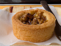
Center: Rifugio Bignami - tortina.
Right: Rifugio Bignami - bresaola and sciatt.


Right: Rifugio Bignami - bresaola and sciatt.


Left: An ibex's horns stick out behind a rock.
Center: A group of ibex at the proglacial edge.
Right: Information about who is Luigi Marson was - the glacier trail is named after him.


Left: Glacier Info - Schematic shows Fellaria West, East, and Sasso Rosso dividing them as well as surrounding peaks.
Center left: Glacier Info - Explanation of the parts and retreat of Fellaria West.
Center right: Glacier Info - explanation of glacial erratics and roche moutonnée rock formations caused by glacier.
Right: Tracks from Rifugio Zoia to Fellaria Glacier East.


Left: Glacier Info - Explanation of Fellaria East glacial lake and features - glacier reached here once in 2000.
Center left: Glacier Info - explaining the pillow formations seen in alpine meadows.
Center right: Glacier Info - a sign showing how far the glacier has retreated.
Right: Glacier Info - There paths A, B, and C to the Marson trail.


Left: Glacial erratic - Masso erratico example.
Center: Fellaria Est Glacial Lake - Eastern Part.
Right: Fellaria East Glacier Lake edge.


Left: A view across Alpe Gera lake to the start of Alpe Val Poschiavina.
Center: Diga Alpe Gera and the ramp to get up on the dam - hikers must go up the ramp.
Right: Campo Moro Lake - Rifugio Zoia to the right out of frame.
No comments:
Post a Comment
All comments are moderated. If your comment doesn't appear right away, it was likely accepted. Check back in a day if you asked a question.